| Well Information Table |
|---|
| Common Well ID | NA04100720CCD |
| USGS Well ID | 374630106140001 |
| USGS Station Name | NA04100720CCD |
| USGS Construction Date | 01/01/1950 |
| USGS Site Type | Well |
| USGS Site Use Information | Withdrawal of Water |
| USGS Groundwater Use Information | Irrigation |
| Data Source(s) | USGS |
| Location Data |
|---|
| TRS | NA04100720CCD |
| USGS TRS 1 | NA04100720CCD |
| Longitude/Latitude (NAD83) | -106.23391920 , 37.77500180 |
| Longitude/Latitude Data Source | GWSI decimal LAT/LONG field |
| USGS Longitude/Latitude (NAD83) | -106.2339192 , 37.77500180 |
| Easting, Northing RGDSS-NAD83 (US ft) | 38240.89 , 284112.04 |
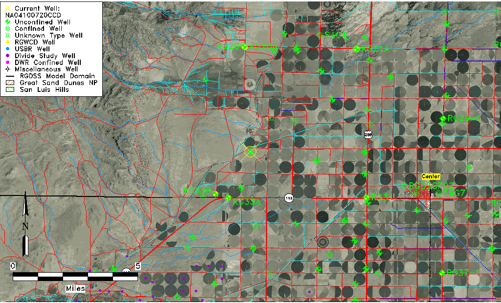
| USGS County | Saguache County |
| Elevation and Depth Data |
|---|
| Ground Elevation (ft NAVD88) | 7717.99000000000 |
| Elevation Data Source | USGS GWSI database |
| USGS Ground Elevation (ft NGVD29) | 7713.30 |
| 1/3-Arc Second NED Ground Elevation (ft NAVD88) | 7715.41 |
| 1-Arc Second NED Ground Elevation (ft NAVD88) | 7716.21 |
| SRTM Ground Elevation (ft NAVD88) | 7720.17 |
| Total Depth (ft) | 160.00 |
| USGS Well Depth (ft) | 160.00 |
| Model Layer | 1 |
| Model Layer Source | Well Depth |
| Depth of Bottom of Layer 1 | 164 |
| Depth of Bottom of Layer 2 | 367 |
| Additional Well Information | NONE |
| Aquifer Information |
|---|
| Aquifer Type | Unconfined |
| Aquifer Type Source | TD Elevation/Model Layer |
| USGS Hydrologic Unit | Saguache |
| USGS Data Available | Miscellaneous (GW.MISC) |
| Water-level Database Information |
|---|
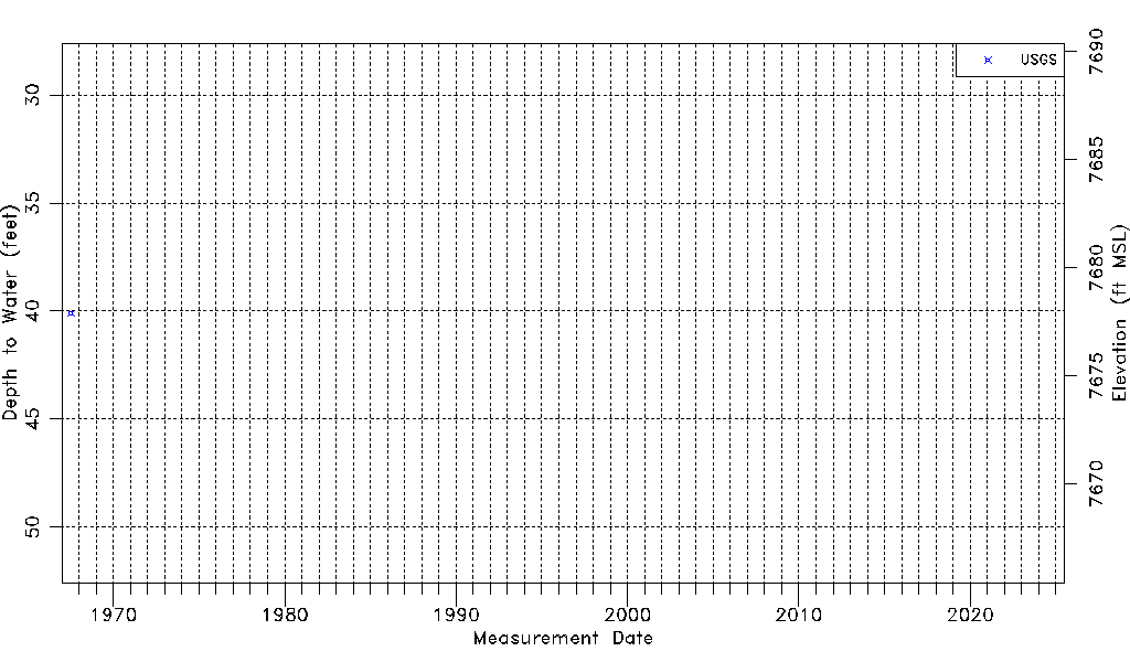
| Water-level Count | 1 |
| Water-level Date Range | 07/14/1967 thru 07/14/1967 |
| Monitored within the last 18 months | No, most recently on 07/14/1967 |
| Depth-to-Water Range (ft) | 40.09 to 40.09 |
| Water Table Elevation Range (ft NAVD88) | 7677.90 to 7677.90 |
| Water-Level-Source:Number-of-Measurements | USGS:1 |