| Well Information Table |
|---|
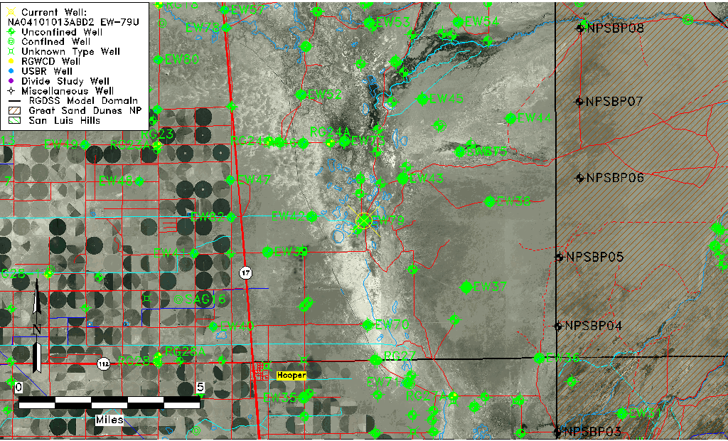
| Common Well ID | NA04101013ABD2 EW-79U |
| USBR Well ID | EW79U |
| USGS Well ID | 374820105492802 |
| GSDNP Well Name | EW79U |
| USGS Station Name | NA04101013ABD2 EW-79U |
| USGS Construction Date | 06/21/2002 |
| USGS Site Type | Well |
| USGS Site Use Information | Observation |
| USGS Groundwater Use Information | Unused |
| Data Source(s) | USGS, USBR |
| Location Data |
|---|
| TRS | NA04101013ABD2 EW-79U |
| USBR TRS | NA04101013ABD2 |
| USGS TRS 1 | NA04101013ABD2 EW-79U |
| Longitude/Latitude (NAD83) | -105.82480797 , 37.80604769 |
| Longitude/Latitude Data Source | USBOR EW well locations |
| USGS Longitude/Latitude (NAD83) | -105.8250185 , 37.80555510 |
| USBR Longitude/Latitude (NAD27) | -105.824233887993 , 37.8060481412472 |
| Easting, Northing RGDSS-NAD83 (US ft) | 156474.21 , 294954.41 |
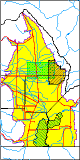
| USGS County | Saguache County |
| USGS Map Name | DEADMAN CAMP |
| USGS Map Scale | 24000 |
| Elevation and Depth Data |
|---|
| Ground Elevation (ft NAVD88) | 7534.42000000000 |
| Elevation Data Source | USBOR EW well database |
| USBR Ground Elevation (ft NGVD29) | 7530.5 |
| USGS Ground Elevation (ft NGVD29) | 7530.30 |
| 1/3-Arc Second NED Ground Elevation (ft NAVD88) | 7533.97 |
| 1-Arc Second NED Ground Elevation (ft NAVD88) | 7533.56 |
| SRTM Ground Elevation (ft NAVD88) | 7533.04 |
| Total Depth (ft) | 13.00 |
| USBR Total Depth (ft) | 13 |
| USGS Hole Depth (ft) | 17.50 |
| USGS Well Depth (ft) | 17.50 |
| Model Layer | 1 |
| Model Layer Source | Aquifer Type |
| Depth of Bottom of Layer 1 | 99 |
| Depth of Bottom of Layer 2 | 286 |
| Depth of Bottom of Layer 3 | 1563 |
| Depth of Bottom of Layer 4 | 3628 |
| Additional Well Information | NONE |
| Aquifer Information |
|---|
| Aquifer Type | Unconfined |
| Aquifer Type Source | EW_AQFR |
| USGS Hydrologic Unit | San Luis |
| USGS Data Available | Discharge (GW.DISC) |
| Water-level Database Information |
|---|
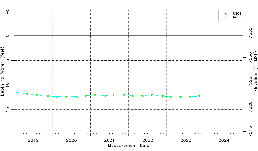
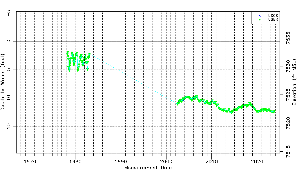
| Water-level Count | 197 |
| Water-level Date Range | 04/05/1978 thru 11/08/2023 |
| Monitored within the last 18 months | Yes, most recently on 11/08/2023 |
| Depth-to-Water Range (ft) | 1.90 to 12.56 |
| Water Table Elevation Range (ft NAVD88) | 7521.86 to 7532.52 |
| Water-Level-Source:Number-of-Measurements | USGS:35 USBR:193 |