| Well Information Table |
|---|
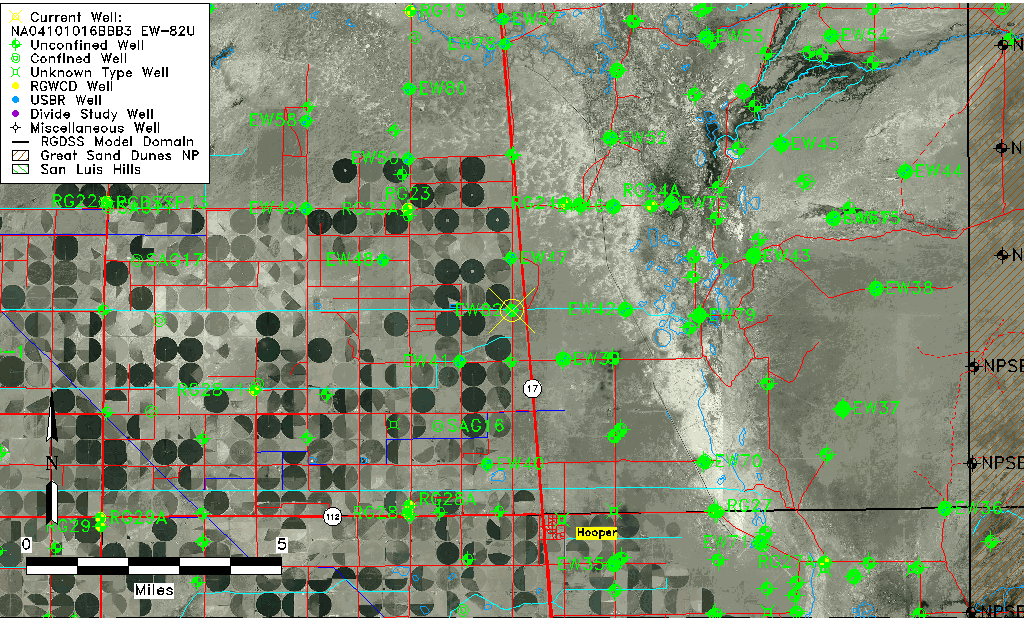
| Common Well ID | NA04101016BBB3 EW-82U |
| USBR Well ID | EW82U |
| USGS Well ID | 374826105532803 |
| USGS Station Name | NA04101016BBB3 EW-82U |
| USGS Construction Date | 01/27/1981 |
| USGS Site Type | Well |
| USGS Site Use Information | Observation |
| USGS Groundwater Use Information | Unused |
| Data Source(s) | USGS, USBR |
| Location Data |
|---|
| TRS | NA04101016BBB3 EW-82U |
| USBR TRS | NA04101016BBB3 |
| USGS TRS 1 | NA04101016BBB3 EW-82U |
| Longitude/Latitude (NAD83) | -105.89165011 , 37.80734689 |
| Longitude/Latitude Data Source | USBOR EW well locations |
| USGS Longitude/Latitude (NAD83) | -105.8916866 , 37.80722178 |
| USBR Longitude/Latitude (NAD27) | -105.891074643363 , 37.8073473375673 |
| Easting, Northing RGDSS-NAD83 (US ft) | 137169.67 , 295467.13 |
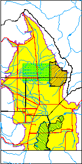
| USGS County | Saguache County |
| USGS Map Name | DEADMAN CAMP SW |
| USGS Map Scale | 24000 |
| Elevation and Depth Data |
|---|
| Ground Elevation (ft NAVD88) | 7549.83000000000 |
| Elevation Data Source | USBOR EW well database |
| USBR Ground Elevation (ft NGVD29) | 7546.0 |
| USGS Ground Elevation (ft NGVD29) | 7546.00 |
| 1/3-Arc Second NED Ground Elevation (ft NAVD88) | 7549.76 |
| 1-Arc Second NED Ground Elevation (ft NAVD88) | 7549.65 |
| SRTM Ground Elevation (ft NAVD88) | 7548.98 |
| Total Depth (ft) | 34.00 |
| USBR Total Depth (ft) | 34 |
| USGS Well Depth (ft) | 32.40 |
| Model Layer | 1 |
| Model Layer Source | Aquifer Type |
| Depth of Bottom of Layer 1 | 99 |
| Depth of Bottom of Layer 2 | 228 |
| Depth of Bottom of Layer 3 | 1303 |
| Depth of Bottom of Layer 4 | 3349 |
| Additional Well Information | NONE |
| Aquifer Information |
|---|
| Aquifer Type | Unconfined |
| Aquifer Type Source | EW_AQFR |
| USGS Hydrologic Unit | San Luis |
| USGS Data Available | Discharge (GW.DISC) |
| Water-level Database Information |
|---|
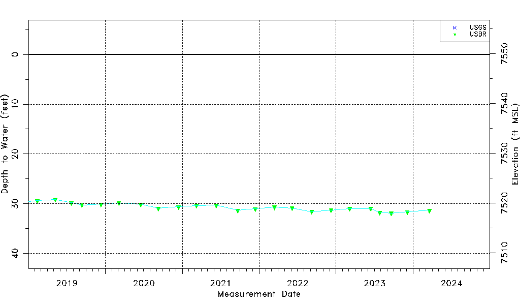
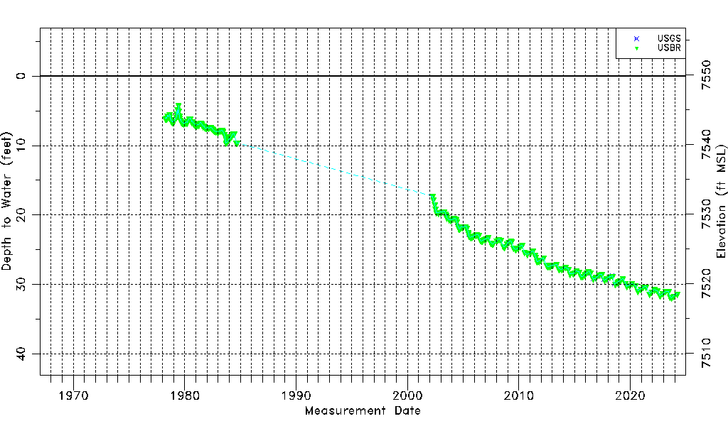
| Water-level Count | 233 |
| Water-level Date Range | 04/05/1978 thru 12/05/2023 |
| Monitored within the last 18 months | Yes, most recently on 12/05/2023 |
| Depth-to-Water Range (ft) | 4.20 to 31.88 |
| Water Table Elevation Range (ft NAVD88) | 7517.95 to 7545.63 |
| Water-Level-Source:Number-of-Measurements | USGS:16 USBR:220 |