| Well Information Table |
|---|
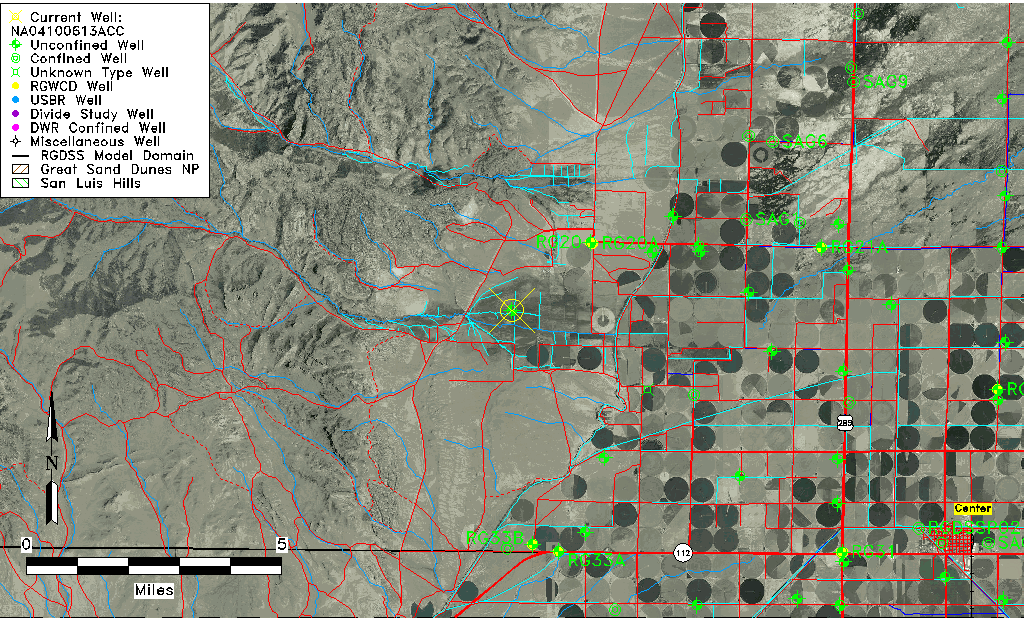
| Common Well ID | NA04100613ACC |
| USGS Well ID | 374900106160001 |
| USGS Station Name | NA04100613ACC |
| USGS Site Type | Well |
| USGS Site Use Information | Observation |
| USGS Groundwater Use Information | Unused |
| Data Source(s) | USGS |
| Location Data |
|---|
| TRS | NA04100613ACC |
| USGS TRS 1 | NA04100613ACC |
| USGS TRS | SWSWNES013T0041NR0006EN |
| Longitude/Latitude (NAD83) | -106.26725320 , 37.81666830 |
| Longitude/Latitude Data Source | GWSI decimal LAT/LONG field |
| USGS Longitude/Latitude (NAD83) | -106.2672532 , 37.81666830 |
| Easting, Northing RGDSS-NAD83 (US ft) | 28706.17 , 299340.97 |
| USGS Topography | Flat Surface |
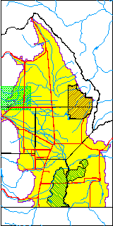
| USGS County | Saguache County |
| Elevation and Depth Data |
|---|
| Ground Elevation (ft NAVD88) | 7839.71000000000 |
| Elevation Data Source | USGS GWSI database |
| USGS Ground Elevation (ft NGVD29) | 7835.00 |
| 1/3-Arc Second NED Ground Elevation (ft NAVD88) | 7822.68 |
| 1-Arc Second NED Ground Elevation (ft NAVD88) | 7821.90 |
| SRTM Ground Elevation (ft NAVD88) | 7828.10 |
| Total Depth (ft) | 38.00 |
| USGS Well Depth (ft) | 38.00 |
| Model Layer | 1 |
| Model Layer Source | Well Depth |
| Depth of Bottom of Layer 1 | 258 |
| Depth of Bottom of Layer 2 | 346 |
| Additional Well Information | Geohydrology, Construction |
| Aquifer Information |
|---|
| Aquifer Type | Unconfined |
| Aquifer Type Source | TD Elevation/Model Layer |
| USGS Primary Aquifer | Cenozoic Erathem |
| USGS Hydrologic Unit | Saguache |
| USGS Data Available | Water-level (GW.LEV) |
| Water-level Database Information |
|---|
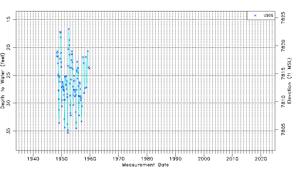
| Water-level Count | 113 |
| Water-level Date Range | 06/01/1948 thru 10/07/1959 |
| Monitored within the last 18 months | No, most recently on 10/07/1959 |
| Depth-to-Water Range (ft) | 16.71 to 35.30 |
| Water Table Elevation Range (ft NAVD88) | 7804.41 to 7823.00 |
| Water-Level-Source:Number-of-Measurements | USGS:113 |