| Well Information Table |
|---|
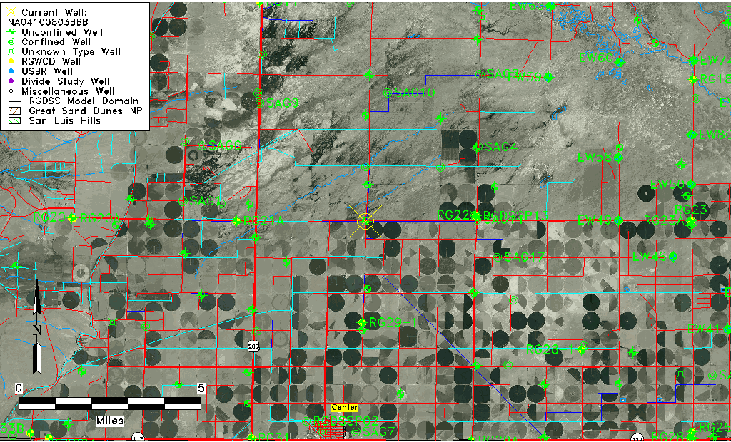
| Common Well ID | NA04100803BBB |
| USGS Well ID | 374906106053001 |
| USGS Station Name | NA04100803BBB |
| USGS Construction Date | 01/01/1946 |
| USGS Site Type | Well |
| USGS Site Use Information | Observation |
| USGS Groundwater Use Information | Unused |
| Data Source(s) | USGS |
| Location Data |
|---|
| TRS | NA04100803BBB |
| USGS TRS 1 | NA04100803BBB |
| USGS TRS | NWNWNWS003T0041NR0008EN |
| Longitude/Latitude (NAD83) | -106.09213580 , 37.83527808 |
| Longitude/Latitude Data Source | GWSI decimal LAT/LONG field |
| USGS Longitude/Latitude (NAD83) | -106.0921358 , 37.83527808 |
| Easting, Northing RGDSS-NAD83 (US ft) | 79310.68 , 305837.39 |
| USGS Topography | Valley flat |
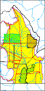
| USGS County | Saguache County |
| USGS Map Name | CENTER NORTH |
| USGS Map Scale | 24000 |
| Elevation and Depth Data |
|---|
| Ground Elevation (ft NAVD88) | 7606.41000000000 |
| Elevation Data Source | USGS GWSI database |
| USGS Ground Elevation (ft NGVD29) | 7602.00 |
| 1/3-Arc Second NED Ground Elevation (ft NAVD88) | 7606.37 |
| 1-Arc Second NED Ground Elevation (ft NAVD88) | 7606.16 |
| SRTM Ground Elevation (ft NAVD88) | 7613.80 |
| Total Depth (ft) | 8.00 |
| USGS Well Depth (ft) | 8.00 |
| Model Layer | 1 |
| Model Layer Source | Well Depth |
| Depth of Bottom of Layer 1 | 84 |
| Depth of Bottom of Layer 2 | 129 |
| Depth of Bottom of Layer 3 | 654 |
| Depth of Bottom of Layer 4 | 2524 |
| Additional Well Information | Geohydrology, Construction |
| Aquifer Information |
|---|
| Aquifer Type | Unconfined |
| Aquifer Type Source | TD Elevation/Model Layer |
| USGS Primary Aquifer | Cenozoic Erathem |
| USGS Aquifer Type | Unconfined Single Aquifer |
| USGS Hydrologic Unit | Saguache |
| USGS Data Available | Water-level (GW.LEV) |
| Water-level Database Information |
|---|
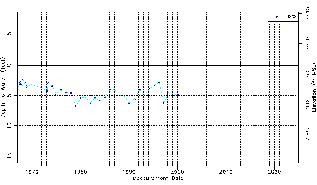
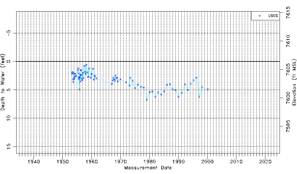
| Water-level Count | 87 |
| Water-level Date Range | 05/05/1953 thru 02/17/2000 |
| Monitored within the last 18 months | No, most recently on 02/17/2000 |
| Depth-to-Water Range (ft) | 0.58 to 6.75 |
| Water Table Elevation Range (ft NAVD88) | 7599.66 to 7605.83 |
| Water-Level-Source:Number-of-Measurements | USGSaguache Creek:87 |