| Well Information Table |
|---|
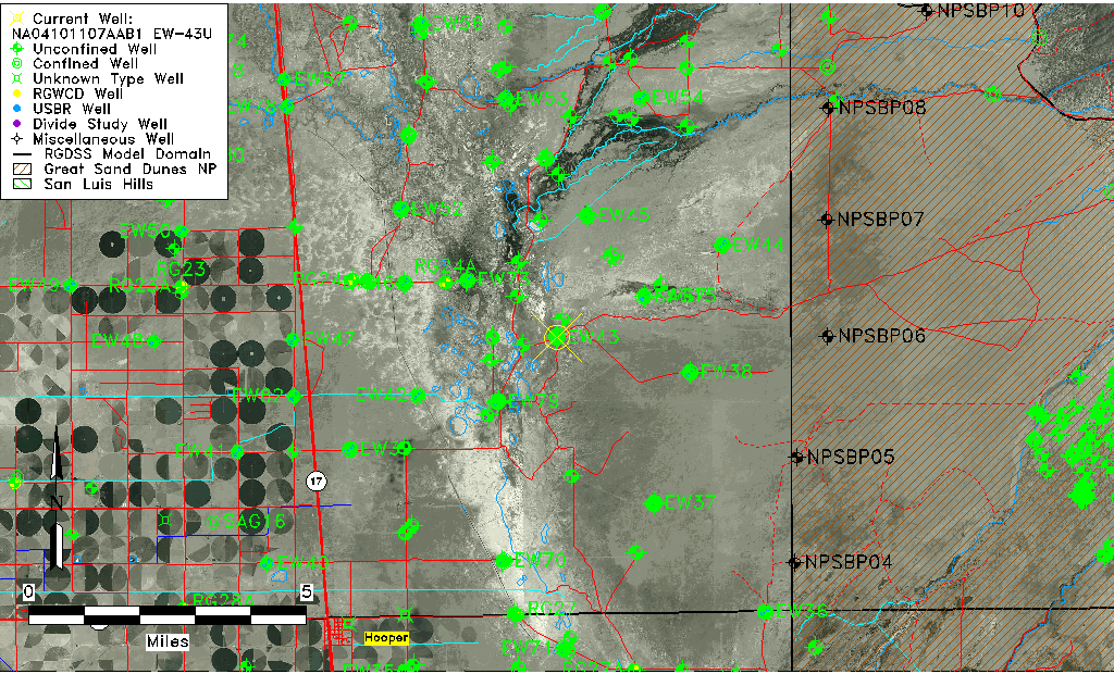
| Common Well ID | NA04101107AAB1 EW-43U |
| USBR Well ID | EW43U |
| USGS Well ID | 374923105481801 |
| GSDNP Well Name | 374923105481801 |
| USGS Station Name | NA04101107AAB1 EW-43U |
| USGS Construction Date | 05/27/1984 |
| USGS Site Type | Well |
| USGS Site Use Information | Observation |
| USGS Groundwater Use Information | Unused |
| Data Source(s) | USGS, USBR |
| Location Data |
|---|
| TRS | NA04101107AAB1 EW-43U |
| USBR TRS | NA04101107AAB1 |
| USGS TRS 1 | NA04101107AAB1 EW-43U |
| Longitude/Latitude (NAD83) | -105.80526110 , 37.82283337 |
| Longitude/Latitude Data Source | USBOR EW well locations |
| USGS Longitude/Latitude (NAD83) | -105.8055733 , 37.82305506 |
| USBR Longitude/Latitude (NAD27) | -105.804687839481 , 37.8228338614199 |
| Easting, Northing RGDSS-NAD83 (US ft) | 162128.94 , 301055.81 |
| USGS Topography | Valley flat |
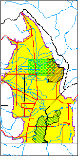
| USGS County | Saguache County |
| USGS Map Name | DEADMAN CAMP |
| USGS Map Scale | 24000 |
| Elevation and Depth Data |
|---|
| Ground Elevation (ft NAVD88) | 7538.27000000000 |
| Elevation Data Source | USBOR EW well database |
| USBR Ground Elevation (ft NGVD29) | 7534.3 |
| USGS Ground Elevation (ft NGVD29) | 7534.30 |
| 1/3-Arc Second NED Ground Elevation (ft NAVD88) | 7535.32 |
| 1-Arc Second NED Ground Elevation (ft NAVD88) | 7538.25 |
| SRTM Ground Elevation (ft NAVD88) | 7533.92 |
| Total Depth (ft) | 43.00 |
| USBR Total Depth (ft) | 43 |
| USGS Hole Depth (ft) | 143.00 |
| USGS Well Depth (ft) | 41.80 |
| Model Layer | 1 |
| Model Layer Source | Aquifer Type |
| Depth of Bottom of Layer 1 | 87 |
| Depth of Bottom of Layer 2 | 315 |
| Depth of Bottom of Layer 3 | 1636 |
| Depth of Bottom of Layer 4 | 3968 |
| Additional Well Information | Logs, Construction |
| Aquifer Information |
|---|
| Aquifer Type | Unconfined |
| Aquifer Type Source | EW_AQFR |
| USGS Hydrologic Unit | San Luis |
| USGS Data Available | Water-level (GW.LEV) |
| Water-level Database Information |
|---|
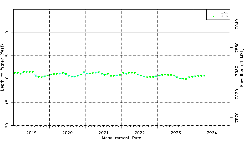
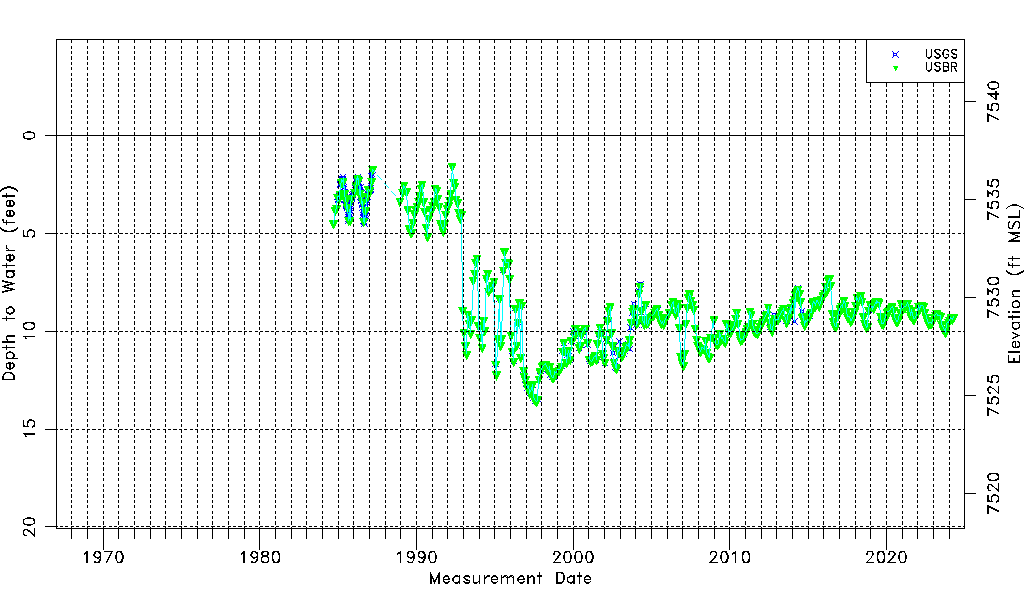
| Water-level Count | 622 |
| Water-level Date Range | 09/14/1984 thru 12/15/2023 |
| Monitored within the last 18 months | Yes, most recently on 12/15/2023 |
| Depth-to-Water Range (ft) | 1.58 to 13.57 |
| Water Table Elevation Range (ft NAVD88) | 7524.70 to 7536.69 |
| Water-Level-Source:Number-of-Measurements | USGS:249 USBR:448 |