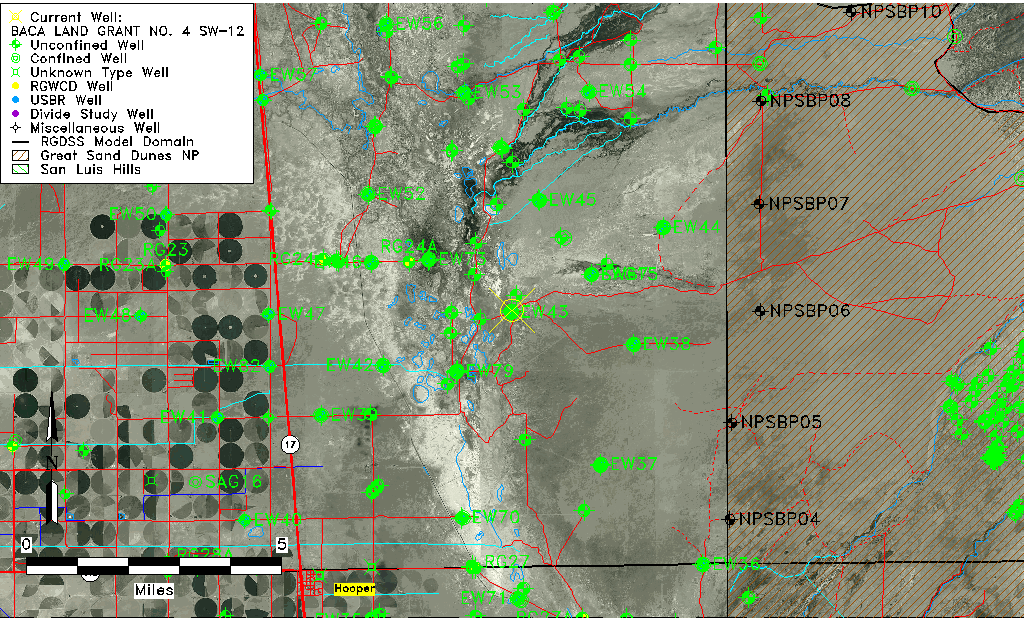
| Well Information Table |
|---|
| Common Well ID | BACA LAND GRANT NO. 4 SW-12 |
| USGS Well ID | 374924105481801 |
| GSDNP Well Name | SW-12 |
| USGS Station Name | BACA LAND GRANT NO. 4 SW-12 |
| USGS Construction Date | 04/19/1996 |
| USGS Site Type | Well |
| USGS Site Use Information | Observation |
| USGS Groundwater Use Information | Unknown |
| Data Source(s) | USGS, HRS |
| Location Data |
|---|
| TRS | BACA LAND GRANT NO. 4 SW-12 |
| USGS TRS 1 | BACA LAND GRANT NO. 4 SW-12 |
| Longitude/Latitude (NAD83) | -105.80503532 , 37.82337277 |
| Longitude/Latitude Data Source | Davis Engineering Survey |
| USGS Longitude/Latitude (NAD83) | -105.8050556 , 37.82338889 |
| Halapaska & Assoc. Easting/Northing (CO-S) | 1912052.00000000 , 421311.000000000 |
| Easting, Northing RGDSS-NAD83 (US ft) | 162194.43 , 301252.07 |
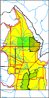
| USGS County | Saguache County |
| USGS Map Name | DEADMAN CAMP |
| USGS Map Scale | 24000 |
| Elevation and Depth Data |
|---|
| Ground Elevation (ft NAVD88) | 7538.98000000000 |
| Elevation Data Source | USGS GWSI database |
| USGS Ground Elevation (ft NGVD29) | 7535.00 |
| BACA Well database (Halapaska & Assoc, ft NGVD29) | 7534 |
| HRS Dunes Well database (ft NGVD29) | 7534.00000 |
| 1/3-Arc Second NED Ground Elevation (ft NAVD88) | 7534.63 |
| 1-Arc Second NED Ground Elevation (ft NAVD88) | 7536.03 |
| SRTM Ground Elevation (ft NAVD88) | 7539.79 |
| Total Depth (ft) | 101.00 |
| USGS Hole Depth (ft) | 120.00 |
| USGS Well Depth (ft) | 101.00 |
| Model Layer | 1 |
| Model Layer Source | Dunes Layer |
| Depth of Bottom of Layer 1 | 87 |
| Depth of Bottom of Layer 2 | 316 |
| Depth of Bottom of Layer 3 | 1638 |
| Depth of Bottom of Layer 4 | 3978 |
| Additional Well Information | NONE |
| Aquifer Information |
|---|
| Aquifer Type | Unconfined |
| Aquifer Type Source | HRS_AQUIFER |
| USGS Aquifer Type | Unconfined Single Aquifer |
| USGS Hydrologic Unit | San Luis |
| USGS Data Available | Discharge (GW.DISC) |
| Water-level Database Information |
|---|
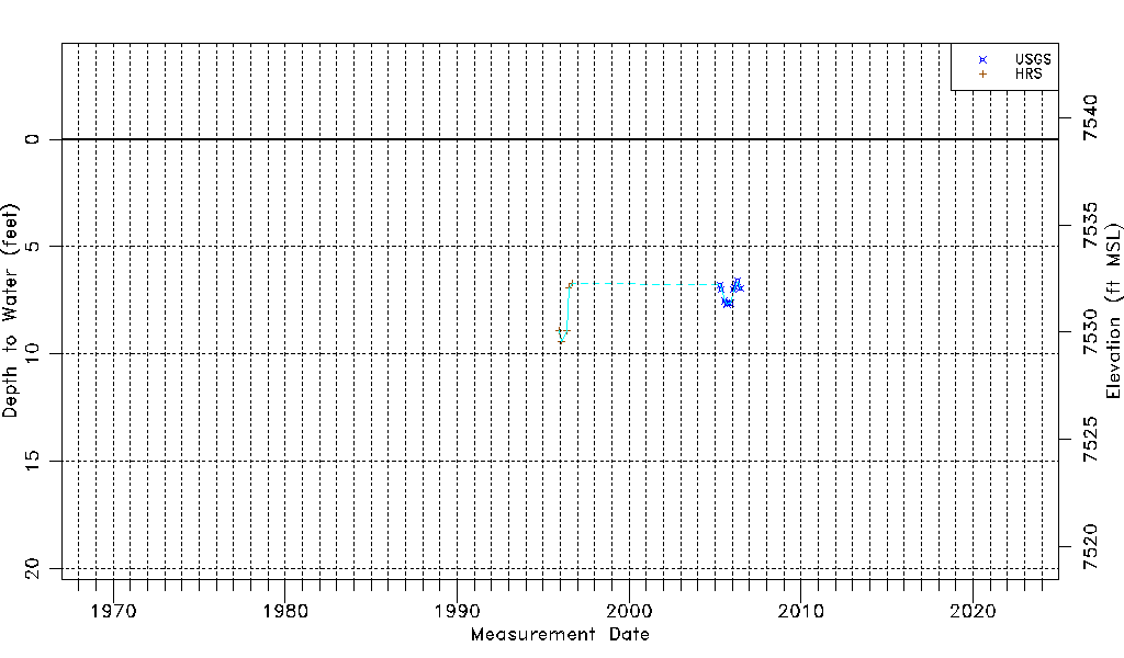
| Water-level Count | 17 |
| Water-level Date Range | 11/30/1995 thru 06/27/2006 |
| Monitored within the last 18 months | No, most recently on 06/27/2006 |
| Depth-to-Water Range (ft) | 6.60 to 9.40 |
| Water Table Elevation Range (ft NAVD88) | 7529.58 to 7532.38 |
| Water-Level-Source:Number-of-Measurements | USGSaguache Creek:12 HRS:5 |