| Well Information Table |
|---|
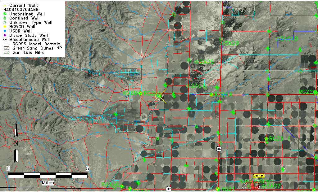
| Common Well ID | NA04100704ABB |
| USGS Well ID | 375000106130001 |
| USGS Station Name | NA04100704ABB |
| USGS Site Type | Well |
| USGS Site Use Information | Withdrawal of Water |
| USGS Groundwater Use Information | Irrigation |
| Data Source(s) | USGS |
| Location Data |
|---|
| TRS | NA04100704ABB |
| USGS TRS 1 | NA04100704ABB |
| USGS TRS | NWNWNES004T0041NR0007EN |
| Longitude/Latitude (NAD83) | -106.21725130 , 37.83333467 |
| Longitude/Latitude Data Source | GWSI decimal LAT/LONG field |
| USGS Longitude/Latitude (NAD83) | -106.2172513 , 37.83333467 |
| Easting, Northing RGDSS-NAD83 (US ft) | 43182.62 , 305319.21 |
| USGS Topography | Flat Surface |
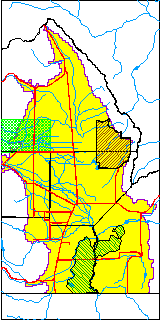
| USGS County | Saguache County |
| Elevation and Depth Data |
|---|
| Ground Elevation (ft NAVD88) | 7702.67000000000 |
| Elevation Data Source | USGS GWSI database |
| USGS Ground Elevation (ft NGVD29) | 7698.00 |
| 1/3-Arc Second NED Ground Elevation (ft NAVD88) | 7715.38 |
| 1-Arc Second NED Ground Elevation (ft NAVD88) | 7714.48 |
| SRTM Ground Elevation (ft NAVD88) | 7720.19 |
| Total Depth (ft) | 98.00 |
| USGS Well Depth (ft) | 98.00 |
| Model Layer | 1 |
| Model Layer Source | Well Depth |
| Depth of Bottom of Layer 1 | 173 |
| Depth of Bottom of Layer 2 | 327 |
| Depth of Bottom of Layer 3 | 398 |
| Depth of Bottom of Layer 4 | 1029 |
| Additional Well Information | Geohydrology, Construction |
| Aquifer Information |
|---|
| Aquifer Type | Unconfined |
| Aquifer Type Source | TD Elevation/Model Layer |
| USGS Primary Aquifer | Cenozoic Erathem |
| USGS Hydrologic Unit | Saguache |
| USGS Data Available | Water-level (GW.LEV) |
| Water-level Database Information |
|---|
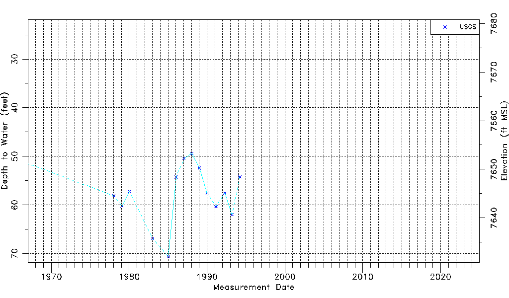
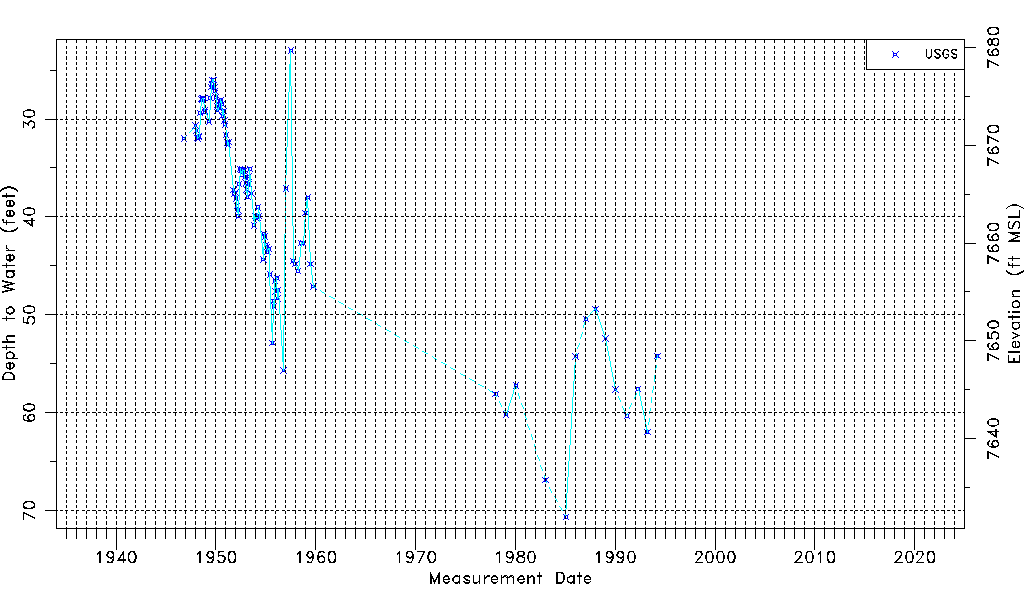
| Water-level Count | 109 |
| Water-level Date Range | 11/01/1946 thru 03/24/1994 |
| Monitored within the last 18 months | No, most recently on 03/24/1994 |
| Depth-to-Water Range (ft) | 23.00 to 70.65 |
| Water Table Elevation Range (ft NAVD88) | 7632.02 to 7679.67 |
| Water-Level-Source:Number-of-Measurements | USGSaguache Creek:109 |