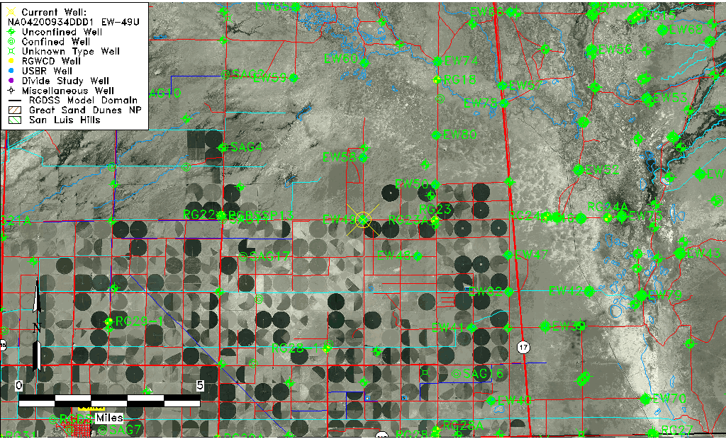
| Well Information Table |
|---|
| Common Well ID | NA04200934DDD1 EW-49U |
| USBR Well ID | EW49U |
| USGS Well ID | 375011105575401 |
| USGS Station Name | NA04200934DDD1 EW-49U |
| USGS Construction Date | 06/29/1983 |
| USGS Site Type | Well |
| USGS Site Use Information | Observation |
| USGS Groundwater Use Information | Unused |
| Data Source(s) | USGS, USBR |
| Location Data |
|---|
| TRS | NA04200934DDD1 EW-49U |
| USBR TRS | NA04200934DDD1 |
| USGS TRS 1 | NA04200934DDD1 EW-49U |
| Longitude/Latitude (NAD83) | -105.96537466 , 37.83609425 |
| Longitude/Latitude Data Source | USBOR EW well locations |
| USGS Longitude/Latitude (NAD83) | -105.9655763 , 37.83638840 |
| USBR Longitude/Latitude (NAD27) | -105.964798315759 , 37.8360947112208 |
| Easting, Northing RGDSS-NAD83 (US ft) | 115909.92 , 305992.06 |
| USGS Topography | Valley flat |
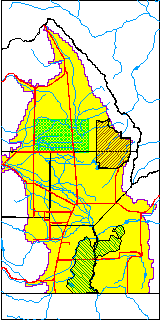
| USGS County | Saguache County |
| USGS Map Name | DEADMAN CAMP SW |
| USGS Map Scale | 24000 |
| Elevation and Depth Data |
|---|
| Ground Elevation (ft NAVD88) | 7560.23000000000 |
| Elevation Data Source | USBOR EW well database |
| USBR Ground Elevation (ft NGVD29) | 7556.3 |
| USGS Ground Elevation (ft NGVD29) | 7556.30 |
| 1/3-Arc Second NED Ground Elevation (ft NAVD88) | 7560.31 |
| 1-Arc Second NED Ground Elevation (ft NAVD88) | 7560.63 |
| SRTM Ground Elevation (ft NAVD88) | 7568.08 |
| Total Depth (ft) | 45.00 |
| USBR Total Depth (ft) | 45 |
| USGS Hole Depth (ft) | 126.00 |
| USGS Well Depth (ft) | 42.50 |
| Model Layer | 1 |
| Model Layer Source | Aquifer Type |
| Depth of Bottom of Layer 1 | 94 |
| Depth of Bottom of Layer 2 | 180 |
| Depth of Bottom of Layer 3 | 960 |
| Depth of Bottom of Layer 4 | 2838 |
| Additional Well Information | Construction |
| Aquifer Information |
|---|
| Aquifer Type | Unconfined |
| Aquifer Type Source | EW_AQFR |
| USGS Hydrologic Unit | San Luis |
| USGS Data Available | Water-level (GW.LEV) |
| Water-level Database Information |
|---|
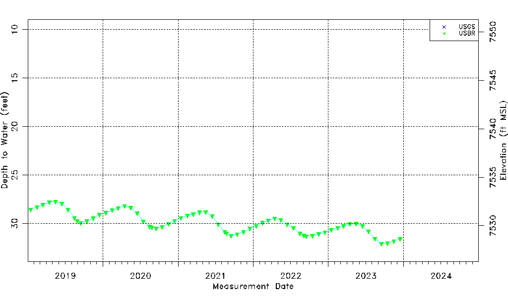
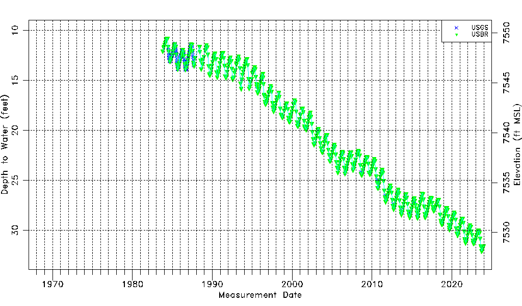
| Water-level Count | 723 |
| Water-level Date Range | 10/17/1983 thru 12/15/2023 |
| Monitored within the last 18 months | Yes, most recently on 12/15/2023 |
| Depth-to-Water Range (ft) | 10.80 to 32.07 |
| Water Table Elevation Range (ft NAVD88) | 7528.16 to 7549.43 |
| Water-Level-Source:Number-of-Measurements | USGS:258 USBR:487 |