| Well Information Table |
|---|
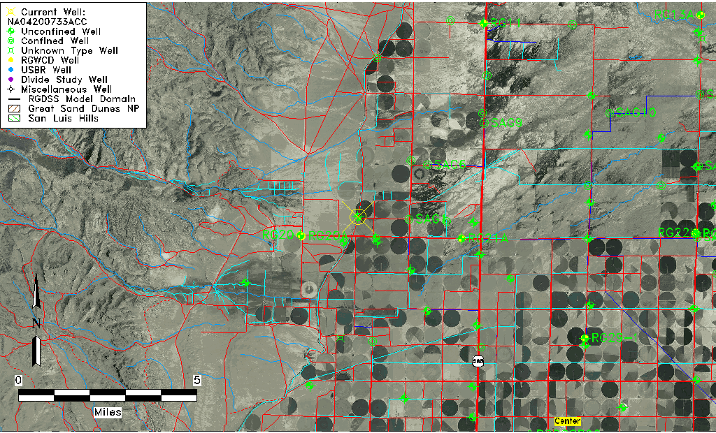
| Common Well ID | NA04200733ACC |
| USGS Well ID | 375037106123401 |
| USGS Station Name | NA04200733ACC |
| USGS Construction Date | 08/11/1993 |
| USGS Site Type | Well |
| USGS Site Use Information | Observation |
| USGS Groundwater Use Information | Unused |
| Data Source(s) | USGS |
| Location Data |
|---|
| TRS | NA04200733ACC |
| USGS TRS 1 | NA04200733ACC |
| USGS TRS | SWSWNES 33T 42NR 7E |
| Longitude/Latitude (NAD83) | -106.20981670 , 37.84371389 |
| Longitude/Latitude Data Source | GWSI decimal LAT/LONG field |
| USGS Longitude/Latitude (NAD83) | -106.2098167 , 37.84371389 |
| Easting, Northing RGDSS-NAD83 (US ft) | 45351.28 , 309085.16 |
| USGS Topography | Valley flat |
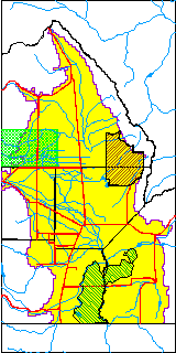
| USGS County | Saguache County |
| USGS Map Name | LA GARITA |
| USGS Map Scale | 2400 |
| Elevation and Depth Data |
|---|
| Ground Elevation (ft NAVD88) | 7708.00000000000 |
| Elevation Data Source | USGS GWSI database |
| USGS Ground Elevation (ft NAVD88) | 7708.00 |
| 1/3-Arc Second NED Ground Elevation (ft NAVD88) | 7705.06 |
| 1-Arc Second NED Ground Elevation (ft NAVD88) | 7705.09 |
| SRTM Ground Elevation (ft NAVD88) | 7715.58 |
| Total Depth (ft) | 19.50 |
| USGS Hole Depth (ft) | 21.50 |
| USGS Well Depth (ft) | 19.50 |
| Model Layer | 1 |
| Model Layer Source | Well Depth |
| Depth of Bottom of Layer 1 | 174 |
| Depth of Bottom of Layer 2 | 307 |
| Depth of Bottom of Layer 3 | 381 |
| Depth of Bottom of Layer 4 | 1139 |
| Additional Well Information | Logs, Geohydrology, Construction, Aquifer |
| Aquifer Information |
|---|
| Aquifer Type | Unconfined |
| Aquifer Type Source | TD Elevation/Model Layer |
| USGS Primary Aquifer | 112ALMS |
| USGS Aquifer Type | Unconfined Single Aquifer |
| USGS Hydrologic Unit | Saguache |
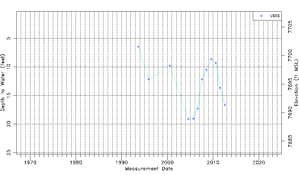
| USGS Data Available | Water-level (GW.LEV) |
| Water-level Database Information |
|---|
| Water-level Count | 12 |
| Water-level Date Range | 09/09/1993 thru 07/26/2012 |
| Monitored within the last 18 months | No, most recently on 07/26/2012 |
| Depth-to-Water Range (ft) | 6.44 to 19.11 |
| Water Table Elevation Range (ft NAVD88) | 7688.89 to 7701.56 |
| Water-Level-Source:Number-of-Measurements | USGSaguache Creek:12 |