| Well Information Table |
|---|
| Common Well ID | NA04200931BAD |
| USGS Well ID | 375054106013401 |
| USGS Station Name | NA04200931BAD |
| USGS Construction Date | 08/11/1993 |
| USGS Site Type | Well |
| USGS Site Use Information | Observation |
| USGS Groundwater Use Information | Unused |
| Data Source(s) | USGS |
| Location Data |
|---|
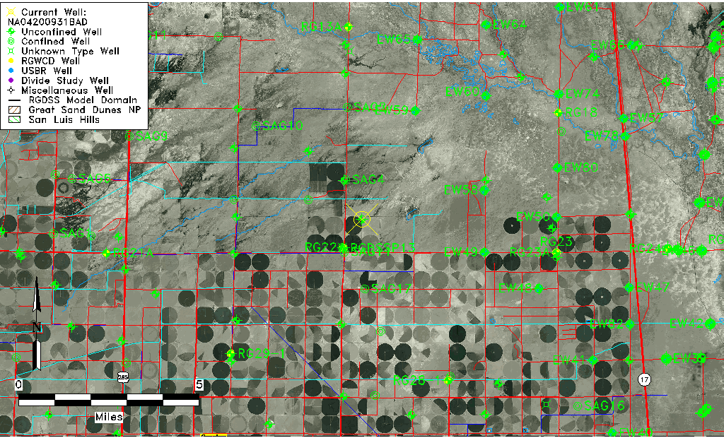
| TRS | NA04200931BAD |
| USGS TRS 1 | NA04200931BAD |
| USGS TRS | SENENWS 31T 42NR 9E |
| Longitude/Latitude (NAD83) | -106.02744440 , 37.84918889 |
| Longitude/Latitude Data Source | GWSI decimal LAT/LONG field |
| USGS Longitude/Latitude (NAD83) | -106.0274444 , 37.84918889 |
| Easting, Northing RGDSS-NAD83 (US ft) | 98008.02 , 310822.57 |
| USGS Topography | Valley flat |
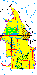
| USGS County | Saguache County |
| USGS Map Name | CENTER NORTH |
| USGS Map Scale | 24000 |
| Elevation and Depth Data |
|---|
| Ground Elevation (ft NAVD88) | 7574.00000000000 |
| Elevation Data Source | USGS GWSI database |
| USGS Ground Elevation (ft NAVD88) | 7574.00 |
| 1/3-Arc Second NED Ground Elevation (ft NAVD88) | 7572.44 |
| 1-Arc Second NED Ground Elevation (ft NAVD88) | 7572.58 |
| SRTM Ground Elevation (ft NAVD88) | 7584.96 |
| Total Depth (ft) | 14.40 |
| USGS Hole Depth (ft) | 15.00 |
| USGS Well Depth (ft) | 14.40 |
| Model Layer | 1 |
| Model Layer Source | Well Depth |
| Depth of Bottom of Layer 1 | 89 |
| Depth of Bottom of Layer 2 | 211 |
| Depth of Bottom of Layer 3 | 637 |
| Depth of Bottom of Layer 4 | 2466 |
| Additional Well Information | Logs, Geohydrology, Construction, Aquifer |
| Aquifer Information |
|---|
| Aquifer Type | Unconfined |
| Aquifer Type Source | TD Elevation/Model Layer |
| USGS Primary Aquifer | 112ALMS |
| USGS Aquifer Type | Unconfined Single Aquifer |
| USGS Hydrologic Unit | Saguache |
| USGS Data Available | Water-level (GW.LEV) |
| Water-level Database Information |
|---|
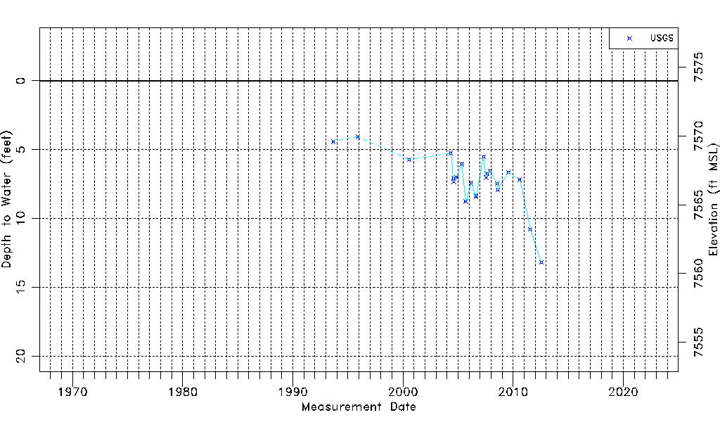
| Water-level Count | 23 |
| Water-level Date Range | 08/31/1993 thru 07/26/2012 |
| Monitored within the last 18 months | No, most recently on 07/26/2012 |
| Depth-to-Water Range (ft) | 4.07 to 13.18 |
| Water Table Elevation Range (ft NAVD88) | 7560.82 to 7569.93 |
| Water-Level-Source:Number-of-Measurements | USGSaguache Creek:23 |