| Well Information Table |
|---|
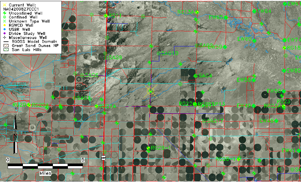
| Common Well ID | NA04200827CCC1 |
| USGS Well ID | 375100106052501 |
| USGS Station Name | NA04200827CCC1 |
| USGS Site Type | Well |
| USGS Site Use Information | Withdrawal of Water |
| USGS Groundwater Use Information | Irrigation |
| Data Source(s) | USGS |
| Location Data |
|---|
| TRS | NA04200827CCC1 |
| USGS TRS 1 | NA04200827CCC1 |
| USGS TRS | SWSWSWS027T0042NR0008EN |
| Longitude/Latitude (NAD83) | -106.09105220 , 37.84994470 |
| Longitude/Latitude Data Source | GWSI decimal LAT/LONG field |
| USGS Longitude/Latitude (NAD83) | -106.0910522 , 37.84994470 |
| Easting, Northing RGDSS-NAD83 (US ft) | 79647.89 , 311175.24 |
| USGS Topography | Valley flat |
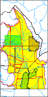
| USGS County | Saguache County |
| Elevation and Depth Data |
|---|
| Ground Elevation (ft NAVD88) | 7600.39000000000 |
| Elevation Data Source | USGS GWSI database |
| USGS Ground Elevation (ft NGVD29) | 7596.00 |
| 1/3-Arc Second NED Ground Elevation (ft NAVD88) | 7600.34 |
| 1-Arc Second NED Ground Elevation (ft NAVD88) | 7600.39 |
| SRTM Ground Elevation (ft NAVD88) | 7610.20 |
| Total Depth (ft) | 170.00 |
| USGS Well Depth (ft) | 170.00 |
| Model Layer | 1 |
| Model Layer Source | HRS |
| Depth of Bottom of Layer 1 | 93 |
| Depth of Bottom of Layer 2 | 132 |
| Depth of Bottom of Layer 3 | 585 |
| Depth of Bottom of Layer 4 | 2463 |
| Additional Well Information | Geohydrology, Construction |
| Aquifer Information |
|---|
| Aquifer Type | Unconfined |
| Aquifer Type Source | TD Elevation/Model Layer |
| USGS Primary Aquifer | Cenozoic Erathem |
| USGS Aquifer Type | Confined Single Aquifer |
| USGS Hydrologic Unit | Saguache |
| USGS Data Available | Water-level (GW.LEV) |
| Water-level Database Information |
|---|
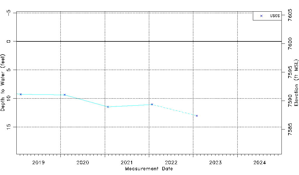
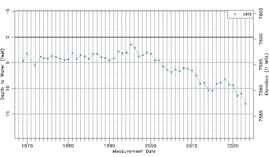
| Water-level Count | 55 |
| Water-level Date Range | 01/28/1969 thru 01/30/2023 |
| Monitored within the last 18 months | Yes, most recently on 01/30/2023 |
| Depth-to-Water Range (ft) | 1.47 to 13.02 |
| Water Table Elevation Range (ft NAVD88) | 7587.37 to 7598.92 |
| Water-Level-Source:Number-of-Measurements | USGS:55 |