| Well Information Table |
|---|
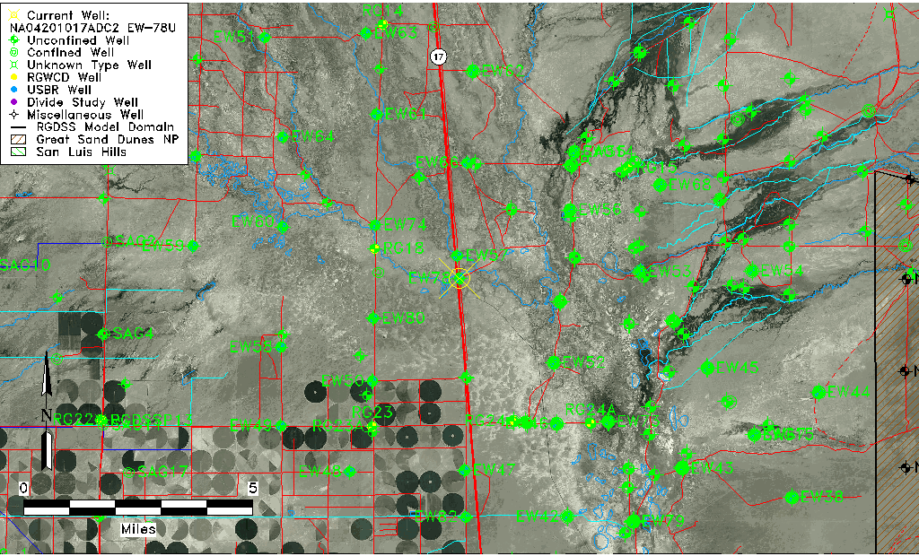
| Common Well ID | NA04201017ADC2 EW-78U |
| USBR Well ID | EW78U |
| USGS Well ID | 375258105533802 |
| USGS Station Name | NA04201017ADC2 EW-78U |
| USGS Construction Date | 02/16/1978 |
| USGS Site Type | Well |
| USGS Site Use Information | Observation |
| USGS Groundwater Use Information | Unused |
| Data Source(s) | USGS, USBR |
| Location Data |
|---|
| TRS | NA04201017ADC2 EW-78U |
| USBR TRS | NA04201017ADC2 |
| USGS TRS 1 | NA04201017ADC2 EW-78U |
| Longitude/Latitude (NAD83) | -105.89430307 , 37.88290362 |
| Longitude/Latitude Data Source | USBOR EW well locations |
| USGS Longitude/Latitude (NAD83) | -105.8944626 , 37.88277720 |
| USBR Longitude/Latitude (NAD27) | -105.893729374077 , 37.8829041763739 |
| Easting, Northing RGDSS-NAD83 (US ft) | 136470.95 , 322974.09 |
| USGS Topography | Valley flat |
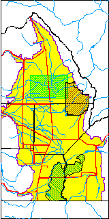
| USGS County | Saguache County |
| USGS Map Name | MOFFAT SOUTH |
| USGS Map Scale | 24000 |
| Elevation and Depth Data |
|---|
| Ground Elevation (ft NAVD88) | 7543.07000000000 |
| Elevation Data Source | USBOR EW well database |
| USBR Ground Elevation (ft NGVD29) | 7539.3 |
| USGS Ground Elevation (ft NGVD29) | 7539.60 |
| 1/3-Arc Second NED Ground Elevation (ft NAVD88) | 7542.08 |
| 1-Arc Second NED Ground Elevation (ft NAVD88) | 7542.43 |
| SRTM Ground Elevation (ft NAVD88) | 7551.70 |
| Total Depth (ft) | 20.00 |
| USBR Total Depth (ft) | 20 |
| USGS Hole Depth (ft) | 20.00 |
| USGS Well Depth (ft) | 20.00 |
| Model Layer | 1 |
| Model Layer Source | Aquifer Type |
| Depth of Bottom of Layer 1 | 77 |
| Depth of Bottom of Layer 2 | 178 |
| Depth of Bottom of Layer 3 | 1087 |
| Depth of Bottom of Layer 4 | 3785 |
| Additional Well Information | Construction |
| Aquifer Information |
|---|
| Aquifer Type | Unconfined |
| Aquifer Type Source | EW_AQFR |
| USGS Hydrologic Unit | Saguache |
| USGS Data Available | Water-level (GW.LEV) |
| Water-level Database Information |
|---|
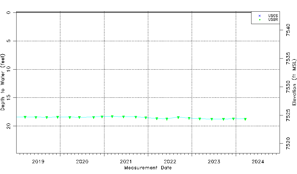
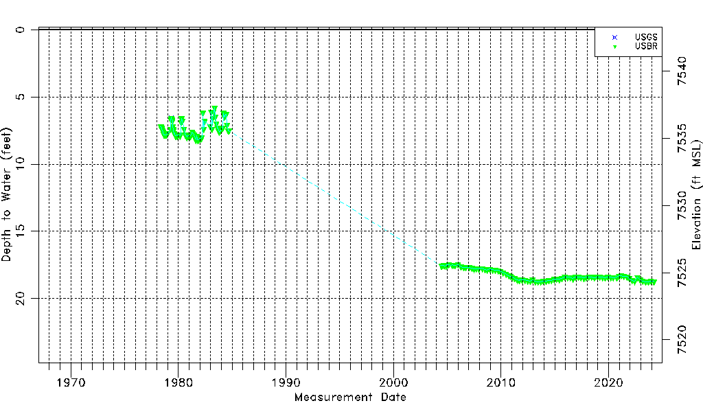
| Water-level Count | 172 |
| Water-level Date Range | 05/10/1978 thru 12/11/2023 |
| Monitored within the last 18 months | Yes, most recently on 12/11/2023 |
| Depth-to-Water Range (ft) | 5.80 to 18.76 |
| Water Table Elevation Range (ft NAVD88) | 7524.31 to 7537.27 |
| Water-Level-Source:Number-of-Measurements | USGS:3 USBR:170 |