| Well Information Table |
|---|
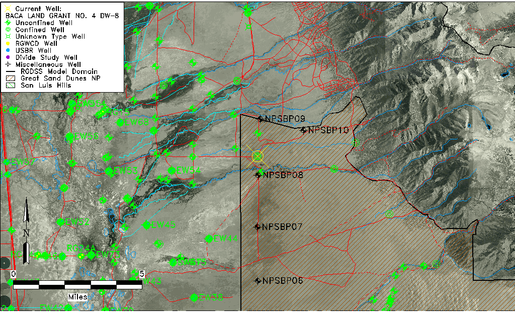
| Common Well ID | BACA LAND GRANT NO. 4 DW-8 |
| USGS Well ID | 375307105425701 |
| GSDNP Well Name | DW-8 |
| USGS Station Name | BACA LAND GRANT NO. 4 DW-8 |
| USGS Construction Date | 06/05/1996 |
| USGS Site Type | Well |
| USGS Site Use Information | Observation |
| USGS Groundwater Use Information | Unknown |
| Data Source(s) | USGS, HRS |
| Location Data |
|---|
| TRS | BACA LAND GRANT NO. 4 DW-8 |
| USGS TRS 1 | BACA LAND GRANT NO. 4 DW-8 |
| Longitude/Latitude (NAD83) | -105.71641082 , 37.89352223 |
| Longitude/Latitude Data Source | Davis Engineering Survey |
| USGS Longitude/Latitude (NAD83) | -105.7158611 , 37.88525000 |
| Easting, Northing RGDSS-NAD83 (US ft) | 187799.17 , 326762.07 |
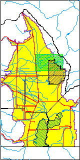
| USGS County | Saguache County |
| USGS Map Name | CRESTONE |
| USGS Map Scale | 24000 |
| Elevation and Depth Data |
|---|
| Ground Elevation (ft NAVD88) | 7649.72000000000 |
| Elevation Data Source | Davis Engineering Survey |
| USGS Ground Elevation (ft NGVD29) | 7640.00 |
| BACA Well database (Halapaska & Assoc, ft NGVD29) | 7638 |
| HRS Dunes Well database (ft NGVD29) | 7638.00000 |
| 1/3-Arc Second NED Ground Elevation (ft NAVD88) | 7642.74 |
| 1-Arc Second NED Ground Elevation (ft NAVD88) | 7641.39 |
| SRTM Ground Elevation (ft NAVD88) | 7643.22 |
| Total Depth (ft) | 977.00 |
| USGS Hole Depth (ft) | 1011.00 |
| USGS Well Depth (ft) | 977.00 |
| Model Layer | 3 |
| Model Layer Source | Dunes Layer |
| Depth of Bottom of Layer 1 | 229 |
| Depth of Bottom of Layer 2 | 628 |
| Depth of Bottom of Layer 3 | 1441 |
| Depth of Bottom of Layer 4 | 3926 |
| Additional Well Information | NONE |
| Aquifer Information |
|---|
| Aquifer Type | Confined |
| Aquifer Type Source | HRS_AQUIFER |
| USGS Primary Aquifer | Cenozoic Erathem |
| USGS Aquifer Type | Confined Multiple Aquifers |
| USGS Hydrologic Unit | San Luis |
| USGS Data Available | Discharge (GW.DISC) |
| Water-level Database Information |
|---|
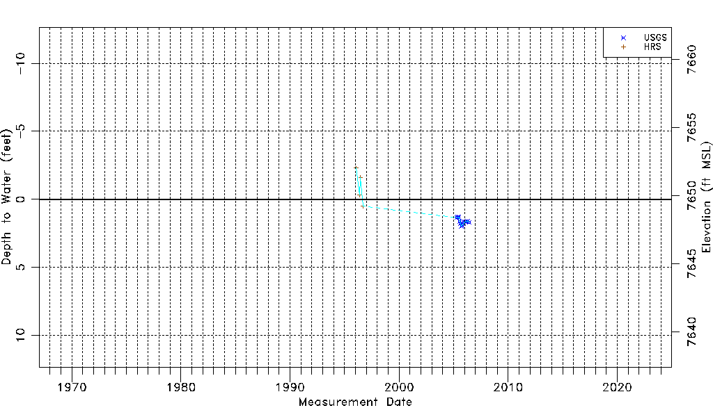
| Water-level Count | 18 |
| Water-level Date Range | 01/28/1996 thru 06/08/2006 |
| Monitored within the last 18 months | No, most recently on 06/08/2006 |
| Depth-to-Water Range (ft) | -2.30 to 1.98 |
| Water Table Elevation Range (ft NAVD88) | 7647.74 to 7652.02 |
| Water-Level-Source:Number-of-Measurements | USGS:14 HRS:4 |