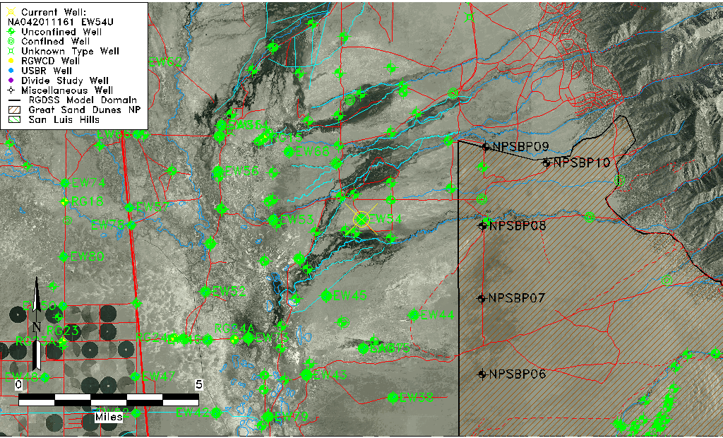
| Well Information Table |
|---|
| Common Well ID | NA042011161 EW54U |
| USBR Well ID | EW54U |
| USGS Well ID | 375308105463701 |
| GSDNP Well Name | 375308105463701 |
| USGS Station Name | NA042011161 EW54U |
| USGS Site Type | Well |
| USGS Site Use Information | Observation |
| USGS Groundwater Use Information | Unknown |
| Data Source(s) | USGS, USBR |
| Location Data |
|---|
| TRS | NA042011161 EW54U |
| USBR TRS | NA042011161 |
| USGS TRS 1 | NA042011161 EW54U |
| Longitude/Latitude (NAD83) | -105.77754036 , 37.88544928 |
| Longitude/Latitude Data Source | USBOR EW well locations |
| USGS Longitude/Latitude (NAD83) | -105.7775156 , 37.88555488 |
| USBR Longitude/Latitude (NAD27) | -105.776969234002 , 37.8854499531129 |
| Easting, Northing RGDSS-NAD83 (US ft) | 170160.98 , 323838.90 |
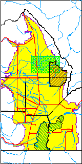
| USGS County | Saguache County |
| Elevation and Depth Data |
|---|
| Ground Elevation (ft NAVD88) | 7564.80000000000 |
| Elevation Data Source | USBOR EW well database |
| USBR Ground Elevation (ft NGVD29) | 7560.7 |
| USGS Ground Elevation (ft NGVD29) | 7560.67 |
| 1/3-Arc Second NED Ground Elevation (ft NAVD88) | 7563.38 |
| 1-Arc Second NED Ground Elevation (ft NAVD88) | 7563.81 |
| SRTM Ground Elevation (ft NAVD88) | 7558.46 |
| Total Depth (ft) | 43.00 |
| USBR Total Depth (ft) | 43 |
| USGS Well Depth (ft) | 40.00 |
| Model Layer | 1 |
| Model Layer Source | Aquifer Type |
| Depth of Bottom of Layer 1 | 165 |
| Depth of Bottom of Layer 2 | 442 |
| Depth of Bottom of Layer 3 | 1677 |
| Depth of Bottom of Layer 4 | 4533 |
| Additional Well Information | NONE |
| Aquifer Information |
|---|
| Aquifer Type | Unconfined |
| Aquifer Type Source | EW_AQFR |
| USGS Hydrologic Unit | San Luis |
| USGS Data Available | Water-level (GW.LEV) |
| Water-level Database Information |
|---|
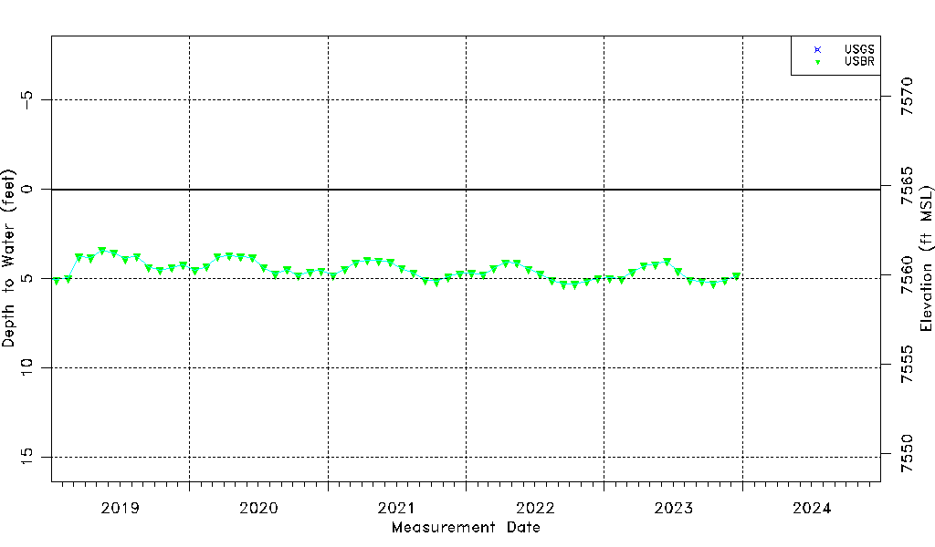
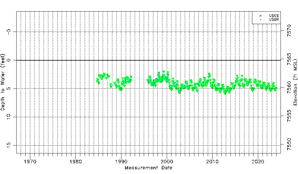
| Water-level Count | 501 |
| Water-level Date Range | 09/14/1984 thru 12/15/2023 |
| Monitored within the last 18 months | Yes, most recently on 12/15/2023 |
| Depth-to-Water Range (ft) | 1.93 to 5.84 |
| Water Table Elevation Range (ft NAVD88) | 7558.96 to 7562.87 |
| Water-Level-Source:Number-of-Measurements | USGS:96 USBR:408 |