| Well Information Table |
|---|
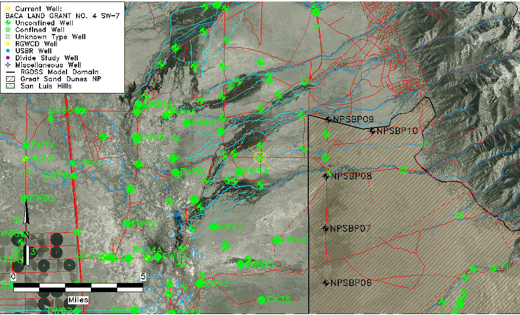
| Common Well ID | BACA LAND GRANT NO. 4 SW-7 |
| USGS Well ID | 375336105454601 |
| GSDNP Well Name | SW-7 |
| USGS Station Name | BACA LAND GRANT NO. 4 SW-7 |
| USGS Construction Date | 04/19/1996 |
| USGS Site Type | Well |
| USGS Site Use Information | Observation |
| USGS Groundwater Use Information | Unknown |
| Data Source(s) | USGS, HRS |
| Location Data |
|---|
| TRS | BACA LAND GRANT NO. 4 SW-7 |
| USGS TRS 1 | BACA LAND GRANT NO. 4 SW-7 |
| Longitude/Latitude (NAD83) | -105.76271241 , 37.89321371 |
| Longitude/Latitude Data Source | Davis Engineering Survey |
| USGS Longitude/Latitude (NAD83) | -105.7627500 , 37.89325000 |
| Halapaska & Assoc. Easting/Northing (CO-S) | 1924349.00000000 , 446702.000000000 |
| Easting, Northing RGDSS-NAD83 (US ft) | 174442.00 , 326660.53 |
| USGS Topography | Flat Surface |
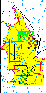
| USGS County | Saguache County |
| USGS Map Name | DEADMAN CAMP |
| USGS Map Scale | 24000 |
| Elevation and Depth Data |
|---|
| Ground Elevation (ft NAVD88) | 7559.14000000000 |
| Elevation Data Source | USGS GWSI database |
| USGS Ground Elevation (ft NGVD29) | 7555.00 |
| BACA Well database (Halapaska & Assoc, ft NGVD29) | 7575 |
| HRS Dunes Well database (ft NGVD29) | 7575.00000 |
| 1/3-Arc Second NED Ground Elevation (ft NAVD88) | 7579.29 |
| 1-Arc Second NED Ground Elevation (ft NAVD88) | 7579.92 |
| SRTM Ground Elevation (ft NAVD88) | 7584.53 |
| Total Depth (ft) | 160.00 |
| USGS Hole Depth (ft) | 180.00 |
| USGS Well Depth (ft) | 160.00 |
| Model Layer | 1 |
| Model Layer Source | Dunes Layer |
| Depth of Bottom of Layer 1 | 136 |
| Depth of Bottom of Layer 2 | 471 |
| Depth of Bottom of Layer 3 | 1615 |
| Depth of Bottom of Layer 4 | 4347 |
| Additional Well Information | NONE |
| Aquifer Information |
|---|
| Aquifer Type | Unconfined |
| Aquifer Type Source | HRS_AQUIFER |
| USGS Aquifer Type | Unconfined Single Aquifer |
| USGS Hydrologic Unit | San Luis |
| USGS Data Available | Miscellaneous (GW.MISC) |
| Water-level Database Information |
|---|
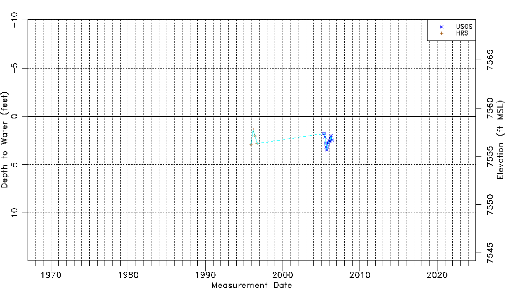
| Water-level Count | 19 |
| Water-level Date Range | 11/26/1995 thru 06/08/2006 |
| Monitored within the last 18 months | No, most recently on 06/08/2006 |
| Depth-to-Water Range (ft) | 1.40 to 3.47 |
| Water Table Elevation Range (ft NAVD88) | 7555.67 to 7557.74 |
| Water-Level-Source:Number-of-Measurements | USGSaguache Creek:14 HRS:5 |