| Well Information Table |
|---|
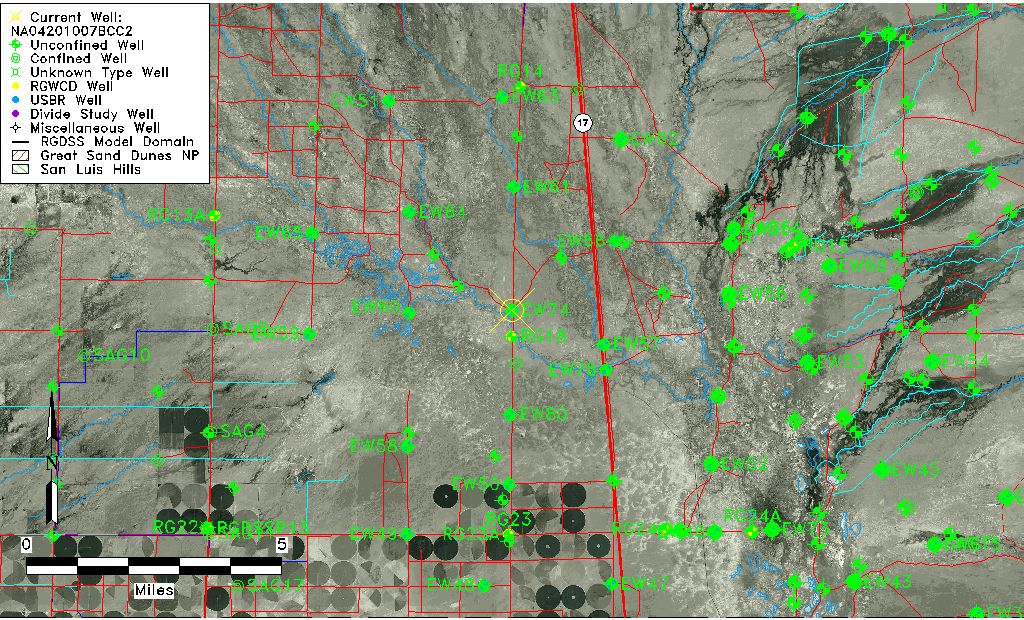
| Common Well ID | NA04201007BCC2 |
| USGS Well ID | 375359105553902 |
| USGS Station Name | NA04201007BCC2 |
| USGS Construction Date | 02/28/1978 |
| USGS Site Type | Well |
| USGS Site Use Information | Observation |
| USGS Groundwater Use Information | Unknown |
| Data Source(s) | USGS |
| Location Data |
|---|
| TRS | NA04201007BCC2 |
| USGS TRS 1 | NA04201007BCC2 |
| Longitude/Latitude (NAD83) | -105.92807400 , 37.89972167 |
| Longitude/Latitude Data Source | GWSI decimal LAT/LONG field |
| USGS Longitude/Latitude (NAD83) | -105.9280740 , 37.89972167 |
| Easting, Northing RGDSS-NAD83 (US ft) | 126744.41 , 329122.24 |
| USGS Topography | Valley flat |
| USGS County | Saguache County |
| USGS Map Name | MOFFAT SOUTH |
| USGS Map Scale | 24000 |
| Elevation and Depth Data |
|---|
| Ground Elevation (ft NAVD88) | 7549.20000000000 |
| Elevation Data Source | USGS GWSI database |
| USGS Ground Elevation (ft NGVD29) | 7545.40 |
| 1/3-Arc Second NED Ground Elevation (ft NAVD88) | 7549.00 |
| 1-Arc Second NED Ground Elevation (ft NAVD88) | 7548.61 |
| SRTM Ground Elevation (ft NAVD88) | 7555.77 |
| Depth of Bottom of Layer 1 | 83 |
| Depth of Bottom of Layer 2 | 150 |
| Depth of Bottom of Layer 3 | 735 |
| Depth of Bottom of Layer 4 | 3126 |
| Additional Well Information | Construction |
| Aquifer Information |
|---|
| Aquifer Type | Unknown |
| Aquifer Type Source | None |
| USGS Hydrologic Unit | Saguache |
| USGS Data Available | Water-level (GW.LEV) |
| Water-level Database Information |
|---|
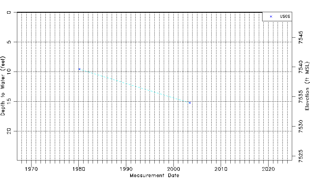
| Water-level Count | 2 |
| Water-level Date Range | 03/05/1980 thru 06/12/2003 |
| Monitored within the last 18 months | No, most recently on 06/12/2003 |
| Depth-to-Water Range (ft) | 9.57 to 15.24 |
| Water Table Elevation Range (ft NAVD88) | 7533.96 to 7539.63 |
| Water-Level-Source:Number-of-Measurements | USGSaguache Creek:2 |