| Well Information Table |
|---|
| Common Well ID | NA04201007BCC3 EW-74U |
| USBR Well ID | EW74U |
| USGS Well ID | 375359105553903 |
| USGS Station Name | NA04201007BCC3 EW-74U |
| USGS Construction Date | 01/17/1983 |
| USGS Site Type | Well |
| USGS Site Use Information | Observation |
| USGS Groundwater Use Information | Unused |
| Data Source(s) | USGS, USBR |
| Location Data |
|---|
| TRS | NA04201007BCC3 EW-74U |
| USBR TRS | NA04201007BCC3 |
| USGS TRS 1 | NA04201007BCC3 EW-74U |
| Longitude/Latitude (NAD83) | -105.92794758 , 37.89974224 |
| Longitude/Latitude Data Source | USBOR EW well locations |
| USGS Longitude/Latitude (NAD83) | -105.9280740 , 37.89972167 |
| USBR Longitude/Latitude (NAD27) | -105.927373572530 , 37.8997427905099 |
| Easting, Northing RGDSS-NAD83 (US ft) | 126780.90 , 329129.63 |
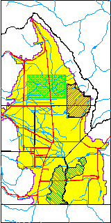
| USGS County | Saguache County |
| USGS Map Name | MO15= 24000 |
| Elevation and Depth Data |
|---|
| Ground Elevation (ft NAVD88) | 7549.20000000000 |
| Elevation Data Source | USBOR EW well database |
| USBR Ground Elevation (ft NGVD29) | 7545.4 |
| USGS Ground Elevation (ft NGVD29) | 7545.40 |
| 1/3-Arc Second NED Ground Elevation (ft NAVD88) | 7549.05 |
| 1-Arc Second NED Ground Elevation (ft NAVD88) | 7548.56 |
| SRTM Ground Elevation (ft NAVD88) | 7554.35 |
| Total Depth (ft) | 19.00 |
| USBR Total Depth (ft) | 19 |
| USGS Well Depth (ft) | 18.70 |
| Model Layer | 1 |
| Model Layer Source | Aquifer Type |
| Depth of Bottom of Layer 1 | 83 |
| Depth of Bottom of Layer 2 | 150 |
| Depth of Bottom of Layer 3 | 735 |
| Depth of Bottom of Layer 4 | 3128 |
| Additional Well Information | NONE |
| Aquifer Information |
|---|
| Aquifer Type | Unconfined |
| Aquifer Type Source | EW_AQFR |
| USGS Hydrologic Unit | Saguache |
| USGS Data Available | Discharge (GW.DISC) |
| Water-level Database Information |
|---|
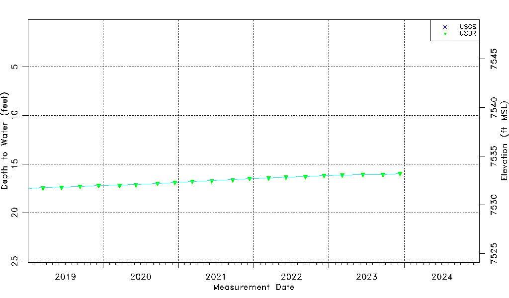
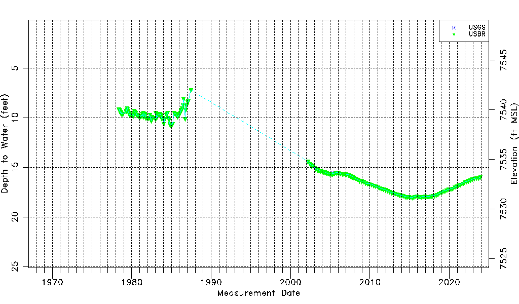
| Water-level Count | 221 |
| Water-level Date Range | 05/12/1978 thru 12/11/2023 |
| Monitored within the last 18 months | Yes, most recently on 12/11/2023 |
| Depth-to-Water Range (ft) | 7.20 to 18.05 |
| Water Table Elevation Range (ft NAVD88) | 7531.15 to 7542.00 |
| Water-Level-Source:Number-of-Measurements | USGS:7 USBR:218 |