| Well Information Table |
|---|
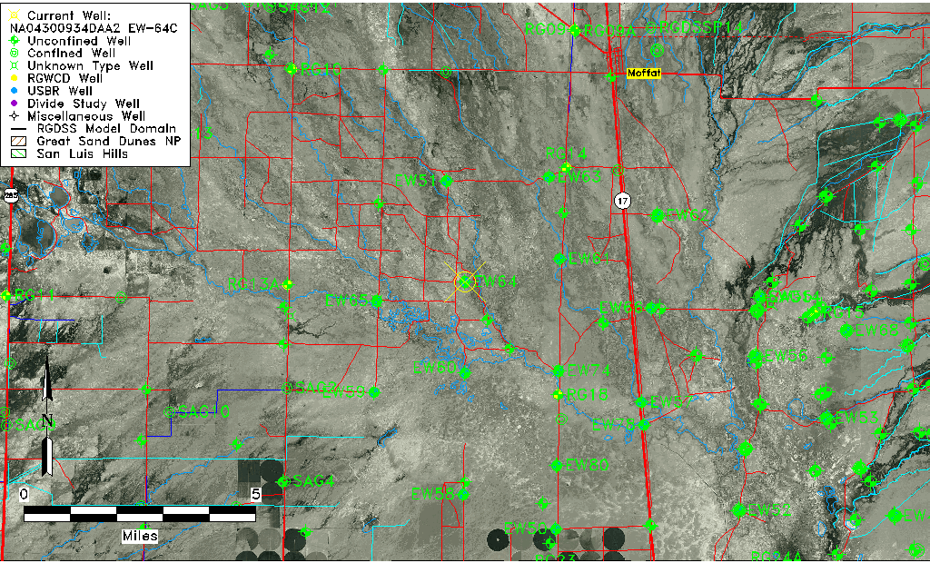
| Common Well ID | NA04300934DAA2 EW-64C |
| USBR Well ID | EW64C |
| USGS Well ID | 375539105574802 |
| USGS Station Name | NA04300934DAA2 EW-64C |
| USGS Construction Date | 07/01/1983 |
| USGS Site Type | Well |
| USGS Site Use Information | Observation |
| USGS Groundwater Use Information | Unused |
| Data Source(s) | USGS, USBR |
| Location Data |
|---|
| TRS | NA04300934DAA2 EW-64C |
| USBR TRS | NA04300934DAA2 |
| USGS TRS 1 | NA04300934DAA2 EW-64C |
| Longitude/Latitude (NAD83) | -105.96496889 , 37.92749110 |
| Longitude/Latitude Data Source | USBOR EW well locations |
| USGS Longitude/Latitude (NAD83) | -105.9639075 , 37.92749947 |
| USBR Longitude/Latitude (NAD27) | -105.964394747608 , 37.9274916318032 |
| Easting, Northing RGDSS-NAD83 (US ft) | 116134.21 , 339263.64 |
| USGS Topography | Valley flat |
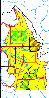
| USGS County | Saguache County |
| USGS Map Name | MOFFAT SOUTH |
| USGS Map Scale | 24000 |
| Elevation and Depth Data |
|---|
| Ground Elevation (ft NAVD88) | 7548.85000000000 |
| Elevation Data Source | USBOR EW well database |
| USBR Ground Elevation (ft NGVD29) | 7544.9 |
| USGS Ground Elevation (ft NGVD29) | 7544.90 |
| 1/3-Arc Second NED Ground Elevation (ft NAVD88) | 7550.51 |
| 1-Arc Second NED Ground Elevation (ft NAVD88) | 7548.36 |
| SRTM Ground Elevation (ft NAVD88) | 7549.31 |
| Total Depth (ft) | 125.00 |
| USBR Total Depth (ft) | 125 |
| USGS Hole Depth (ft) | 128.00 |
| USGS Well Depth (ft) | 123.00 |
| Model Layer | 2 |
| Model Layer Source | Well Depth |
| Depth of Bottom of Layer 1 | 81 |
| Depth of Bottom of Layer 2 | 134 |
| Depth of Bottom of Layer 3 | 454 |
| Depth of Bottom of Layer 4 | 2583 |
| Additional Well Information | Construction |
| Aquifer Information |
|---|
| Aquifer Type | Confined |
| Aquifer Type Source | EW_AQFR |
| USGS Hydrologic Unit | Saguache |
| USGS Data Available | Water-level (GW.LEV) |
| Water-level Database Information |
|---|
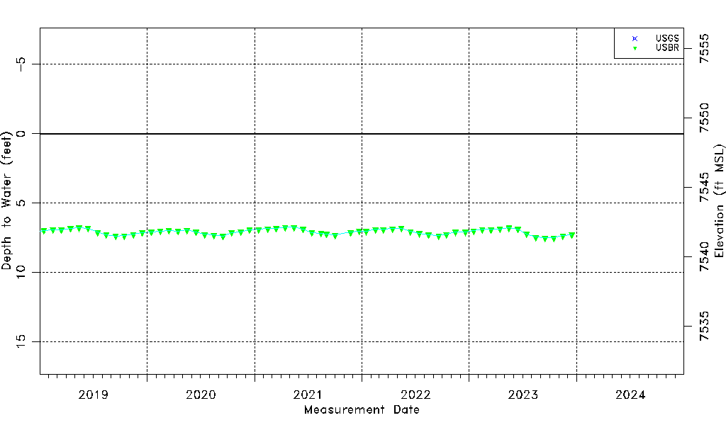
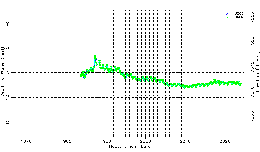
| Water-level Count | 676 |
| Water-level Date Range | 10/17/1983 thru 12/15/2023 |
| Monitored within the last 18 months | Yes, most recently on 12/15/2023 |
| Depth-to-Water Range (ft) | 1.71 to 7.98 |
| Water Table Elevation Range (ft NAVD88) | 7540.87 to 7547.14 |
| Water-Level-Source:Number-of-Measurements | USGS:213 USBR:468 |