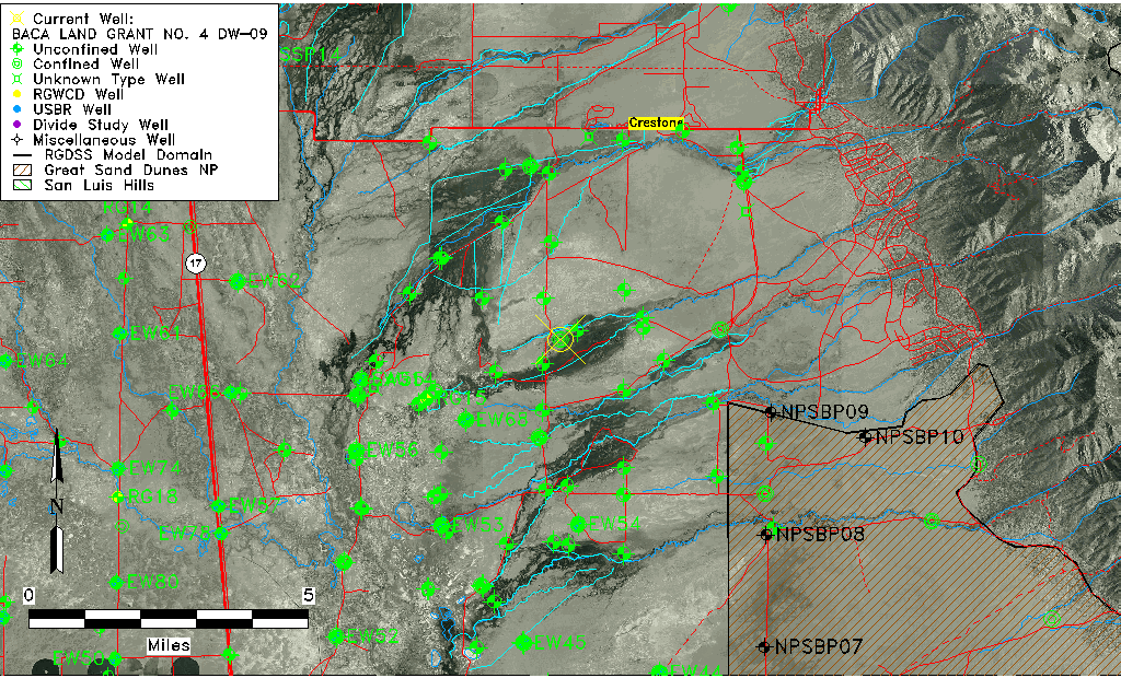
| Well Information Table |
|---|
| Common Well ID | BACA LAND GRANT NO. 4 DW-09 |
| Baca Well Name | DW-9 |
| USGS Well ID | 375601105471501 |
| GSDNP Well Name | DW-9 |
| USGS Station Name | BACA LAND GRANT NO. 4 DW-09 |
| USGS Construction Date | 07/09/1996 |
| USGS Site Type | Well |
| USGS Site Use Information | Observation |
| USGS Groundwater Use Information | Unknown |
| Data Source(s) | USGS, HRS |
| Location Data |
|---|
| TRS | BACA LAND GRANT NO. 4 DW-09 |
| USGS TRS 1 | BACA LAND GRANT NO. 4 DW-09 |
| Longitude/Latitude (NAD83) | -105.78342780 , 37.93345278 |
| Longitude/Latitude Data Source | GWSI decimal LAT/LONG field |
| USGS Longitude/Latitude (NAD83) | -105.7834278 , 37.93345278 |
| Easting, Northing RGDSS-NAD83 (US ft) | 168484.74 , 341315.75 |
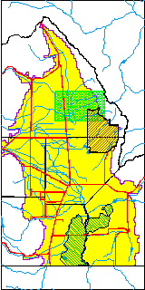
| USGS County | Saguache County |
| USGS Map Name | SHEDS CAMP |
| USGS Map Scale | 24000 |
| Elevation and Depth Data |
|---|
| Ground Elevation (ft NAVD88) | 7571.83000000000 |
| Elevation Data Source | USGS GWSI database |
| USGS Ground Elevation (ft NAVD88) | 7571.83 |
| BACA Well database (Halapaska & Assoc, ft NGVD29) | 7573 |
| HRS Dunes Well database (ft NGVD29) | 7573.00000 |
| 1/3-Arc Second NED Ground Elevation (ft NAVD88) | 7576.91 |
| 1-Arc Second NED Ground Elevation (ft NAVD88) | 7577.10 |
| SRTM Ground Elevation (ft NAVD88) | 7576.51 |
| Total Depth (ft) | 2160.00 |
| USGS Hole Depth (ft) | 2172.00 |
| USGS Well Depth (ft) | 2160.00 |
| Model Layer | 4 |
| Model Layer Source | Dunes Layer |
| Depth of Bottom of Layer 1 | 223 |
| Depth of Bottom of Layer 2 | 446 |
| Depth of Bottom of Layer 3 | 1676 |
| Depth of Bottom of Layer 4 | 4146 |
| Additional Well Information | NONE |
| Aquifer Information |
|---|
| Aquifer Type | Confined |
| Aquifer Type Source | HRS_AQUIFER |
| USGS Primary Aquifer | Valley-fill Deposits |
| USGS Aquifer Type | Confined Multiple Aquifers |
| USGS Hydrologic Unit | San Luis |
| USGS Data Available | Discharge (GW.DISC) |
| Water-level Database Information |
|---|
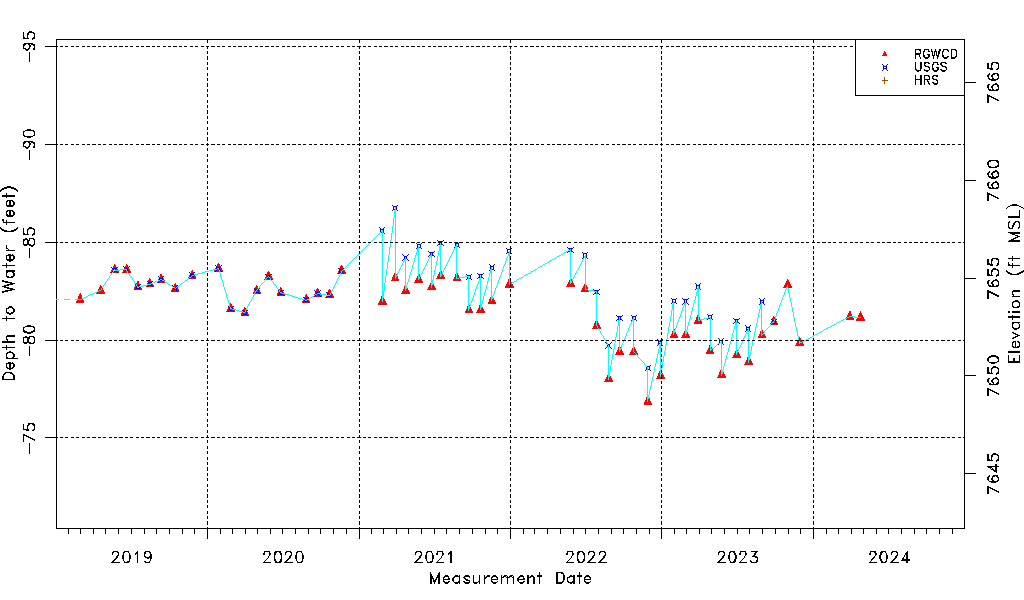
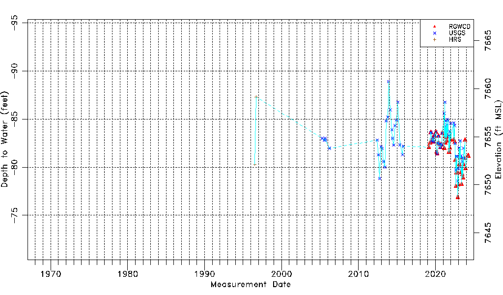
| Water-level Count | 112 |
| Water-level Date Range | 07/19/1996 thru 03/29/2024 |
| Monitored within the last 18 months | Yes, most recently on 03/29/2024 |
| Depth-to-Water Range (ft) | -88.89 to -76.87 |
| Water Table Elevation Range (ft NAVD88) | 7648.70 to 7660.72 |
| Water-Level-Source:Number-of-Measurements | RGWCD:54 USGS:70 HRS:2 |