| Well Information Table |
|---|
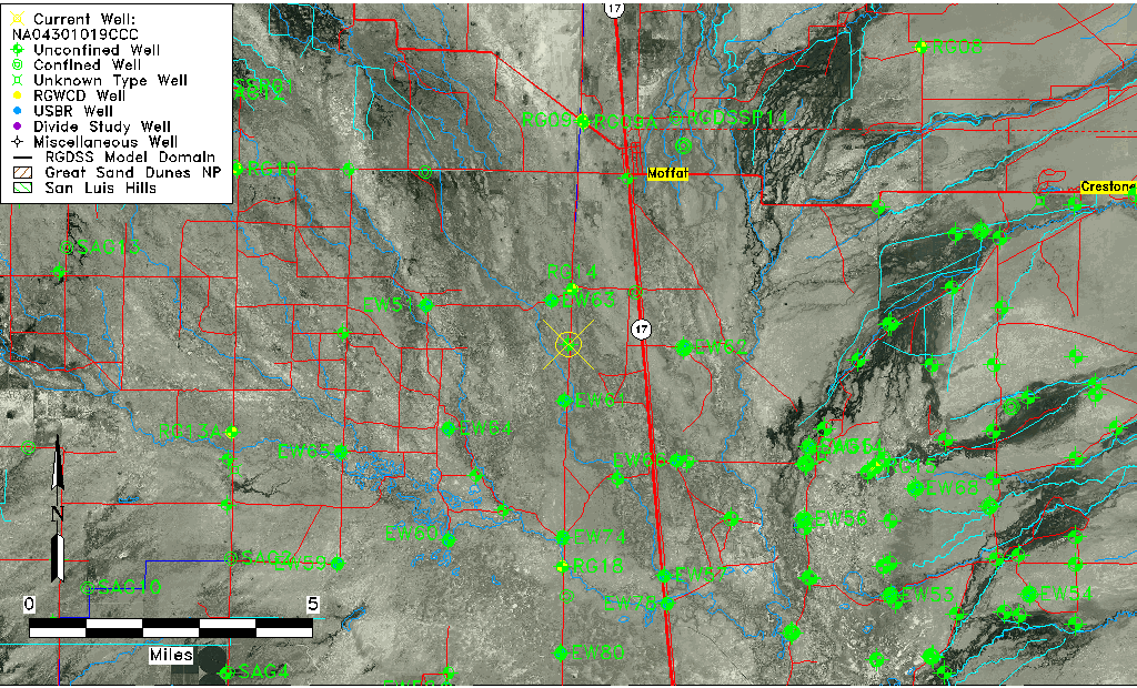
| Common Well ID | NA04301019CCC |
| USGS Well ID | 375700105552801 |
| USGS Station Name | NA04301019CCC |
| USGS Construction Date | 01/01/1967 |
| USGS Site Type | Well |
| USGS Site Use Information | Observation |
| USGS Groundwater Use Information | Unused |
| Data Source(s) | USGS |
| Location Data |
|---|
| TRS | NA04301019CCC |
| USGS TRS 1 | NA04301019CCC |
| USGS TRS | SWSWSWS019T0043NR0010EN |
| Longitude/Latitude (NAD83) | -105.92637830 , 37.94911050 |
| Longitude/Latitude Data Source | GWSI decimal LAT/LONG field |
| USGS Longitude/Latitude (NAD83) | -105.9263783 , 37.94911050 |
| Easting, Northing RGDSS-NAD83 (US ft) | 127284.18 , 347100.32 |
| USGS Topography | Valley flat |
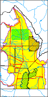
| USGS County | Saguache County |
| USGS Map Name | MOFFAT SOUTH |
| USGS Map Scale | 24000 |
| Elevation and Depth Data |
|---|
| Ground Elevation (ft NAVD88) | 7552.95000000000 |
| Elevation Data Source | USGS GWSI database |
| USGS Ground Elevation (ft NGVD29) | 7549.00 |
| 1/3-Arc Second NED Ground Elevation (ft NAVD88) | 7553.92 |
| 1-Arc Second NED Ground Elevation (ft NAVD88) | 7552.48 |
| SRTM Ground Elevation (ft NAVD88) | 7562.31 |
| Total Depth (ft) | 13.00 |
| USGS Well Depth (ft) | 13.00 |
| Model Layer | 1 |
| Model Layer Source | Well Depth |
| Depth of Bottom of Layer 1 | 61 |
| Depth of Bottom of Layer 2 | 141 |
| Depth of Bottom of Layer 3 | 484 |
| Depth of Bottom of Layer 4 | 2877 |
| Additional Well Information | Geohydrology, Construction |
| Aquifer Information |
|---|
| Aquifer Type | Unconfined |
| Aquifer Type Source | TD Elevation/Model Layer |
| USGS Primary Aquifer | Cenozoic Erathem |
| USGS Aquifer Type | Unconfined Single Aquifer |
| USGS Hydrologic Unit | Saguache |
| USGS Data Available | Water-level (GW.LEV) |
| Water-level Database Information |
|---|
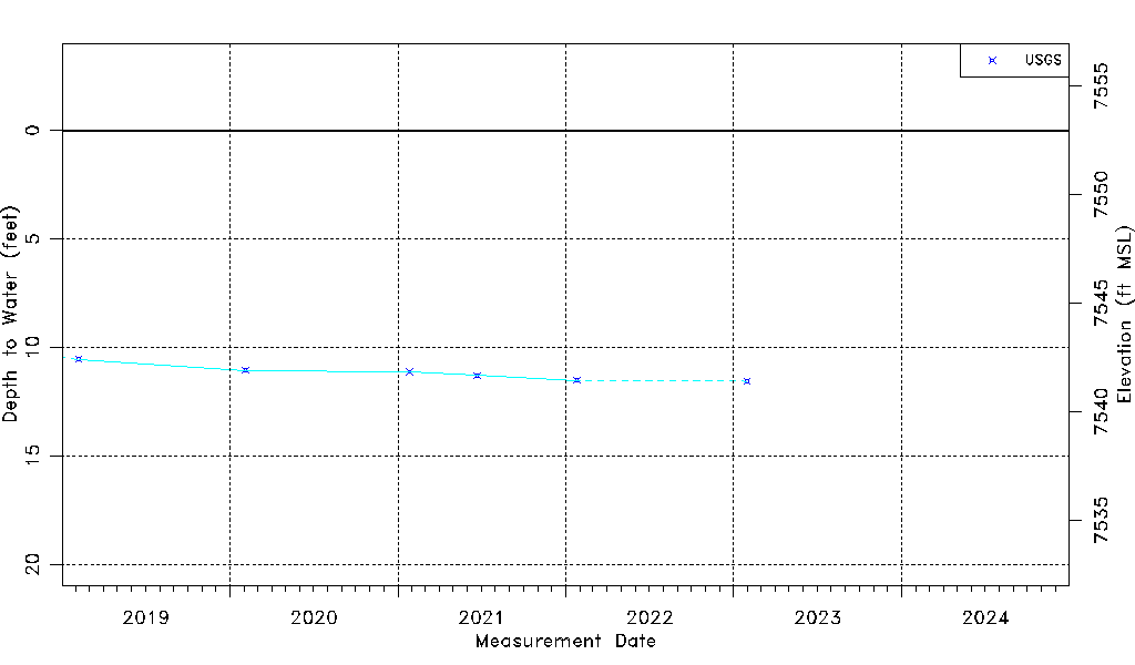
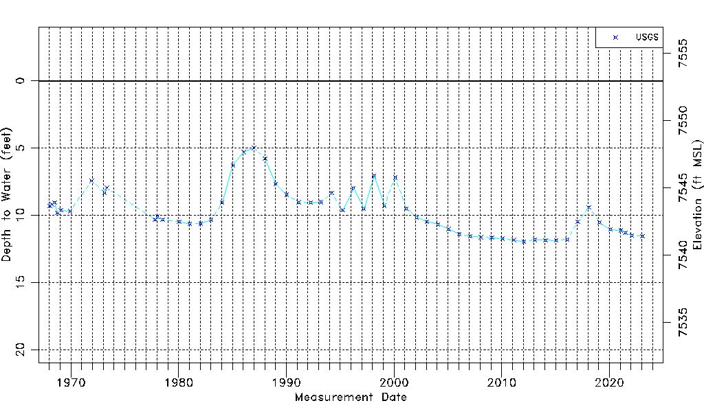
| Water-level Count | 57 |
| Water-level Date Range | 01/16/1968 thru 01/30/2023 |
| Monitored within the last 18 months | Yes, most recently on 01/30/2023 |
| Depth-to-Water Range (ft) | 4.99 to 11.97 |
| Water Table Elevation Range (ft NAVD88) | 7540.98 to 7547.96 |
| Water-Level-Source:Number-of-Measurements | USGS:57 |