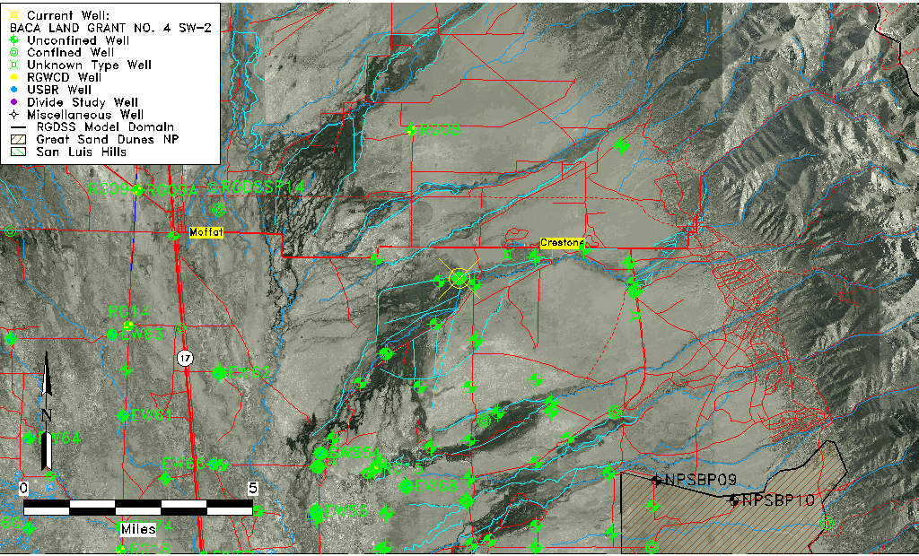
| Well Information Table |
|---|
| Common Well ID | BACA LAND GRANT NO. 4 SW-2 |
| USGS Well ID | 375842105473601 |
| GSDNP Well Name | SW-2 |
| USGS Station Name | BACA LAND GRANT NO. 4 SW-2 |
| USGS Construction Date | 04/19/1996 |
| USGS Site Type | Well |
| USGS Site Use Information | Observation |
| USGS Groundwater Use Information | Unknown |
| Data Source(s) | USGS, HRS |
| Location Data |
|---|
| TRS | BACA LAND GRANT NO. 4 SW-2 |
| USGS TRS 1 | BACA LAND GRANT NO. 4 SW-2 |
| Longitude/Latitude (NAD83) | -105.79328342 , 37.97842690 |
| Longitude/Latitude Data Source | Davis Engineering Survey |
| USGS Longitude/Latitude (NAD83) | -105.7933333 , 37.97844444 |
| Halapaska & Assoc. Easting/Northing (CO-S) | 1915624.00000000 , 477757.000000000 |
| Easting, Northing RGDSS-NAD83 (US ft) | 165665.93 , 357691.66 |
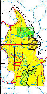
| USGS County | Saguache County |
| USGS Map Name | SHEDS CAMP |
| USGS Map Scale | 24000 |
| Elevation and Depth Data |
|---|
| Ground Elevation (ft NAVD88) | 7624.23000000000 |
| Elevation Data Source | USGS GWSI database |
| USGS Ground Elevation (ft NGVD29) | 7620.00 |
| BACA Well database (Halapaska & Assoc, ft NGVD29) | 7602 |
| HRS Dunes Well database (ft NGVD29) | 7602.00000 |
| 1/3-Arc Second NED Ground Elevation (ft NAVD88) | 7605.51 |
| 1-Arc Second NED Ground Elevation (ft NAVD88) | 7605.87 |
| SRTM Ground Elevation (ft NAVD88) | 7609.17 |
| Total Depth (ft) | 302.00 |
| USGS Hole Depth (ft) | 320.00 |
| USGS Well Depth (ft) | 302.00 |
| Model Layer | 1 |
| Model Layer Source | Dunes Layer |
| Depth of Bottom of Layer 1 | 194 |
| Depth of Bottom of Layer 2 | 407 |
| Depth of Bottom of Layer 3 | 1600 |
| Depth of Bottom of Layer 4 | 4163 |
| Additional Well Information | NONE |
| Aquifer Information |
|---|
| Aquifer Type | Unconfined |
| Aquifer Type Source | HRS_AQUIFER |
| USGS Aquifer Type | Unconfined Multiple Aquifer |
| USGS Hydrologic Unit | San Luis |
| USGS Data Available | Discharge (GW.DISC) |
| Water-level Database Information |
|---|
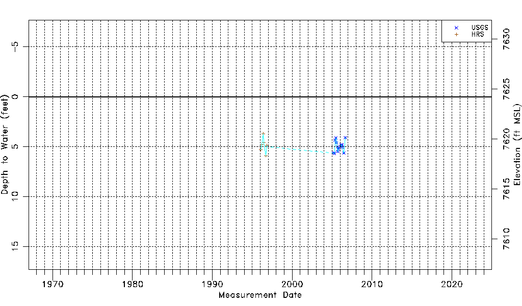
| Water-level Count | 22 |
| Water-level Date Range | 01/29/1996 thru 08/30/2006 |
| Monitored within the last 18 months | No, most recently on 08/30/2006 |
| Depth-to-Water Range (ft) | 3.70 to 5.90 |
| Water Table Elevation Range (ft NAVD88) | 7618.33 to 7620.53 |
| Water-Level-Source:Number-of-Measurements | USGSaguache Creek:15 HRS:7 |