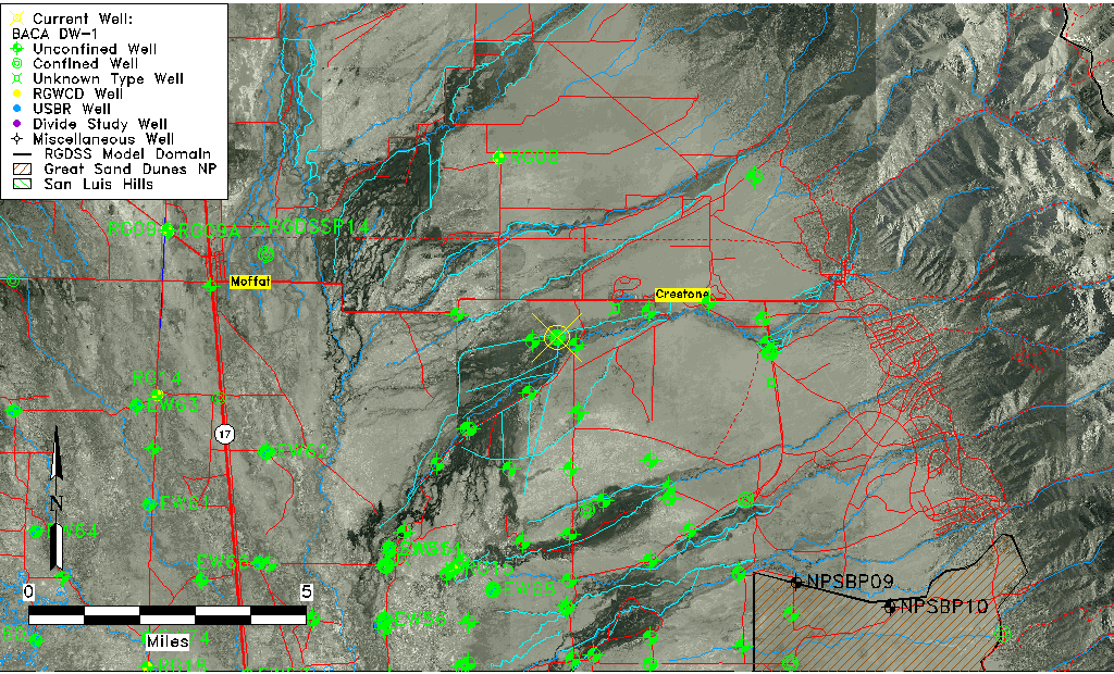
| Well Information Table |
|---|
| Common Well ID | BACA DW-1 |
| Baca Well Name | DW-1 |
| USGS Well ID | 375842105473701 |
| GSDNP Well Name | DW-1 |
| USGS Station Name | BACA DW-1 |
| USGS Construction Date | 10/11/1995 |
| USGS Site Type | Well |
| USGS Site Use Information | Observation |
| USGS Groundwater Use Information | Unknown |
| Data Source(s) | USGS, HRS |
| Location Data |
|---|
| TRS | BACA DW-1 |
| USGS TRS 1 | BACA DW-1 |
| Longitude/Latitude (NAD83) | -105.79345293 , 37.97842369 |
| Longitude/Latitude Data Source | Davis Engineering Survey |
| USGS Longitude/Latitude (NAD83) | -105.7934417 , 37.97841110 |
| Halapaska & Assoc. Easting/Northing (CO-S) | 1915578.00000000 , 477757.000000000 |
| Easting, Northing RGDSS-NAD83 (US ft) | 165617.09 , 357690.56 |
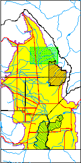
| USGS County | Saguache County |
| USGS Map Name | SHEDS CAMP |
| USGS Map Scale | 24000 |
| Elevation and Depth Data |
|---|
| Ground Elevation (ft NAVD88) | 7605.19000000000 |
| Elevation Data Source | USGS GWSI database |
| USGS Ground Elevation (ft NAVD88) | 7605.19 |
| BACA Well database (Halapaska & Assoc, ft NGVD29) | 7602 |
| HRS Dunes Well database (ft NGVD29) | 7604.89014 |
| 1/3-Arc Second NED Ground Elevation (ft NAVD88) | 7605.41 |
| 1-Arc Second NED Ground Elevation (ft NAVD88) | 7605.62 |
| SRTM Ground Elevation (ft NAVD88) | 7610.29 |
| Total Depth (ft) | 1000.00 |
| USGS Hole Depth (ft) | 1020.00 |
| USGS Well Depth (ft) | 1000.00 |
| Model Layer | 3 |
| Model Layer Source | Dunes Layer |
| Depth of Bottom of Layer 1 | 175 |
| Depth of Bottom of Layer 2 | 388 |
| Depth of Bottom of Layer 3 | 1582 |
| Depth of Bottom of Layer 4 | 4148 |
| Additional Well Information | NONE |
| Aquifer Information |
|---|
| Aquifer Type | Confined |
| Aquifer Type Source | HRS_AQUIFER |
| USGS Primary Aquifer | Valley-fill Deposits |
| USGS Aquifer Type | Confined Multiple Aquifers |
| USGS Hydrologic Unit | San Luis |
| USGS Data Available | Discharge (GW.DISC) |
| Water-level Database Information |
|---|
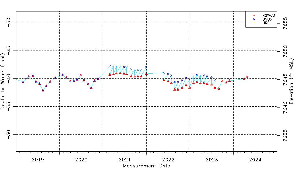
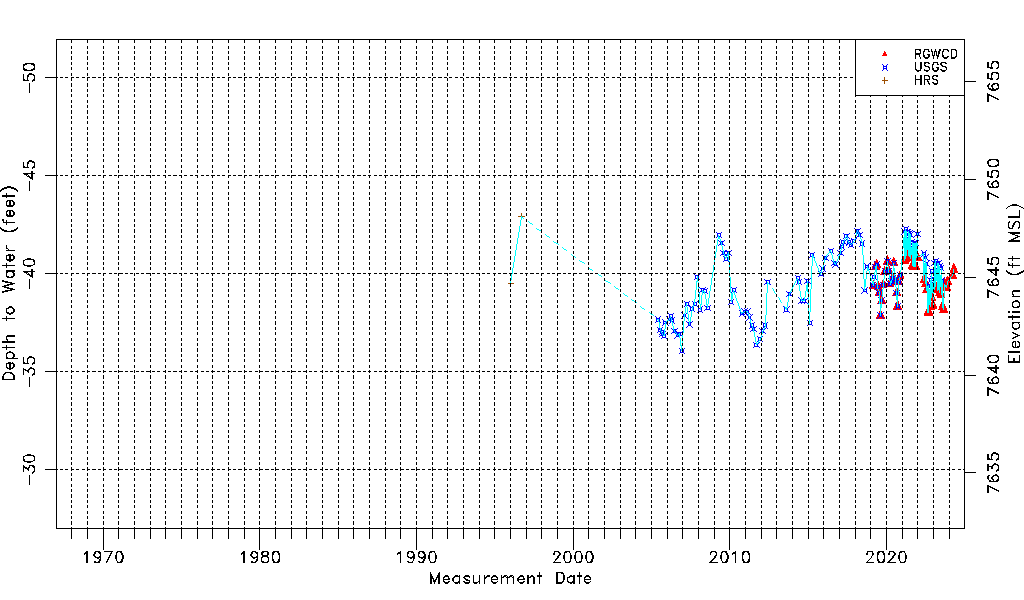
| Water-level Count | 156 |
| Water-level Date Range | 01/09/1996 thru 03/29/2024 |
| Monitored within the last 18 months | Yes, most recently on 03/29/2024 |
| Depth-to-Water Range (ft) | -42.90 to -36.05 |
| Water Table Elevation Range (ft NAVD88) | 7641.24 to 7648.09 |
| Water-Level-Source:Number-of-Measurements | RGWCD:54 USGS:115 HRS:2 |