| Well Information Table |
|---|
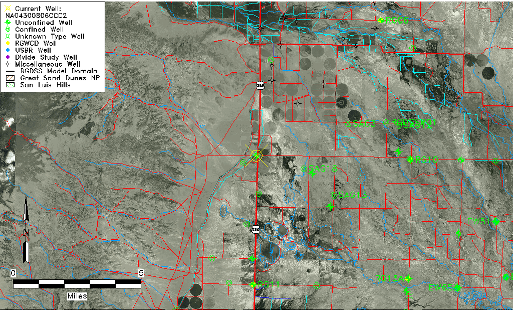
| Common Well ID | NA04300806CCC2 |
| USGS Well ID | 375936106083302 |
| USGS Station Name | NA04300806CCC2 |
| USGS Site Type | Well |
| USGS Site Use Information | Observation |
| USGS Groundwater Use Information | Unused |
| Data Source(s) | USGS |
| Location Data |
|---|
| TRS | NA04300806CCC2 |
| USGS TRS 1 | NA04300806CCC2 |
| USGS TRS | SWSWSWS006T0043NR0008EN |
| Longitude/Latitude (NAD83) | -106.14391270 , 37.99558345 |
| Longitude/Latitude Data Source | GWSI decimal LAT/LONG field |
| USGS Longitude/Latitude (NAD83) | -106.1439127 , 37.99558345 |
| Easting, Northing RGDSS-NAD83 (US ft) | 64661.92 , 364269.12 |
| USGS Topography | Valley flat |
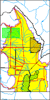
| USGS County | Saguache County |
| USGS Map Name | SWEDE CORNERS |
| USGS Map Scale | 24000 |
| Elevation and Depth Data |
|---|
| Ground Elevation (ft NAVD88) | 7642.52000000000 |
| Elevation Data Source | USGS GWSI database |
| USGS Ground Elevation (ft NGVD29) | 7638.00 |
| 1/3-Arc Second NED Ground Elevation (ft NAVD88) | 7642.95 |
| 1-Arc Second NED Ground Elevation (ft NAVD88) | 7642.95 |
| SRTM Ground Elevation (ft NAVD88) | 7644.43 |
| Total Depth (ft) | 26.00 |
| USGS Well Depth (ft) | 26.00 |
| Model Layer | 1 |
| Model Layer Source | Well Depth |
| Depth of Bottom of Layer 1 | 90 |
| Depth of Bottom of Layer 2 | 215 |
| Depth of Bottom of Layer 3 | 353 |
| Depth of Bottom of Layer 4 | 835 |
| Additional Well Information | Geohydrology, Construction |
| Aquifer Information |
|---|
| Aquifer Type | Unconfined |
| Aquifer Type Source | TD Elevation/Model Layer |
| USGS Primary Aquifer | Cenozoic Erathem |
| USGS Aquifer Type | Unconfined Single Aquifer |
| USGS Hydrologic Unit | Saguache |
| USGS Data Available | Water-level (GW.LEV) |
| Water-level Database Information |
|---|
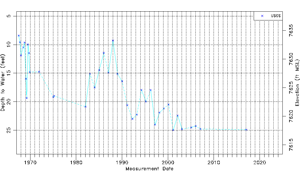
| Water-level Count | 39 |
| Water-level Date Range | 07/03/1967 thru 02/01/2017 |
| Monitored within the last 18 months | No, most recently on 02/01/2017 |
| Depth-to-Water Range (ft) | 8.40 to 24.95 |
| Water Table Elevation Range (ft NAVD88) | 7617.57 to 7634.12 |
| Water-Level-Source:Number-of-Measurements | USGSaguache Creek:39 |