| Well Information Table |
|---|
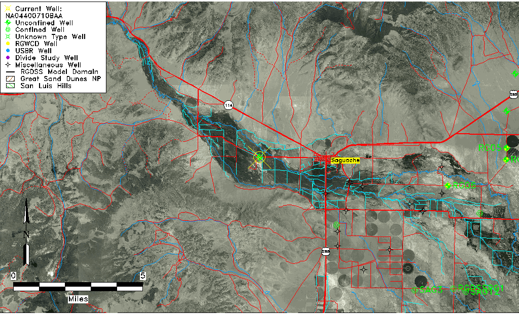
| Common Well ID | NA04400710BAA |
| USGS Well ID | 380506106113001 |
| USGS Station Name | NA04400710BAA |
| USGS Construction Date | 01/01/1966 |
| USGS Site Type | Well |
| USGS Site Use Information | Observation |
| USGS Groundwater Use Information | Unused |
| Data Source(s) | USGS |
| Location Data |
|---|
| TRS | NA04400710BAA |
| USGS TRS 1 | NA04400710BAA |
| USGS TRS | NENENWS010T0044NR0007EN |
| Longitude/Latitude (NAD83) | -106.18877460 , 38.08780575 |
| Longitude/Latitude Data Source | GWSI decimal LAT/LONG field |
| USGS Longitude/Latitude (NAD83) | -106.1887746 , 38.08780575 |
| Easting, Northing RGDSS-NAD83 (US ft) | 51927.46 , 397913.58 |
| USGS Topography | Valley flat |
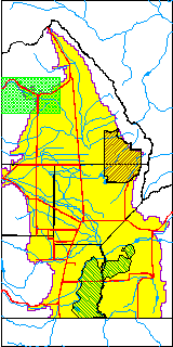
| USGS County | Saguache County |
| USGS Map Name | SAGUACHE |
| USGS Map Scale | 24000 |
| Elevation and Depth Data |
|---|
| Ground Elevation (ft NAVD88) | 7776.66000000000 |
| Elevation Data Source | USGS GWSI database |
| USGS Ground Elevation (ft NGVD29) | 7772.00 |
| 1/3-Arc Second NED Ground Elevation (ft NAVD88) | 7778.53 |
| 1-Arc Second NED Ground Elevation (ft NAVD88) | 7777.99 |
| SRTM Ground Elevation (ft NAVD88) | 7788.85 |
| Total Depth (ft) | 9.00 |
| USGS Well Depth (ft) | 9.00 |
| Model Layer | 1 |
| Model Layer Source | Well Depth |
| Depth of Bottom of Layer 1 | 85 |
| Depth of Bottom of Layer 2 | 142 |
| Depth of Bottom of Layer 3 | 242 |
| Additional Well Information | Geohydrology, Construction |
| Aquifer Information |
|---|
| Aquifer Type | Unconfined |
| Aquifer Type Source | TD Elevation/Model Layer |
| USGS Primary Aquifer | Cenozoic Erathem |
| USGS Aquifer Type | Unconfined Single Aquifer |
| USGS Hydrologic Unit | Saguache |
| USGS Data Available | Water-level (GW.LEV) |
| Water-level Database Information |
|---|
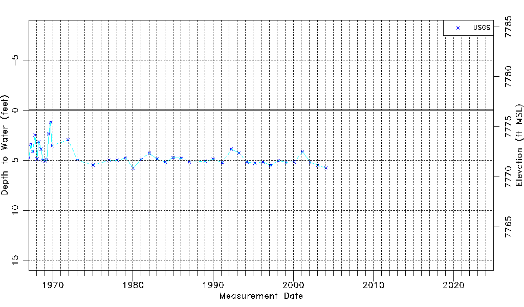
| Water-level Count | 43 |
| Water-level Date Range | 01/04/1967 thru 01/30/2004 |
| Monitored within the last 18 months | No, most recently on 01/30/2004 |
| Depth-to-Water Range (ft) | 1.20 to 5.79 |
| Water Table Elevation Range (ft NAVD88) | 7770.87 to 7775.46 |
| Water-Level-Source:Number-of-Measurements | USGSaguache Creek:43 |