| Well Information Table |
|---|
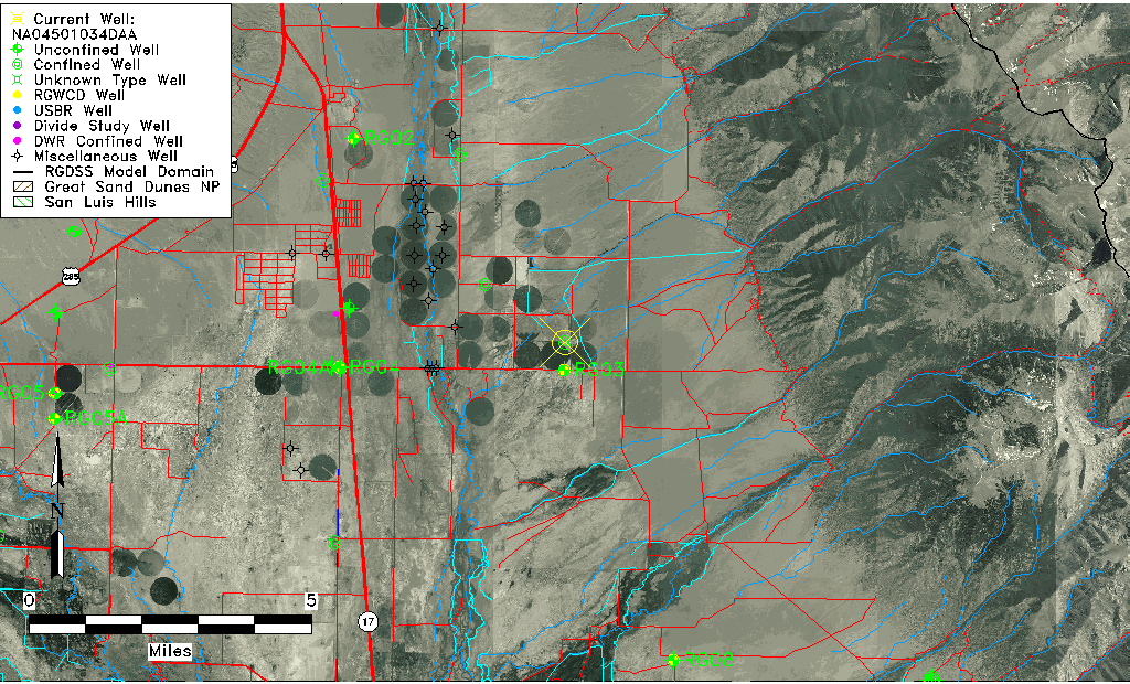
| Common Well ID | NA04501034DAA |
| USGS Well ID | 380640105510001 |
| USGS Station Name | NA04501034DAA |
| USGS Construction Date | 01/01/1955 |
| USGS Site Type | Well |
| USGS Site Use Information | Withdrawal of Water |
| USGS Groundwater Use Information | Irrigation |
| Data Source(s) | USGS |
| Location Data |
|---|
| TRS | NA04501034DAA |
| USGS TRS 1 | NA04501034DAA |
| USGS TRS | NENESES034T0045NR0010EN |
| Longitude/Latitude (NAD83) | -105.84801250 , 38.10708234 |
| Longitude/Latitude Data Source | GWSI decimal LAT/LONG field |
| USGS Longitude/Latitude (NAD83) | -105.8480125 , 38.10708234 |
| Easting, Northing RGDSS-NAD83 (US ft) | 149989.34 , 404554.33 |
| USGS Topography | Valley flat |
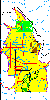
| USGS County | Saguache County |
| Elevation and Depth Data |
|---|
| Ground Elevation (ft NAVD88) | 7712.35000000000 |
| Elevation Data Source | USGS GWSI database |
| USGS Ground Elevation (ft NGVD29) | 7708.00 |
| 1/3-Arc Second NED Ground Elevation (ft NAVD88) | 7709.90 |
| 1-Arc Second NED Ground Elevation (ft NAVD88) | 7708.55 |
| SRTM Ground Elevation (ft NAVD88) | 7718.42 |
| Total Depth (ft) | 300.00 |
| USGS Well Depth (ft) | 300.00 |
| Model Layer | 3 |
| Model Layer Source | Well Depth |
| Depth of Bottom of Layer 1 | 181 |
| Depth of Bottom of Layer 2 | 237 |
| Depth of Bottom of Layer 3 | 531 |
| Depth of Bottom of Layer 4 | 3514 |
| Additional Well Information | Geohydrology, Construction |
| Aquifer Information |
|---|
| Aquifer Type | Confined |
| Aquifer Type Source | TD Elevation/Model Layer |
| USGS Primary Aquifer | Cenozoic Erathem |
| USGS Aquifer Type | Confined Single Aquifer |
| USGS Hydrologic Unit | San Luis |
| USGS Data Available | Water-level (GW.LEV) |
| Water-level Database Information |
|---|
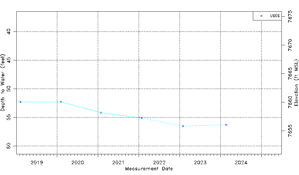
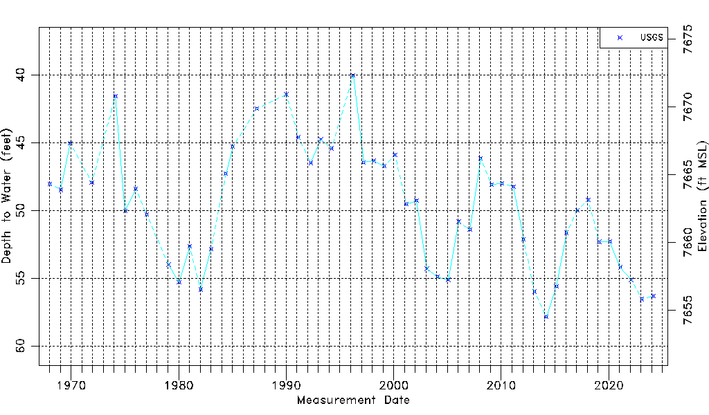
| Water-level Count | 50 |
| Water-level Date Range | 01/16/1968 thru 01/30/2023 |
| Monitored within the last 18 months | Yes, most recently on 01/30/2023 |
| Depth-to-Water Range (ft) | 40.04 to 57.86 |
| Water Table Elevation Range (ft NAVD88) | 7654.49 to 7672.31 |
| Water-Level-Source:Number-of-Measurements | USGS:50 |