| Well Information Table |
|---|
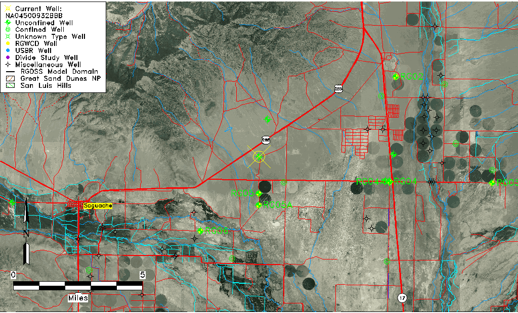
| Common Well ID | NA04500932BBB |
| USGS Well ID | 380651106004501 |
| USGS Station Name | NA04500932BBB |
| USGS Construction Date | 10/18/1982 |
| USGS Site Type | Well |
| USGS Site Use Information | Withdrawal of Water |
| USGS Groundwater Use Information | Stock |
| Data Source(s) | USGS |
| Location Data |
|---|
| TRS | NA04500932BBB |
| USGS TRS 1 | NA04500932BBB |
| USGS TRS | NWNWNWS32 T45 R9N |
| Longitude/Latitude (NAD83) | -106.01379460 , 38.11424947 |
| Longitude/Latitude Data Source | GWSI decimal LAT/LONG field |
| USGS Longitude/Latitude (NAD83) | -106.0137946 , 38.11424947 |
| Easting, Northing RGDSS-NAD83 (US ft) | 102311.78 , 407302.10 |
| USGS Topography | Undulating |
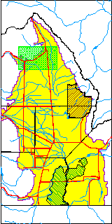
| USGS County | Saguache County |
| USGS Map Name | HICKEY BRIDGE |
| USGS Map Scale | 24000 |
| Elevation and Depth Data |
|---|
| Ground Elevation (ft NAVD88) | 7752.35000000000 |
| Elevation Data Source | USGS GWSI database |
| USGS Ground Elevation (ft NGVD29) | 7748.00 |
| 1/3-Arc Second NED Ground Elevation (ft NAVD88) | 7757.08 |
| 1-Arc Second NED Ground Elevation (ft NAVD88) | 7755.36 |
| SRTM Ground Elevation (ft NAVD88) | 7757.74 |
| Total Depth (ft) | 194.00 |
| USGS Hole Depth (ft) | 194.00 |
| USGS Well Depth (ft) | 194.00 |
| Model Layer | 1 |
| Model Layer Source | Well Depth |
| Depth of Bottom of Layer 1 | 233 |
| Depth of Bottom of Layer 2 | 296 |
| Depth of Bottom of Layer 3 | 440 |
| Depth of Bottom of Layer 4 | 1681 |
| Additional Well Information | Production, Logs, Geohydrology, Construction, Aquifer |
| Aquifer Information |
|---|
| Aquifer Type | Unconfined |
| Aquifer Type Source | TD Elevation/Model Layer |
| USGS Hydrologic Unit | Saguache |
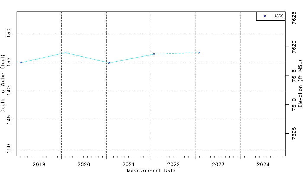
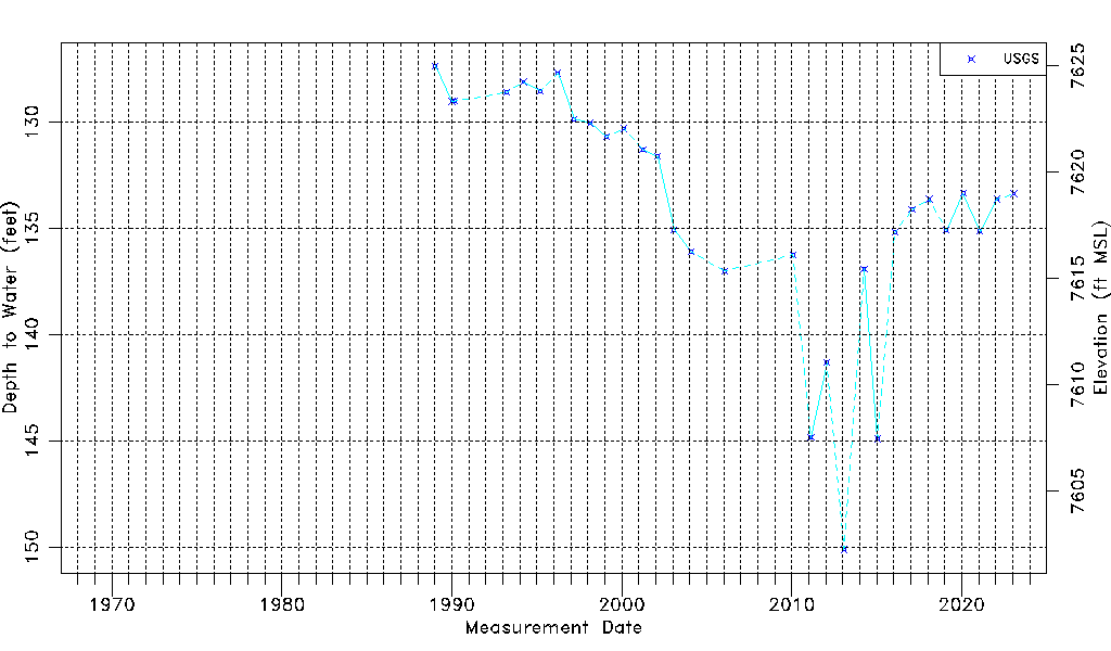
| USGS Data Available | Water-level (GW.LEV) |
| Water-level Database Information |
|---|
| Water-level Count | 30 |
| Water-level Date Range | 01/10/1989 thru 01/30/2023 |
| Monitored within the last 18 months | Yes, most recently on 01/30/2023 |
| Depth-to-Water Range (ft) | 127.35 to 150.11 |
| Water Table Elevation Range (ft NAVD88) | 7602.24 to 7625.00 |
| Water-Level-Source:Number-of-Measurements | USGS:30 |