| Well Information Table |
|---|
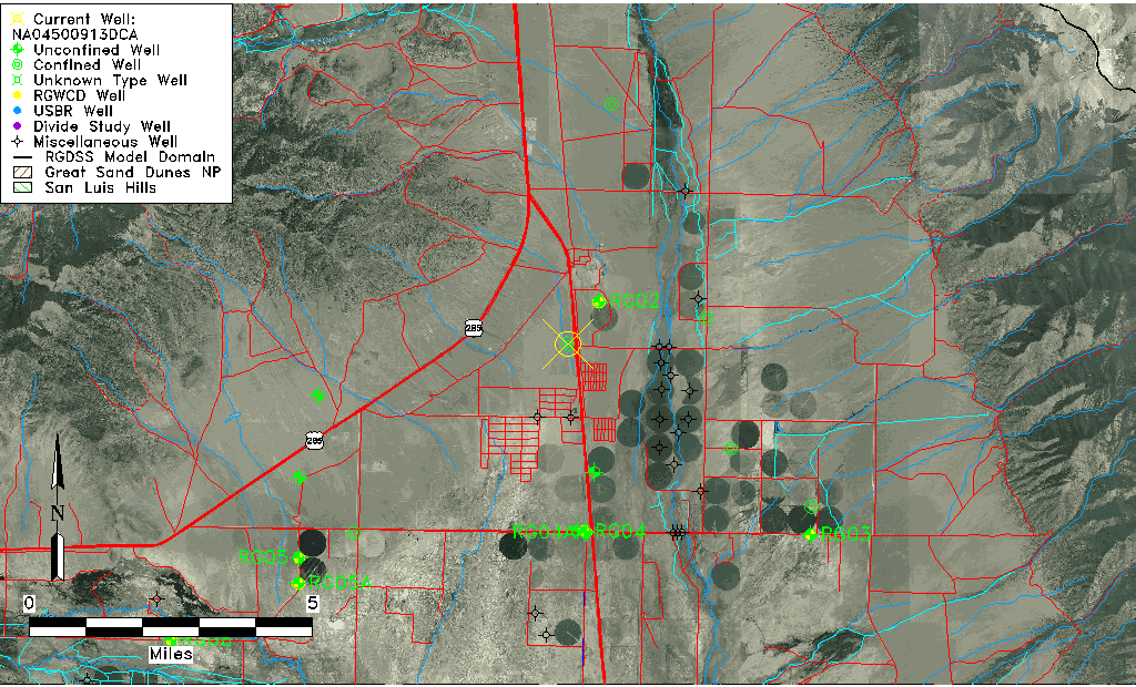
| Common Well ID | NA04500913DCA |
| USGS Well ID | 380855105553501 |
| USGS Station Name | NA04500913DCA |
| USGS Construction Date | 01/01/1965 |
| USGS Site Type | Well |
| USGS Site Use Information | Withdrawal of Water |
| USGS Groundwater Use Information | Irrigation |
| Data Source(s) | USGS |
| Location Data |
|---|
| TRS | NA04500913DCA |
| USGS TRS 1 | NA04500913DCA |
| USGS TRS | NESWSES013T0045NR0009EN |
| Longitude/Latitude (NAD83) | -105.92695830 , 38.14861029 |
| Longitude/Latitude Data Source | GWSI decimal LAT/LONG field |
| USGS Longitude/Latitude (NAD83) | -105.9269583 , 38.14861029 |
| Easting, Northing RGDSS-NAD83 (US ft) | 127323.95 , 419727.99 |
| USGS Topography | Valley flat |
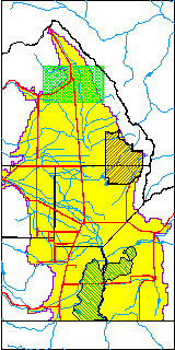
| USGS County | Saguache County |
| Elevation and Depth Data |
|---|
| Ground Elevation (ft NAVD88) | 7692.42000000000 |
| Elevation Data Source | USGS GWSI database |
| USGS Ground Elevation (ft NGVD29) | 7688.00 |
| 1/3-Arc Second NED Ground Elevation (ft NAVD88) | 7696.21 |
| 1-Arc Second NED Ground Elevation (ft NAVD88) | 7698.28 |
| SRTM Ground Elevation (ft NAVD88) | 7703.41 |
| Total Depth (ft) | 200.00 |
| USGS Well Depth (ft) | 200.00 |
| Model Layer | 3 |
| Model Layer Source | Well Depth |
| Depth of Bottom of Layer 1 | 81 |
| Depth of Bottom of Layer 2 | 138 |
| Depth of Bottom of Layer 3 | 409 |
| Depth of Bottom of Layer 4 | 3065 |
| Additional Well Information | Geohydrology, Construction |
| Aquifer Information |
|---|
| Aquifer Type | Confined |
| Aquifer Type Source | TD Elevation/Model Layer |
| USGS Primary Aquifer | Cenozoic Erathem |
| USGS Aquifer Type | Unconfined Single Aquifer |
| USGS Hydrologic Unit | Saguache |
| USGS Data Available | Water-level (GW.LEV) |
| Water-level Database Information |
|---|
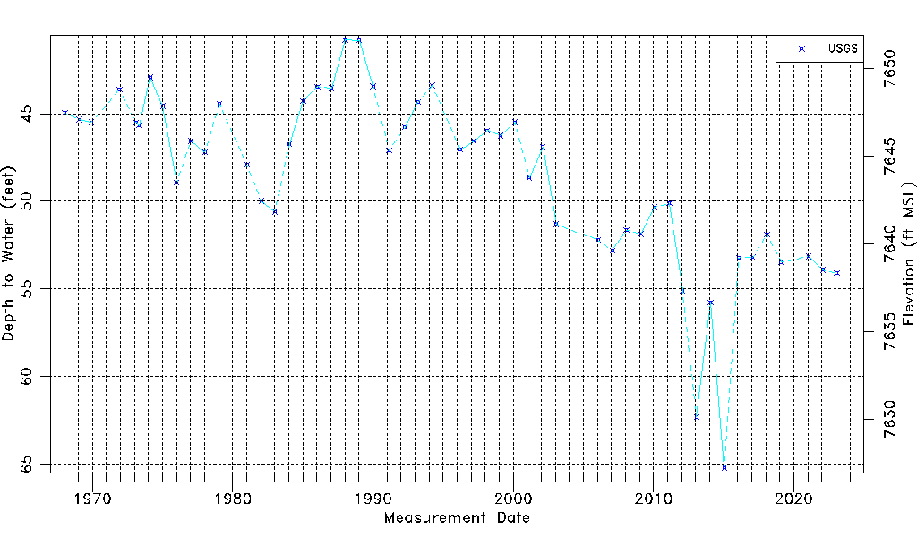
| Water-level Count | 52 |
| Water-level Date Range | 01/16/1968 thru 01/30/2023 |
| Monitored within the last 18 months | Yes, most recently on 01/30/2023 |
| Depth-to-Water Range (ft) | 40.80 to 65.20 |
| Water Table Elevation Range (ft NAVD88) | 7627.22 to 7651.62 |
| Water-Level-Source:Number-of-Measurements | USGS:52 |