| Well Information Table |
|---|
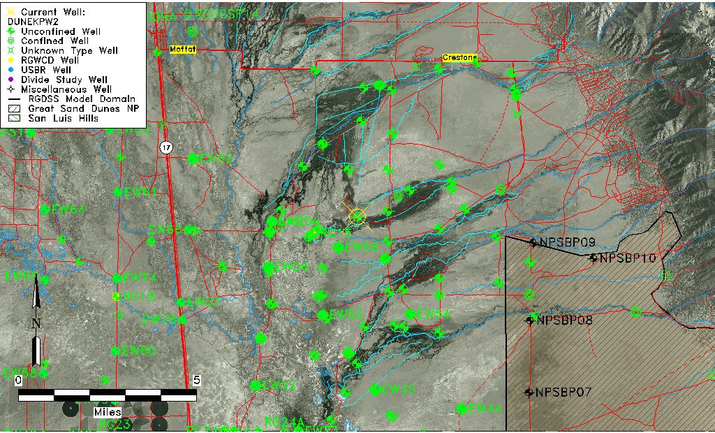
| Common Well ID | DUNEKPW2 |
| GSDNP Well Name | EKPW-2 |
| USGS Site Use Information | Unknown |
| USGS Groundwater Use Information | Unknown |
| Data Source(s) | HRS |
| Location Data |
|---|
| Longitude/Latitude (NAD83) | -105.80462871 , 37.92497591 |
| Longitude/Latitude Data Source | BACA wells reported by Halepaska |
| Halapaska & Assoc. Easting/Northing (CO-S) | 1912295.00000000 , 458309.000000000 |
| Easting, Northing RGDSS-NAD83 (US ft) | 162367.31 , 338238.44 |
| Elevation and Depth Data |
|---|
| Ground Elevation (ft NAVD88) | 7558.11000000000 |
| Elevation Data Source | BACA well (HRS from topo) |
| BACA Well database (HRS, ft NGVD29) | 7554 |
| HRS Dunes Well database (ft NGVD29) | 7554.00000 |
| 1/3-Arc Second NED Ground Elevation (ft NAVD88) | 7557.11 |
| 1-Arc Second NED Ground Elevation (ft NAVD88) | 7558.12 |
| SRTM Ground Elevation (ft NAVD88) | 7559.15 |
| Total Depth (ft) | 7.10 |
| Model Layer | 1 |
| Model Layer Source | Dunes Layer |
| Depth of Bottom of Layer 1 | 173 |
| Depth of Bottom of Layer 2 | 381 |
| Depth of Bottom of Layer 3 | 1639 |
| Depth of Bottom of Layer 4 | 4564 |
| Additional Well Information | NONE |
| Aquifer Information |
|---|
| Aquifer Type | Unconfined |
| Aquifer Type Source | HRS_AQUIFER |
| Water-level Database Information |
|---|
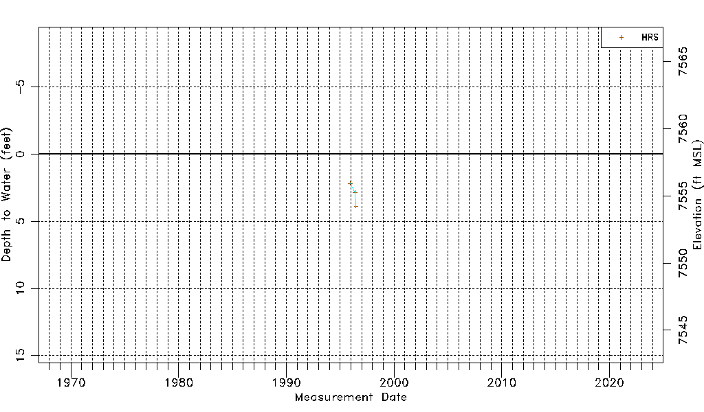
| Water-level Count | 3 |
| Water-level Date Range | 12/13/1995 thru 06/23/1996 |
| Monitored within the last 18 months | No, most recently on 06/23/1996 |
| Depth-to-Water Range (ft) | 2.19 to 3.88 |
| Water Table Elevation Range (ft NAVD88) | 7554.23 to 7555.92 |
| Water-Level-Source:Number-of-Measurements | HRSaguache Creek:3 |