| Well Information Table |
|---|
| Common Well ID | DUNNAPW2 |
| GSDNP Well Name | NAPW-2 |
| USGS Site Use Information | Unknown |
| USGS Groundwater Use Information | Unknown |
| Data Source(s) | HRS |
| Location Data |
|---|
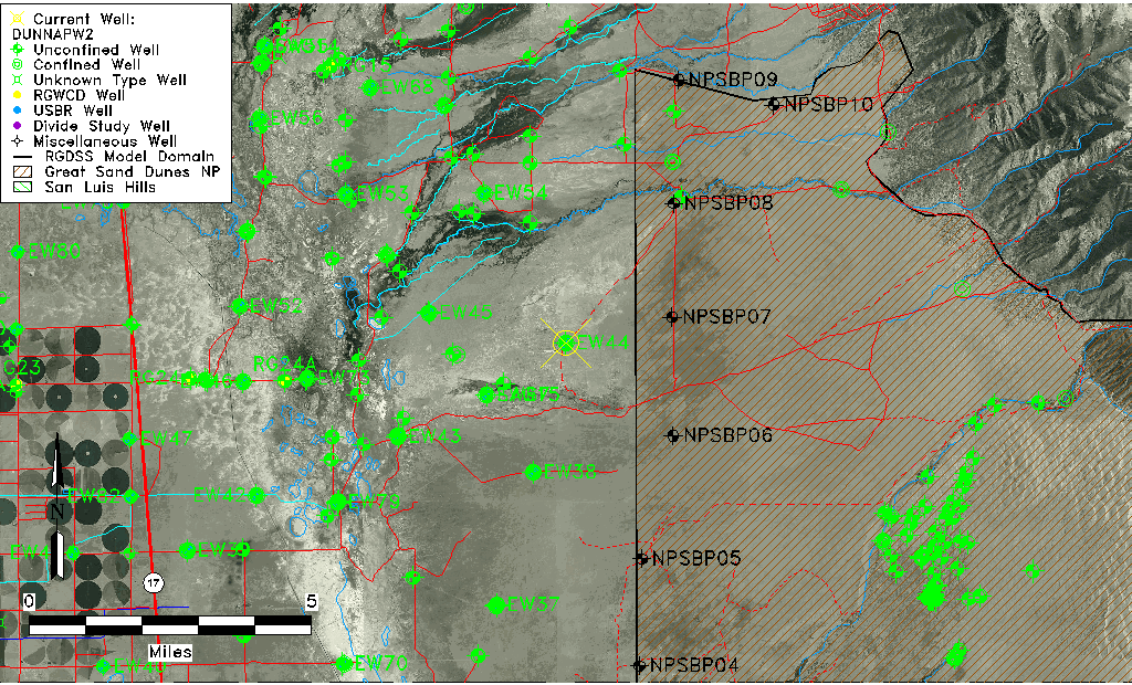
| Longitude/Latitude (NAD83) | -105.75093129 , 37.84698901 |
| Longitude/Latitude Data Source | BACA wells reported by Halepaska |
| Halapaska & Assoc. Easting/Northing (CO-S) | 1927708.00000000 , 429866.000000000 |
| Easting, Northing RGDSS-NAD83 (US ft) | 177825.09 , 309830.14 |
| Elevation and Depth Data |
|---|
| Ground Elevation (ft NAVD88) | 7580.14000000000 |
| Elevation Data Source | BACA well (HRS from topo) |
| BACA Well database (HRS, ft NGVD29) | 7576 |
| HRS Dunes Well database (ft NGVD29) | 7576.00000 |
| 1/3-Arc Second NED Ground Elevation (ft NAVD88) | 7579.83 |
| 1-Arc Second NED Ground Elevation (ft NAVD88) | 7581.02 |
| SRTM Ground Elevation (ft NAVD88) | 7588.43 |
| Total Depth (ft) | 7.75 |
| Model Layer | 1 |
| Model Layer Source | Dunes Layer |
| Depth of Bottom of Layer 1 | 149 |
| Depth of Bottom of Layer 2 | 454 |
| Depth of Bottom of Layer 3 | 1622 |
| Depth of Bottom of Layer 4 | 4059 |
| Additional Well Information | NONE |
| Aquifer Information |
|---|
| Aquifer Type | Unconfined |
| Aquifer Type Source | HRS_AQUIFER |
| Water-level Database Information |
|---|
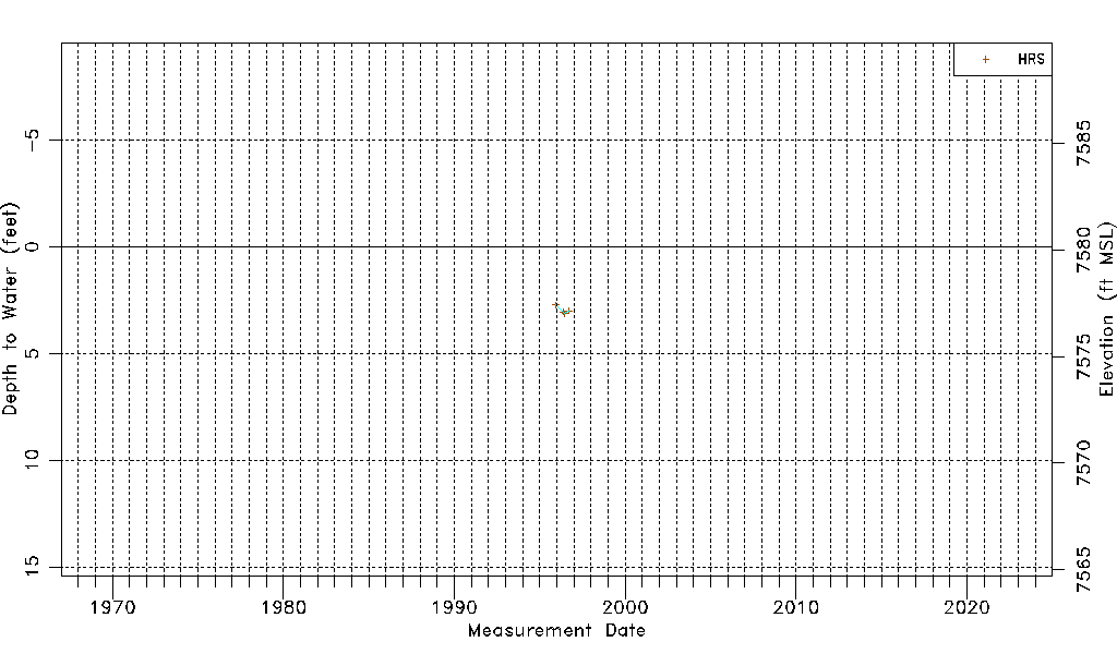
| Water-level Count | 4 |
| Water-level Date Range | 12/13/1995 thru 09/18/1996 |
| Monitored within the last 18 months | No, most recently on 09/18/1996 |
| Depth-to-Water Range (ft) | 2.72 to 3.13 |
| Water Table Elevation Range (ft NAVD88) | 7577.01 to 7577.42 |
| Water-Level-Source:Number-of-Measurements | HRSaguache Creek:4 |