| Well Information Table |
|---|
| Common Well ID | Unknown |
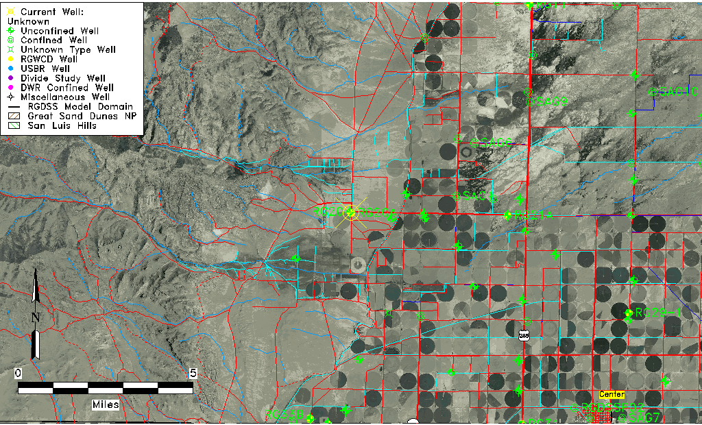
| RGWCD Well ID | RG20A |
| USGS Site Use Information | Unknown |
| USGS Groundwater Use Information | Unknown |
| Data Source(s) | RGWCD |
| Location Data |
|---|
| TRS | Unknown |
| RGWCD TRS | Unknown |
| Longitude/Latitude (NAD83) | -106.23859000 , 37.83574706 |
| Longitude/Latitude Data Source | RGWCD/Davis Engineering |
| RGWCD Longitude/Latitude (NAD83) | -106:14:18.9240 , 37:50:08.68941 |
| Easting, Northing RGDSS-NAD83 (US ft) | 37026.77 , 306234.56 |
| Elevation and Depth Data |
|---|
| Ground Elevation (ft NAVD88) | 7788.49000000000 |
| Elevation Data Source | RGWCD well database |
| RGWCD Measuring Point Elevation (ft NAVD88) | 7788.491 |
| RGWCD Well Riser Height (ft) | 0.000 |
| RGWCD Ground Surface (ft NAVD88) | 7788.49 |
| 1/3-Arc Second NED Ground Elevation (ft NAVD88) | 7787.46 |
| 1-Arc Second NED Ground Elevation (ft NAVD88) | 7786.81 |
| SRTM Ground Elevation (ft NAVD88) | 7793.31 |
| Model Layer | 1 |
| Model Layer Source | RGWCD |
| Depth of Bottom of Layer 1 | 251 |
| Depth of Bottom of Layer 2 | 410 |
| Depth of Bottom of Layer 3 | 424 |
| Depth of Bottom of Layer 4 | 584 |
| Additional Well Information | NONE |
| Aquifer Information |
|---|
| Aquifer Type | Unconfined |
| Aquifer Type Source | RGWCD_AQ |
| Water-level Database Information |
|---|
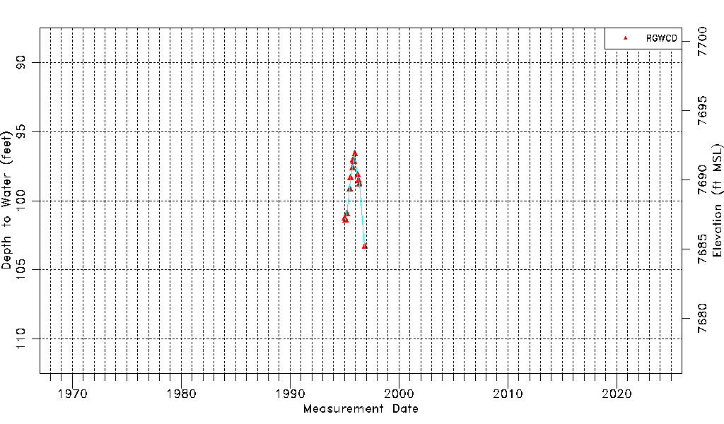
| Water-level Count | 13 |
| Water-level Date Range | 01/12/1995 thru 11/11/1996 |
| Monitored within the last 18 months | No, most recently on 11/11/1996 |
| Depth-to-Water Range (ft) | 96.64 to 103.33 |
| Water Table Elevation Range (ft NAVD88) | 7685.16 to 7691.85 |
| Water-Level-Source:Number-of-Measurements | RGWCD:13 |