| Well Information Table |
|---|
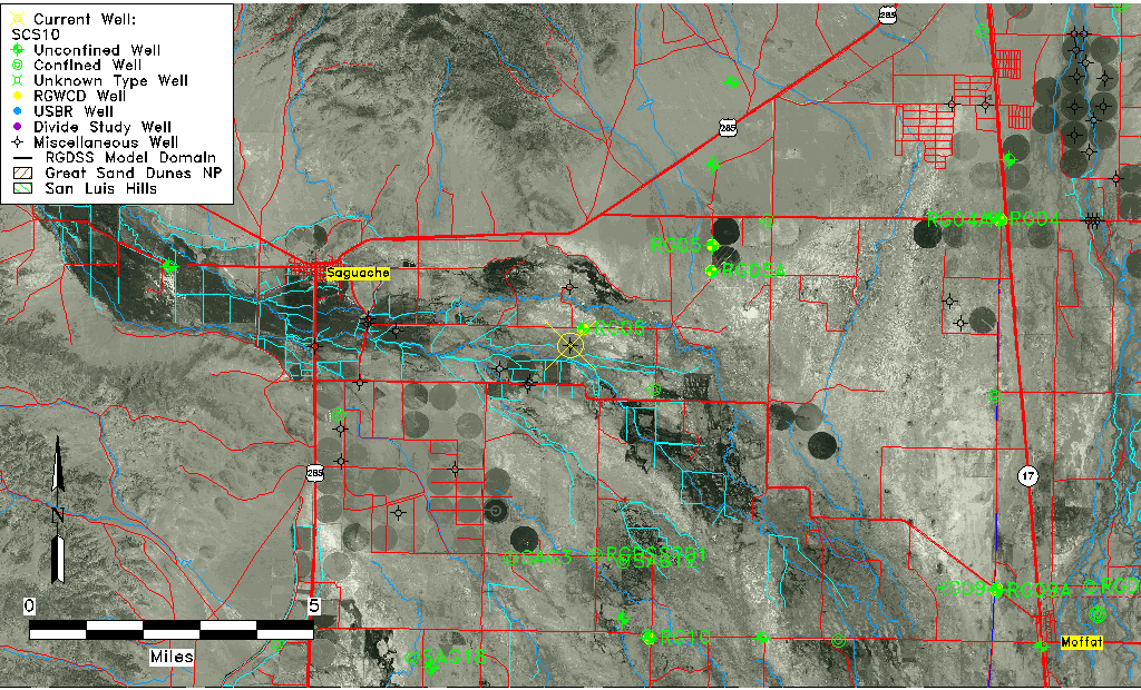
| Common Well ID | SCS10 |
| USGS Site Use Information | Unknown |
| USGS Groundwater Use Information | Unknown |
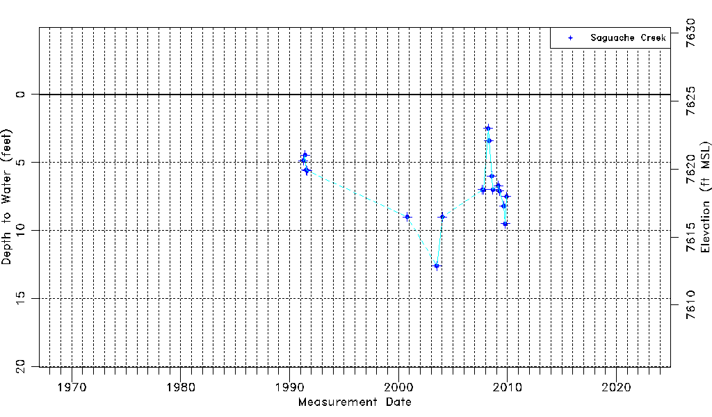
| Data Source(s) | Saguache Creek |
| Location Data |
|---|
| Longitude/Latitude (NAD83) | -106.05940412 , 38.06806122 |
| Longitude/Latitude Data Source | Saguach Ck Survey |
| Easting, Northing RGDSS-NAD83 (US ft) | 89121.16 , 390540.05 |
| Elevation and Depth Data |
|---|
| Ground Elevation (ft NAVD88) | 7625.48000000000 |
| Elevation Data Source | Saguache Creek survey |
| 1/3-Arc Second NED Ground Elevation (ft NAVD88) | 7625.16 |
| 1-Arc Second NED Ground Elevation (ft NAVD88) | 7625.76 |
| SRTM Ground Elevation (ft NAVD88) | 7634.52 |
| Model Layer | 1 |
| Model Layer Source | Saguache Layer |
| Depth of Bottom of Layer 1 | 131 |
| Depth of Bottom of Layer 2 | 233 |
| Depth of Bottom of Layer 3 | 578 |
| Depth of Bottom of Layer 4 | 1175 |
| Additional Well Information | NONE |
| Aquifer Information |
|---|
| Aquifer Type | Unconfined |
| Aquifer Type Source | TD Elevation/Model Layer |
| Water-level Database Information |
|---|
| Water-level Count | 18 |
| Water-level Date Range | 04/12/1991 thru 12/02/2009 |
| Monitored within the last 18 months | No, most recently on 12/02/2009 |
| Depth-to-Water Range (ft) | 2.50 to 12.60 |
| Water Table Elevation Range (ft NAVD88) | 7612.88 to 7622.98 |
| Water-Level-Source:Number-of-Measurements | Saguache Creek:18 |