| Well Information Table |
|---|
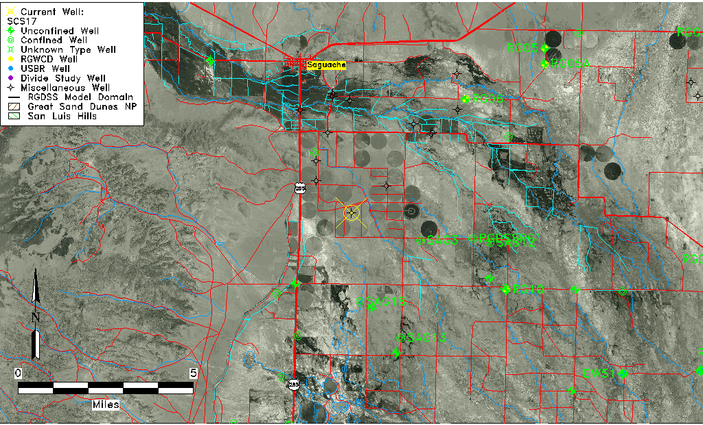
| Common Well ID | SCS17 |
| USGS Site Use Information | Unknown |
| USGS Groundwater Use Information | Unknown |
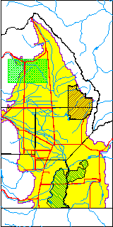
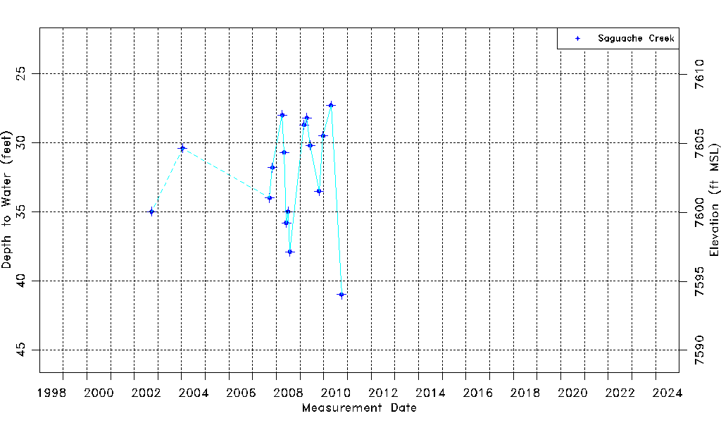
| Data Source(s) | Saguache Creek |
| Location Data |
|---|
| Longitude/Latitude (NAD83) | -106.11455783 , 38.02515634 |
| Longitude/Latitude Data Source | Saguach Ck Survey |
| Easting, Northing RGDSS-NAD83 (US ft) | 73171.27 , 374992.89 |
| Elevation and Depth Data |
|---|
| Ground Elevation (ft NAVD88) | 7635.04000000000 |
| Elevation Data Source | NED3 data |
| 1/3-Arc Second NED Ground Elevation (ft NAVD88) | 7635.04 |
| 1-Arc Second NED Ground Elevation (ft NAVD88) | 7634.69 |
| SRTM Ground Elevation (ft NAVD88) | 7639.23 |
| Model Layer | 1 |
| Model Layer Source | Saguache Layer |
| Depth of Bottom of Layer 1 | 76 |
| Depth of Bottom of Layer 2 | 185 |
| Depth of Bottom of Layer 3 | 391 |
| Depth of Bottom of Layer 4 | 791 |
| Additional Well Information | NONE |
| Aquifer Information |
|---|
| Aquifer Type | Unconfined |
| Aquifer Type Source | TD Elevation/Model Layer |
| Water-level Database Information |
|---|
| Water-level Count | 16 |
| Water-level Date Range | 09/26/2002 thru 10/01/2010 |
| Monitored within the last 18 months | No, most recently on 10/01/2010 |
| Depth-to-Water Range (ft) | 27.30 to 41.00 |
| Water Table Elevation Range (ft NAVD88) | 7594.04 to 7607.74 |
| Water-Level-Source:Number-of-Measurements | Saguache Creek:16 |