| Well Information Table |
|---|
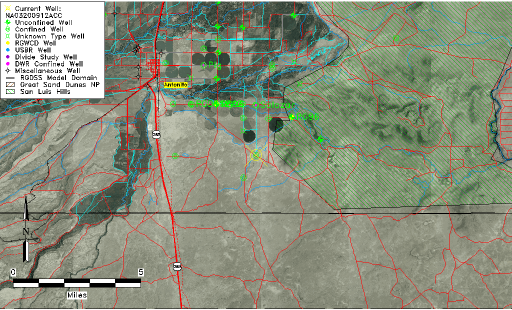
| Common Well ID | NA03200912ACC |
| USGS Well ID | 370142105561101 |
| USGS Station Name | NA03200912ACC |
| USGS Site Type | Well |
| USGS Site Use Information | Observation |
| USGS Groundwater Use Information | Irrigation |
| Data Source(s) | USGS |
| Location Data |
|---|
| TRS | NA03200912ACC |
| USGS TRS 1 | NA03200912ACC |
| Longitude/Latitude (NAD83) | -105.93696380 , 37.02834796 |
| Longitude/Latitude Data Source | GWSI decimal LAT/LONG field |
| USGS Longitude/Latitude (NAD83) | -105.936963800 , 37.028347960 |
| Easting, Northing RGDSS-NAD83 (US ft) | 123283.87 , 11939.60 |
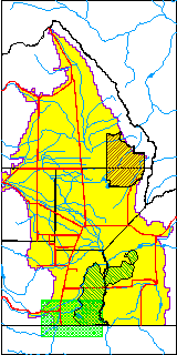
| USGS County | Conejos County |
| USGS Map Name | LOBATOS, CO. |
| USGS Map Scale | 24000 |
| Elevation and Depth Data |
|---|
| Ground Elevation (ft NAVD88) | 7786.04 |
| Elevation Data Source | USGS GWSI database |
| USGS Ground Elevation (ft NGVD29) | 7782.00 |
| 1/3-Arc Second NED Ground Elevation (ft NAVD88) | 7785.35 |
| 1-Arc Second NED Ground Elevation (ft NAVD88) | 7788.20 |
| SRTM Ground Elevation (ft NAVD88) | 7795.28 |
| Total Depth (ft) | 230.00 |
| USGS Well Depth (ft) | 230.00 |
| Model Layer | 3 |
| Model Layer Source | Well Depth |
| Depth of Bottom of Layer 2 | 135 |
| Depth of Bottom of Layer 3 | 324 |
| Depth of Bottom of Layer 4 | 1587 |
| Additional Well Information | Construction |
| Aquifer Information |
|---|
| Aquifer Type | Confined |
| Aquifer Type Source | TD Elevation/Model Layer |
| USGS Hydrologic Unit | Alamosa-Trinchera |
| USGS Data Available | Water-level (GW.LEV) |
| Water-level Database Information |
|---|
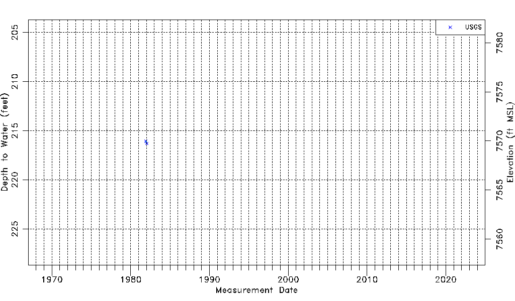
| Water-level Count | 2 |
| Water-level Date Range | 12/14/1981 thru 01/22/1982 |
| Monitored within the last 18 months | No, most recently on 01/22/1982 |
| Depth-to-Water Range (ft) | 216.06 to 216.30 |
| Water Table Elevation Range (ft NAVD88) | 7569.74 to 7569.98 |
| Water-Level-Source:Number-of-Measurements | USGS:2 |