| Well Information Table |
|---|
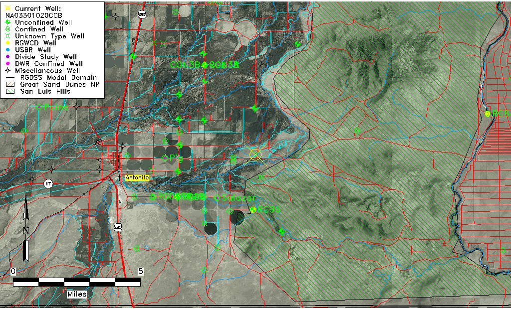
| Common Well ID | NA03301020CCB |
| USGS Well ID | 370453105543401 |
| USGS Station Name | NA03301020CCB |
| USGS Site Type | Well |
| USGS Site Use Information | Observation |
| USGS Groundwater Use Information | Irrigation |
| Data Source(s) | USGS |
| Location Data |
|---|
| TRS | NA03301020CCB |
| USGS TRS 1 | NA03301020CCB |
| Longitude/Latitude (NAD83) | -105.91001950 , 37.08140260 |
| Longitude/Latitude Data Source | GWSI decimal LAT/LONG field |
| USGS Longitude/Latitude (NAD83) | -105.910019500 , 37.081402600 |
| Easting, Northing RGDSS-NAD83 (US ft) | 131194.33 , 31230.38 |
| USGS Topography | Valley flat |
| USGS County | Conejos County |
| USGS Map Name | LOBATOS, CO. |
| USGS Map Scale | 24000 |
| Elevation and Depth Data |
|---|
| Ground Elevation (ft NAVD88) | 7749.98 |
| Elevation Data Source | USGS GWSI database |
| USGS Ground Elevation (ft NGVD29) | 7746.00 |
| 1/3-Arc Second NED Ground Elevation (ft NAVD88) | 7748.94 |
| 1-Arc Second NED Ground Elevation (ft NAVD88) | 7747.96 |
| SRTM Ground Elevation (ft NAVD88) | 7775.70 |
| Depth of Bottom of Layer 1 | 37 |
| Depth of Bottom of Layer 2 | 147 |
| Depth of Bottom of Layer 3 | 321 |
| Depth of Bottom of Layer 4 | 1538 |
| Additional Well Information | NONE |
| Aquifer Information |
|---|
| Aquifer Type | Unknown |
| Aquifer Type Source | None |
| USGS Hydrologic Unit | Conejos |
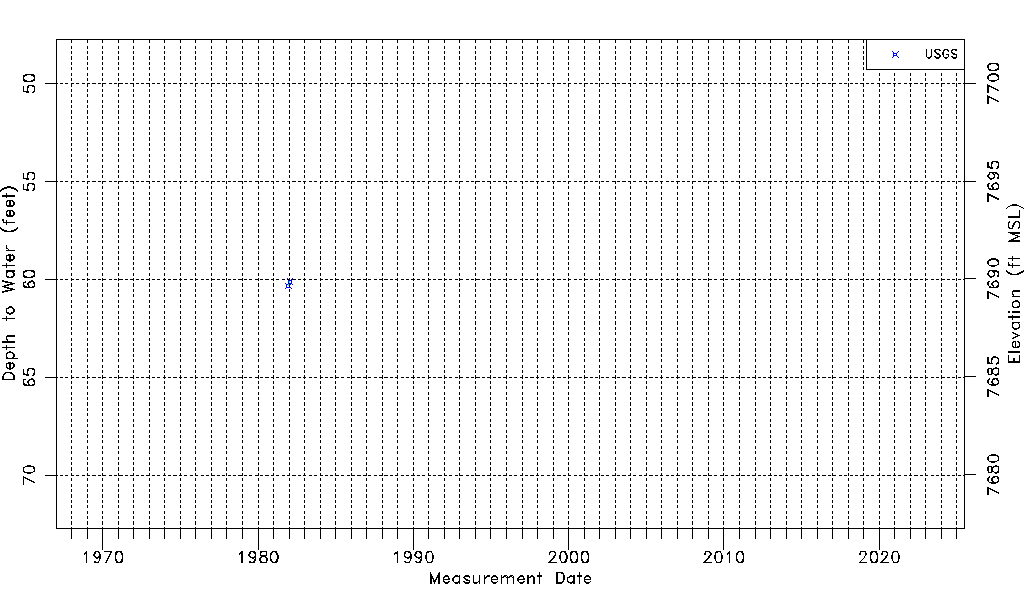
| USGS Data Available | Water-level (GW.LEV) |
| Water-level Database Information |
|---|
| Water-level Count | 2 |
| Water-level Date Range | 12/15/1981 thru 01/22/1982 |
| Monitored within the last 18 months | No, most recently on 01/22/1982 |
| Depth-to-Water Range (ft) | 60.12 to 60.33 |
| Water Table Elevation Range (ft NAVD88) | 7689.65 to 7689.86 |
| Water-Level-Source:Number-of-Measurements | USGS:2 |