| Well Information Table |
|---|
| Common Well ID | NA03400924DCC |
| USGS Well ID | 371006105560701 |
| USGS Station Name | NA03400924DCC |
| USGS Construction Date | 08/25/1977 |
| USGS Site Type | Well |
| USGS Site Use Information | Standby Emergency Supply |
| USGS Groundwater Use Information | Public Supply |
| Data Source(s) | USGS |
| Location Data |
|---|
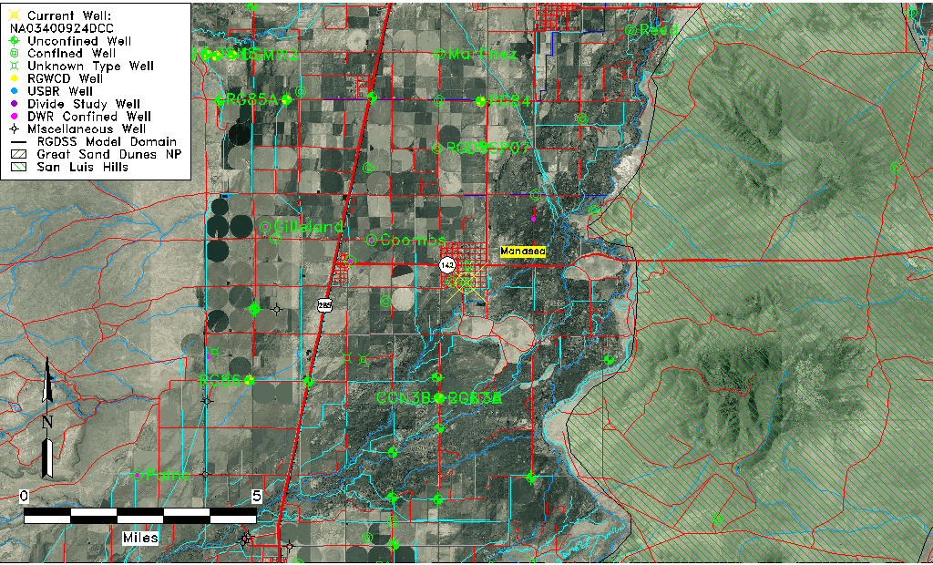
| TRS | NA03400924DCC |
| USGS TRS 1 | NA03400924DCC |
| Longitude/Latitude (NAD83) | -105.93585470 , 37.16834456 |
| Longitude/Latitude Data Source | GWSI decimal LAT/LONG field |
| USGS Longitude/Latitude (NAD83) | -105.935854700 , 37.168344560 |
| Easting, Northing RGDSS-NAD83 (US ft) | 123746.69 , 62895.98 |
| USGS Topography | Valley flat |
| USGS County | Conejos County |
| USGS Map Name | MANASSA |
| USGS Map Scale | 24000 |
| Elevation and Depth Data |
|---|
| Ground Elevation (ft NAVD88) | 7695.00 |
| Elevation Data Source | USGS GWSI database |
| USGS Ground Elevation (ft NGVD29) | 7691.00 |
| 1/3-Arc Second NED Ground Elevation (ft NAVD88) | 7695.22 |
| 1-Arc Second NED Ground Elevation (ft NAVD88) | 7693.50 |
| SRTM Ground Elevation (ft NAVD88) | 7700.26 |
| Total Depth (ft) | 806.00 |
| USGS Hole Depth (ft) | 806.00 |
| USGS Well Depth (ft) | 806.00 |
| Model Layer | 4 |
| Model Layer Source | Well Depth |
| Depth of Bottom of Layer 1 | 35 |
| Depth of Bottom of Layer 2 | 166 |
| Depth of Bottom of Layer 3 | 352 |
| Depth of Bottom of Layer 4 | 1353 |
| Additional Well Information | Production, Logs, Construction |
| Aquifer Information |
|---|
| Aquifer Type | Confined |
| Aquifer Type Source | TD Elevation/Model Layer |
| USGS Hydrologic Unit | Conejos |
| USGS Data Available | Water-level (GW.LEV) |
| Water-level Database Information |
|---|
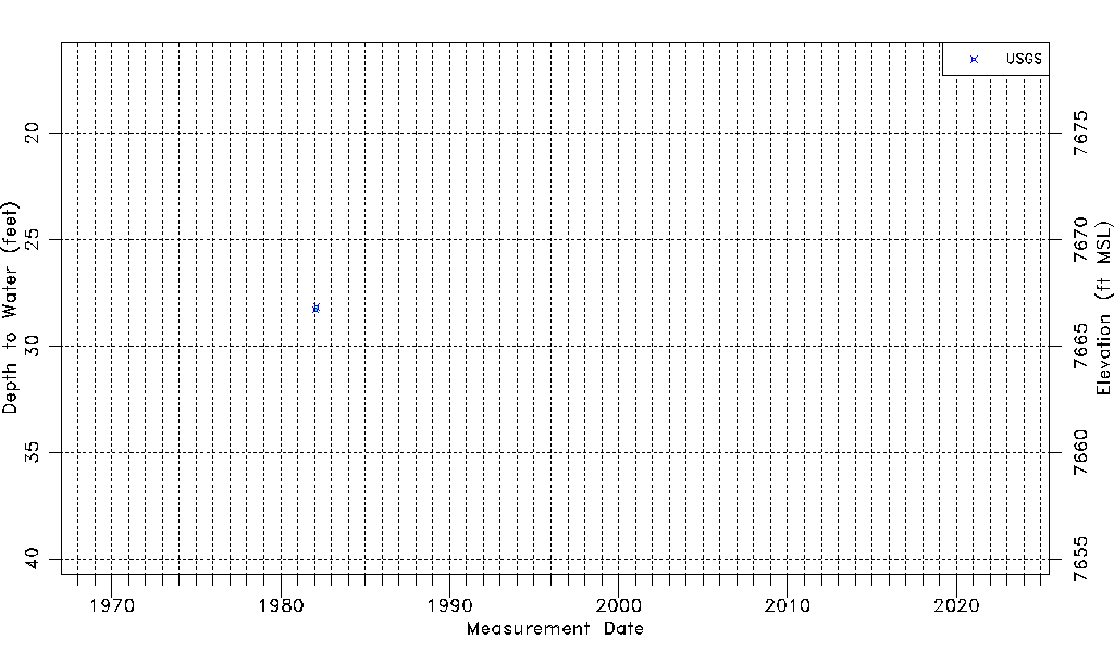
| Water-level Count | 2 |
| Water-level Date Range | 01/26/1982 thru 02/18/1982 |
| Monitored within the last 18 months | No, most recently on 02/18/1982 |
| Depth-to-Water Range (ft) | 28.16 to 28.30 |
| Water Table Elevation Range (ft NAVD88) | 7666.70 to 7666.84 |
| Water-Level-Source:Number-of-Measurements | USGS:2 |