| Well Information Table |
|---|
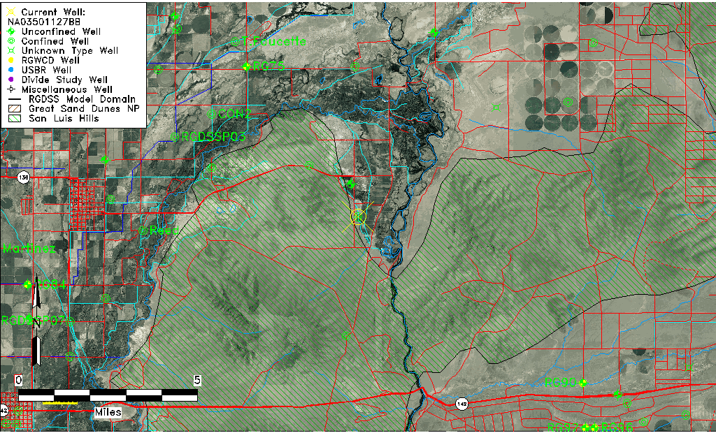
| Common Well ID | NA03501127BB |
| USGS Well ID | 371510105454401 |
| USGS Station Name | NA03501127BB |
| USGS Site Type | Well |
| USGS Site Use Information | Withdrawal of Water |
| USGS Groundwater Use Information | Domestic |
| Data Source(s) | USGS |
| Location Data |
|---|
| TRS | NA03501127BB |
| USGS TRS 1 | NA03501127BB |
| Longitude/Latitude (NAD83) | -105.76279630 , 37.25278857 |
| Longitude/Latitude Data Source | GWSI decimal LAT/LONG field |
| USGS Longitude/Latitude (NAD83) | -105.762796300 , 37.252788570 |
| Easting, Northing RGDSS-NAD83 (US ft) | 174185.57 , 93540.03 |
| USGS Topography | Valley flat |
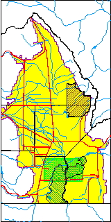
| USGS County | Conejos County |
| USGS Map Name | PIKES STOCKADE |
| USGS Map Scale | 24000 |
| Elevation and Depth Data |
|---|
| Ground Elevation (ft NAVD88) | 7511.97 |
| Elevation Data Source | USGS GWSI database |
| USGS Ground Elevation (ft NGVD29) | 7508.00 |
| 1/3-Arc Second NED Ground Elevation (ft NAVD88) | 7511.11 |
| 1-Arc Second NED Ground Elevation (ft NAVD88) | 7510.09 |
| SRTM Ground Elevation (ft NAVD88) | 7509.63 |
| Total Depth (ft) | 41.00 |
| USGS Well Depth (ft) | 41.00 |
| Model Layer | 2 |
| Model Layer Source | Well Depth |
| Depth of Bottom of Layer 1 | 31 |
| Depth of Bottom of Layer 2 | 128 |
| Depth of Bottom of Layer 3 | 413 |
| Depth of Bottom of Layer 4 | 1757 |
| Additional Well Information | Production, Logs, Construction |
| Aquifer Information |
|---|
| Aquifer Type | Confined |
| Aquifer Type Source | TD Elevation/Model Layer |
| USGS Hydrologic Unit | Alamosa-Trinchera |
| USGS Data Available | Discharge (GW.DISC) |
| Water-level Database Information |
|---|
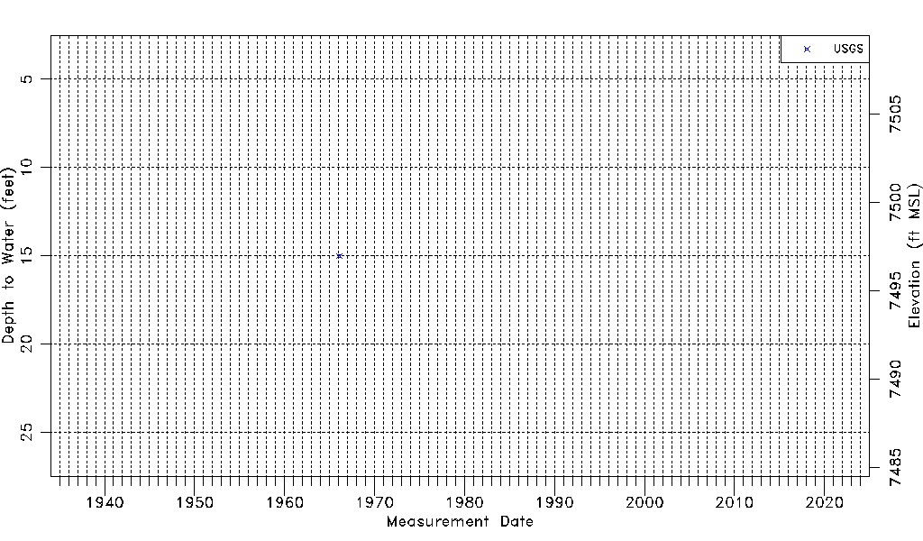
| Water-level Count | 1 |
| Water-level Date Range | 02/01/1966 thru 02/01/1966 |
| Monitored within the last 18 months | No, most recently on 02/01/1966 |
| Depth-to-Water Range (ft) | 15.00 to 15.00 |
| Water Table Elevation Range (ft NAVD88) | 7496.97 to 7496.97 |
| Water-Level-Source:Number-of-Measurements | USGS:1 |