| Well Information Table |
|---|
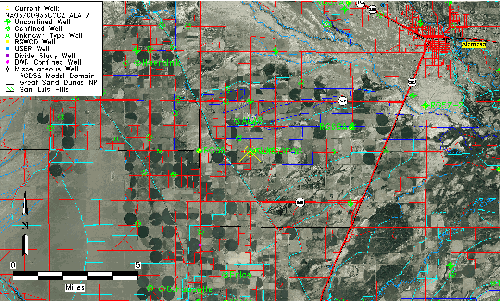
| Common Well ID | NA03700933CCC2 ALA 7 |
| RGWCD Confined Aquifer Well ID | ALA7 |
| USGS Well ID | 372403106000902 |
| USGS Station Name | NA03700933CCC2 ALA 7 |
| USGS Site Type | Well |
| USGS Site Use Information | Unused |
| USGS Groundwater Use Information | Unknown |
| Data Source(s) | USGS |
| Location Data |
|---|
| TRS | NA03700933CCC2 ALA 7 |
| USGS TRS 1 | NA03700933CCC2 ALA 7 |
| Longitude/Latitude (NAD83) | -106.00239358 , 37.40063448 |
| Longitude/Latitude Data Source | Davis Engineering Survey |
| USGS Longitude/Latitude (NAD83) | -106.002388900 , 37.400638890 |
| Easting, Northing RGDSS-NAD83 (US ft) | 104658.14 , 147510.53 |
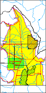
| USGS County | Alamosa County |
| USGS Map Name | WAVERLY |
| USGS Map Scale | 24000 |
| Elevation and Depth Data |
|---|
| Ground Elevation (ft NAVD88) | 7589.59 |
| Elevation Data Source | Davis Engineering Survey |
| USGS Ground Elevation (ft NAVD88) | 7589.59 |
| 1/3-Arc Second NED Ground Elevation (ft NAVD88) | 7590.03 |
| 1-Arc Second NED Ground Elevation (ft NAVD88) | 7589.99 |
| SRTM Ground Elevation (ft NAVD88) | 7588.58 |
| Total Depth (ft) | 490.00 |
| USGS Well Depth (ft) | 490.00 |
| Model Layer | 3 |
| Model Layer Source | Well Depth |
| Depth of Bottom of Layer 1 | 19 |
| Depth of Bottom of Layer 2 | 289 |
| Depth of Bottom of Layer 3 | 652 |
| Depth of Bottom of Layer 4 | 2171 |
| Additional Well Information | Construction |
| Aquifer Information |
|---|
| Aquifer Type | Confined |
| Aquifer Type Source | RGWCD_AQ |
| USGS Aquifer Type | Confined Single Aquifer |
| USGS Hydrologic Unit | Alamosa-Trinchera |
| USGS Data Available | Water-level (GW.LEV) |
| Water-level Database Information |
|---|
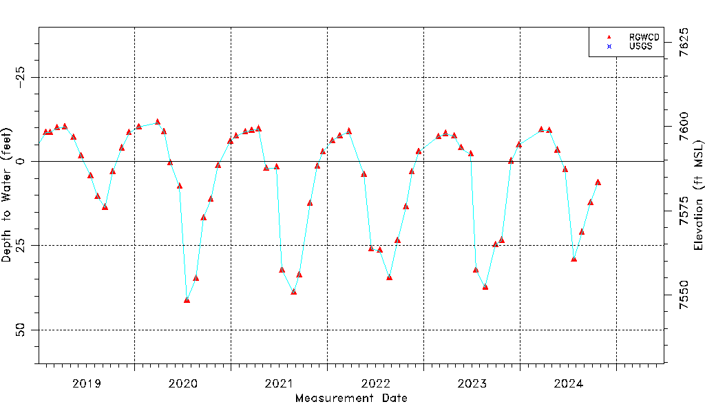
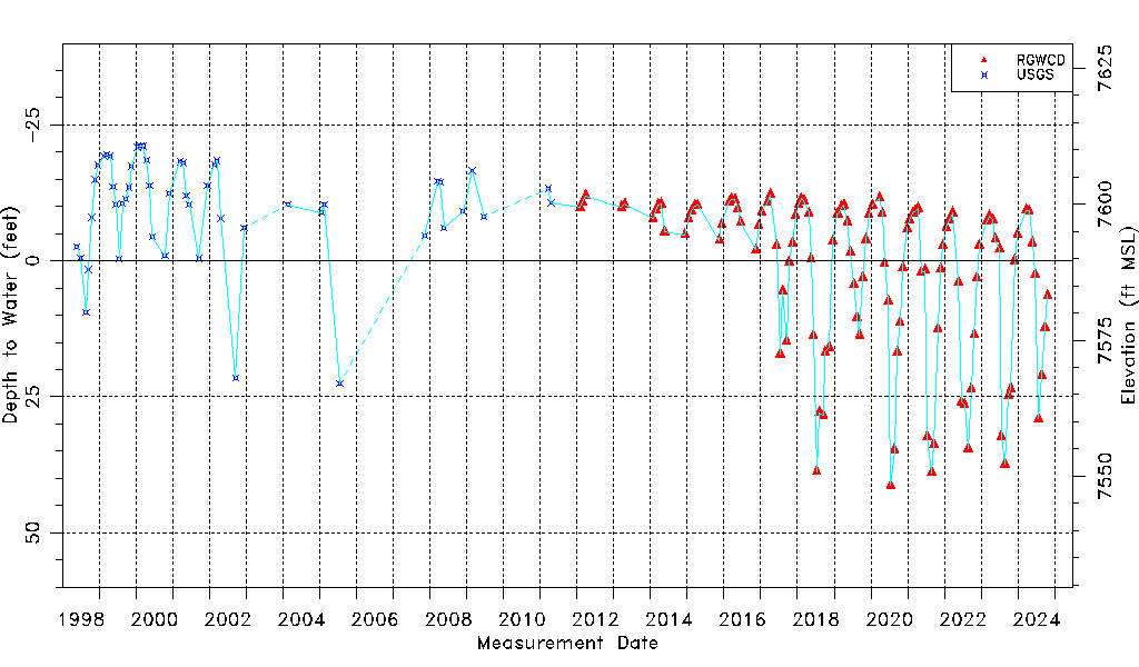
| Water-level Count | 176 |
| Water-level Date Range | 05/27/1998 thru 03/26/2026 |
| Monitored within the last 18 months | Yes, most recently on 03/26/2026 |
| Depth-to-Water Range (ft) | -21.20 to 41.27 |
| Water Table Elevation Range (ft NAVD88) | 7548.32 to 7610.79 |
| Water-Level-Source:Number-of-Measurements | RGWCD:127 USGS:49 |