| Well Information Table |
|---|
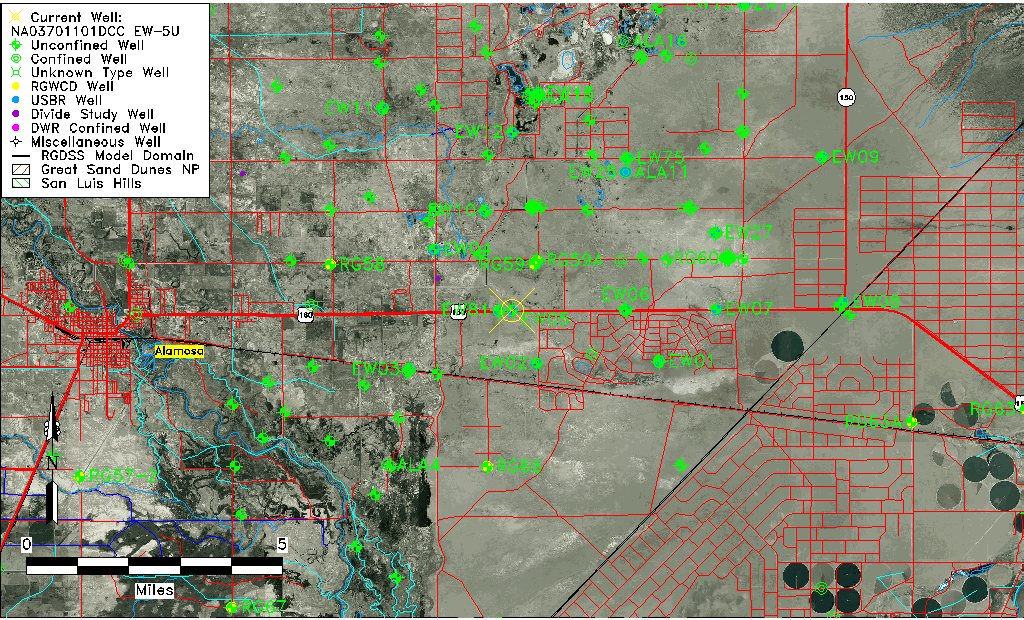
| Common Well ID | NA03701101DCC EW-5U |
| USBR Well ID | EW05U |
| USGS Well ID | 372829105431201 |
| USGS Station Name | NA03701101DCC EW-5U |
| USGS Construction Date | 10/03/1980 |
| USGS Site Type | Well |
| USGS Site Use Information | Observation |
| USGS Groundwater Use Information | Unused |
| Data Source(s) | USGS, Divide Study, USBR |
| Location Data |
|---|
| TRS | NA03701101DCC EW-5U |
| USBR TRS | NA03701101DCC |
| USGS TRS 1 | NA03701101DCC EW-5U |
| Longitude/Latitude (NAD83) | -105.72074473 , 37.47480471 |
| Longitude/Latitude Data Source | Divide Study |
| USGS Longitude/Latitude (NAD83) | -105.720573500 , 37.474727800 |
| USBR Longitude/Latitude (NAD27) | -105.720173191616 , 37.4747920679251 |
| Easting, Northing RGDSS-NAD83 (US ft) | 186462.36 , 174343.86 |
| USGS Topography | Valley flat |
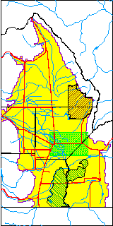
| USGS County | Alamosa County |
| USGS Map Name | BALDY |
| USGS Map Scale | 24000 |
| Elevation and Depth Data |
|---|
| Ground Elevation (ft NAVD88) | 7547.25 |
| Elevation Data Source | Divide study surveying by Davis Engineering |
| USBR Ground Elevation (ft NGVD29) | 7543.2 |
| USGS Ground Elevation (ft NGVD29) | 7543.00 |
| 1/3-Arc Second NED Ground Elevation (ft NAVD88) | 7549.09 |
| 1-Arc Second NED Ground Elevation (ft NAVD88) | 7548.03 |
| SRTM Ground Elevation (ft NAVD88) | 7547.50 |
| Total Depth (ft) | 33.00 |
| USBR Total Depth (ft) | 33 |
| USGS Hole Depth (ft) | 33.00 |
| USGS Well Depth (ft) | 33.00 |
| Model Layer | 1 |
| Model Layer Source | Aquifer Type |
| Depth of Bottom of Layer 1 | 82 |
| Depth of Bottom of Layer 2 | 212 |
| Depth of Bottom of Layer 3 | 708 |
| Depth of Bottom of Layer 4 | 2494 |
| Additional Well Information | Logs, Construction |
| Aquifer Information |
|---|
| Aquifer Type | Unconfined |
| Aquifer Type Source | DIV_AQ |
| USGS Hydrologic Unit | San Luis |
| USGS Data Available | Water-level (GW.LEV) |
| Water-level Database Information |
|---|
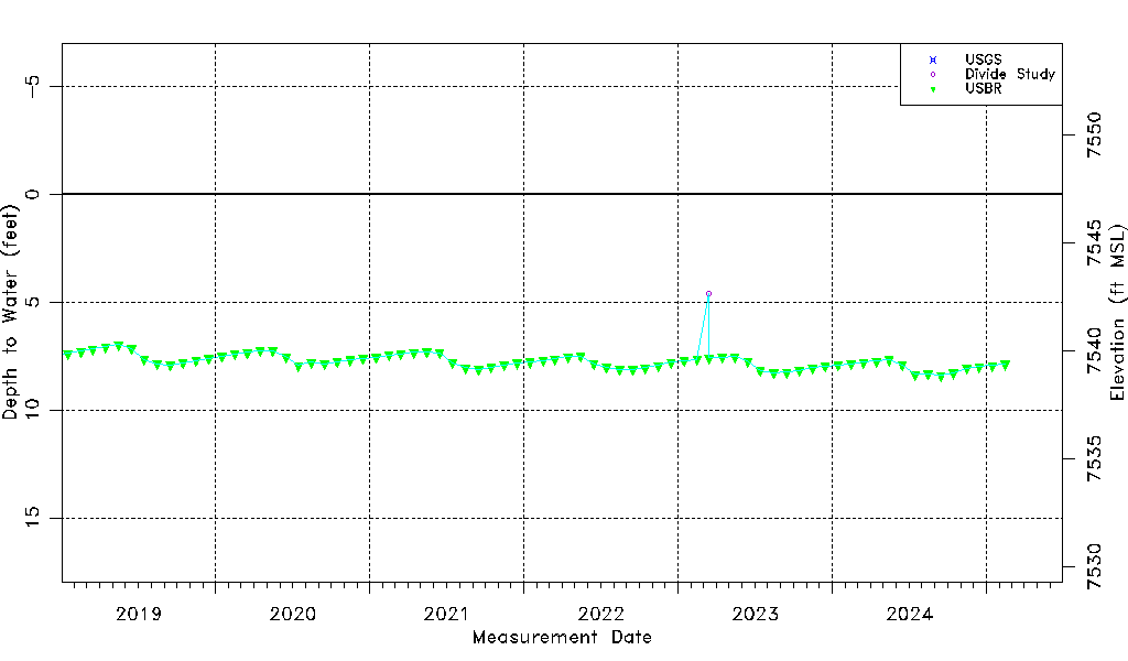
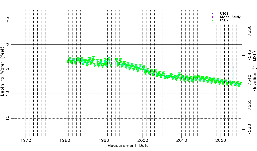
| Water-level Count | 559 |
| Water-level Date Range | 10/20/1980 thru 09/15/2025 |
| Monitored within the last 18 months | Yes, most recently on 09/15/2025 |
| Depth-to-Water Range (ft) | 2.57 to 8.46 |
| Water Table Elevation Range (ft NAVD88) | 7538.79 to 7544.68 |
| Water-Level-Source:Number-of-Measurements | USGS:52 Divide Study:11 USBR:504 |