| Well Information Table |
|---|
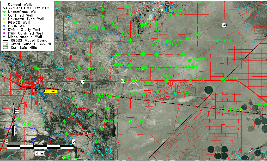
| Common Well ID | NA03701101CCD EW-81C |
| USBR Well ID | EW81C |
| USGS Well ID | 372829105433001 |
| USGS Station Name | NA03701101CCD EW-81C |
| USGS Construction Date | 09/16/1977 |
| USGS Site Type | Well |
| USGS Site Use Information | Observation |
| USGS Groundwater Use Information | Unknown |
| Data Source(s) | USGS, USBR |
| Location Data |
|---|
| TRS | NA03701101CCD EW-81C |
| USBR TRS | NA03701101CCD |
| USGS TRS 1 | NA03701101CCD EW-81C |
| Longitude/Latitude (NAD83) | -105.72539166 , 37.47473938 |
| Longitude/Latitude Data Source | USBOR EW well locations |
| USGS Longitude/Latitude (NAD83) | -105.725573600 , 37.474727790 |
| USBR Longitude/Latitude (NAD27) | -105.724818043164 , 37.4747338137644 |
| Easting, Northing RGDSS-NAD83 (US ft) | 185114.25 , 174320.83 |
| USGS Topography | Valley flat |
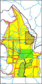
| USGS County | Alamosa County |
| USGS Map Name | BALDY |
| USGS Map Scale | 24000 |
| Elevation and Depth Data |
|---|
| Ground Elevation (ft NAVD88) | 7548.26 |
| Elevation Data Source | USBOR EW well database |
| USBR Ground Elevation (ft NGVD29) | 7544.2 |
| USGS Ground Elevation (ft NGVD29) | 7544.20 |
| 1/3-Arc Second NED Ground Elevation (ft NAVD88) | 7549.17 |
| 1-Arc Second NED Ground Elevation (ft NAVD88) | 7549.19 |
| SRTM Ground Elevation (ft NAVD88) | 7557.04 |
| Total Depth (ft) | 117.00 |
| USBR Total Depth (ft) | 117 |
| USGS Hole Depth (ft) | 118.00 |
| USGS Well Depth (ft) | 109.00 |
| Model Layer | 2 |
| Model Layer Source | Well Depth |
| Depth of Bottom of Layer 1 | 90 |
| Depth of Bottom of Layer 2 | 209 |
| Depth of Bottom of Layer 3 | 707 |
| Depth of Bottom of Layer 4 | 2498 |
| Additional Well Information | Construction |
| Aquifer Information |
|---|
| Aquifer Type | Confined |
| Aquifer Type Source | EW_AQFR |
| USGS Hydrologic Unit | San Luis |
| USGS Data Available | Water-level (GW.LEV) |
| Water-level Database Information |
|---|
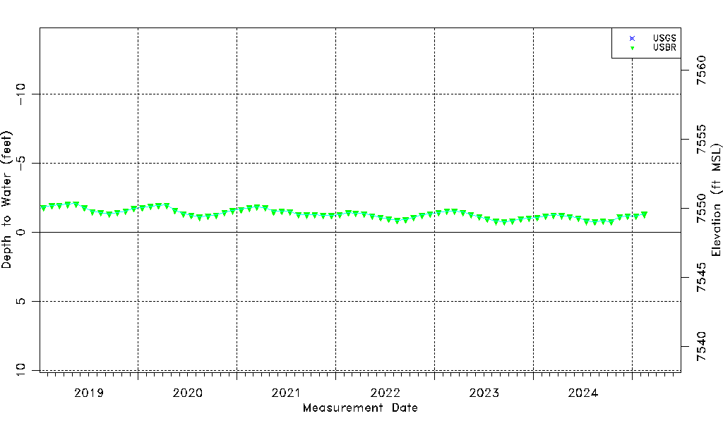
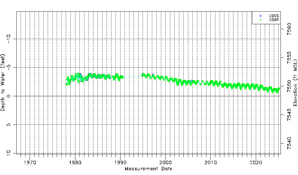
| Water-level Count | 786 |
| Water-level Date Range | 02/18/1978 thru 09/15/2025 |
| Monitored within the last 18 months | Yes, most recently on 09/15/2025 |
| Depth-to-Water Range (ft) | -3.90 to -0.71 |
| Water Table Elevation Range (ft NAVD88) | 7548.97 to 7552.16 |
| Water-Level-Source:Number-of-Measurements | USGS:374 USBR:420 |