| Well Information Table |
|---|
| Common Well ID | NA03701201DAA EW-8U |
| USBR Well ID | EW08U |
| USGS Well ID | 372839105361001 |
| USGS Station Name | NA03701201DAA EW-8U |
| USGS Construction Date | 08/14/1980 |
| USGS Site Type | Well |
| USGS Site Use Information | Observation |
| USGS Groundwater Use Information | Unused |
| Data Source(s) | USGS, USBR |
| Location Data |
|---|
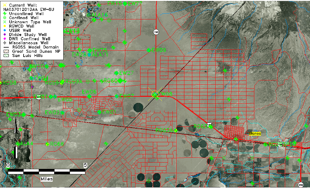
| TRS | NA03701201DAA EW-8U |
| USBR TRS | NA03701201DAA |
| USGS TRS 1 | NA03701201DAA EW-8U |
| Longitude/Latitude (NAD83) | -105.60295003 , 37.47718769 |
| Longitude/Latitude Data Source | USBOR EW well locations |
| USGS Longitude/Latitude (NAD83) | -105.603348100 , 37.477506150 |
| USBR Longitude/Latitude (NAD27) | -105.602379696756 , 37.4771815291974 |
| Easting, Northing RGDSS-NAD83 (US ft) | 220634.31 , 175214.46 |
| USGS Topography | Valley flat |
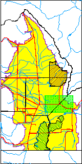
| USGS County | Saguache County |
| USGS Map Name | BLANCA |
| USGS Map Scale | 24000 |
| Elevation and Depth Data |
|---|
| Ground Elevation (ft NAVD88) | 7651.64 |
| Elevation Data Source | USBOR EW well database |
| USBR Ground Elevation (ft NGVD29) | 7647.4 |
| USGS Ground Elevation (ft NGVD29) | 7647.00 |
| 1/3-Arc Second NED Ground Elevation (ft NAVD88) | 7650.31 |
| 1-Arc Second NED Ground Elevation (ft NAVD88) | 7651.96 |
| SRTM Ground Elevation (ft NAVD88) | 7647.79 |
| Total Depth (ft) | 110.00 |
| USBR Total Depth (ft) | 110 |
| USGS Hole Depth (ft) | 194.00 |
| USGS Well Depth (ft) | 110.00 |
| Model Layer | 1 |
| Model Layer Source | Aquifer Type |
| Depth of Bottom of Layer 1 | 179 |
| Depth of Bottom of Layer 2 | 273 |
| Depth of Bottom of Layer 3 | 545 |
| Depth of Bottom of Layer 4 | 1510 |
| Additional Well Information | Logs, Construction |
| Aquifer Information |
|---|
| Aquifer Type | Unconfined |
| Aquifer Type Source | EW_AQFR |
| USGS Hydrologic Unit | San Luis |
| USGS Data Available | Water-level (GW.LEV) |
| Water-level Database Information |
|---|
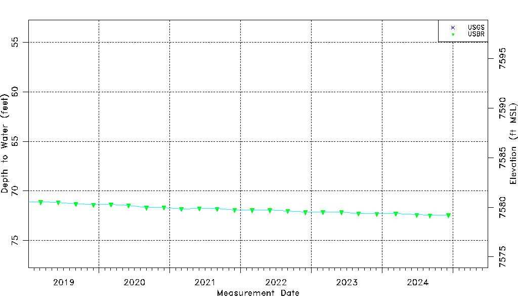
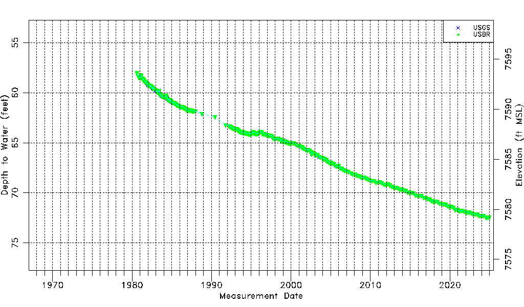
| Water-level Count | 528 |
| Water-level Date Range | 08/14/1980 thru 09/03/2025 |
| Monitored within the last 18 months | Yes, most recently on 09/03/2025 |
| Depth-to-Water Range (ft) | 58.03 to 72.55 |
| Water Table Elevation Range (ft NAVD88) | 7579.09 to 7593.61 |
| Water-Level-Source:Number-of-Measurements | USGS:257 USBR:284 |