| Well Information Table |
|---|
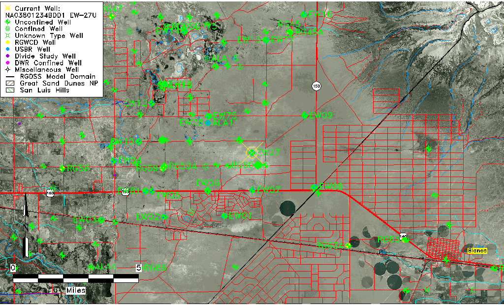
| Common Well ID | NA03801234BDD1 EW-27U |
| USBR Well ID | EW27U |
| USGS Well ID | 372948105385201 |
| USGS Station Name | NA03801234BDD1 EW-27U |
| USGS Construction Date | 09/06/1982 |
| USGS Site Type | Well |
| USGS Site Use Information | Observation |
| USGS Groundwater Use Information | Unknown |
| Data Source(s) | USGS, USBR |
| Location Data |
|---|
| TRS | NA03801234BDD1 EW-27U |
| USBR TRS | NA03801234BDD1 |
| USGS TRS 1 | NA03801234BDD1 EW-27U |
| Longitude/Latitude (NAD83) | -105.64832894 , 37.49687446 |
| Longitude/Latitude Data Source | USBOR EW well locations |
| USGS Longitude/Latitude (NAD83) | -105.648349300 , 37.496672090 |
| USBR Longitude/Latitude (NAD27) | -105.647757398117 , 37.4968690476907 |
| Easting, Northing RGDSS-NAD83 (US ft) | 207468.55 , 182374.12 |
| USGS Topography | Valley flat |
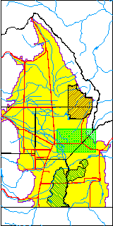
| USGS County | Alamosa County |
| USGS Map Name | BALDY |
| USGS Map Scale | 24000 |
| Elevation and Depth Data |
|---|
| Ground Elevation (ft NAVD88) | 7590.87 |
| Elevation Data Source | USBOR EW well database |
| USBR Ground Elevation (ft NGVD29) | 7586.7 |
| USGS Ground Elevation (ft NGVD29) | 7586.70 |
| 1/3-Arc Second NED Ground Elevation (ft NAVD88) | 7592.22 |
| 1-Arc Second NED Ground Elevation (ft NAVD88) | 7591.44 |
| SRTM Ground Elevation (ft NAVD88) | 7584.48 |
| Total Depth (ft) | 45.00 |
| USBR Total Depth (ft) | 45 |
| USGS Hole Depth (ft) | 120.00 |
| USGS Well Depth (ft) | 43.00 |
| Model Layer | 1 |
| Model Layer Source | Aquifer Type |
| Depth of Bottom of Layer 1 | 104 |
| Depth of Bottom of Layer 2 | 269 |
| Depth of Bottom of Layer 3 | 671 |
| Depth of Bottom of Layer 4 | 1891 |
| Additional Well Information | Logs, Construction |
| Aquifer Information |
|---|
| Aquifer Type | Unconfined |
| Aquifer Type Source | EW_AQFR |
| USGS Hydrologic Unit | San Luis |
| USGS Data Available | Water-level (GW.LEV) |
| Water-level Database Information |
|---|
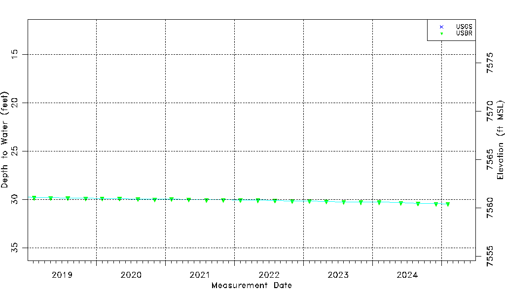
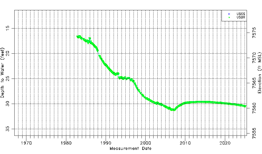
| Water-level Count | 294 |
| Water-level Date Range | 11/02/1982 thru 08/27/2025 |
| Monitored within the last 18 months | Yes, most recently on 08/27/2025 |
| Depth-to-Water Range (ft) | 16.50 to 31.20 |
| Water Table Elevation Range (ft NAVD88) | 7559.67 to 7574.37 |
| Water-Level-Source:Number-of-Measurements | USGS:23 USBR:290 |