| Well Information Table |
|---|
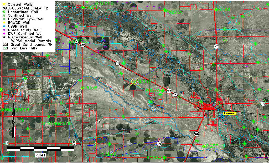
| Common Well ID | NA03800934ADB ALA 12 |
| RGWCD Confined Aquifer Well ID | ALA12 |
| USGS Well ID | 372950105580801 |
| USGS Station Name | NA03800934ADB ALA 12 |
| USGS Site Type | Well |
| USGS Site Use Information | Withdrawal of Water |
| USGS Groundwater Use Information | Unknown |
| Data Source(s) | USGS |
| Location Data |
|---|
| TRS | NA03800934ADB ALA 12 |
| USGS TRS 1 | NA03800934ADB ALA 12 |
| Longitude/Latitude (NAD83) | -105.96870670 , 37.49712384 |
| Longitude/Latitude Data Source | Davis Engineering Survey |
| USGS Longitude/Latitude (NAD83) | -105.968694400 , 37.497111100 |
| Easting, Northing RGDSS-NAD83 (US ft) | 114551.85 , 182601.30 |
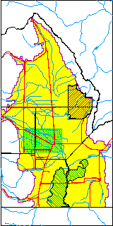
| USGS County | Alamosa County |
| USGS Map Name | ALAMOSA WEST |
| USGS Map Scale | 24000 |
| Elevation and Depth Data |
|---|
| Ground Elevation (ft NAVD88) | 7576.99 |
| Elevation Data Source | Davis Engineering Survey |
| USGS Ground Elevation (ft NAVD88) | 7576.99 |
| 1/3-Arc Second NED Ground Elevation (ft NAVD88) | 7576.12 |
| 1-Arc Second NED Ground Elevation (ft NAVD88) | 7576.57 |
| SRTM Ground Elevation (ft NAVD88) | 7588.18 |
| Depth of Bottom of Layer 1 | 50 |
| Depth of Bottom of Layer 2 | 355 |
| Depth of Bottom of Layer 3 | 795 |
| Depth of Bottom of Layer 4 | 2184 |
| Additional Well Information | NONE |
| Aquifer Information |
|---|
| Aquifer Type | Confined |
| Aquifer Type Source | RGWCD_AQ |
| USGS Aquifer Type | Confined Single Aquifer |
| USGS Hydrologic Unit | Alamosa-Trinchera |
| USGS Data Available | Water-level (GW.LEV) |
| Water-level Database Information |
|---|
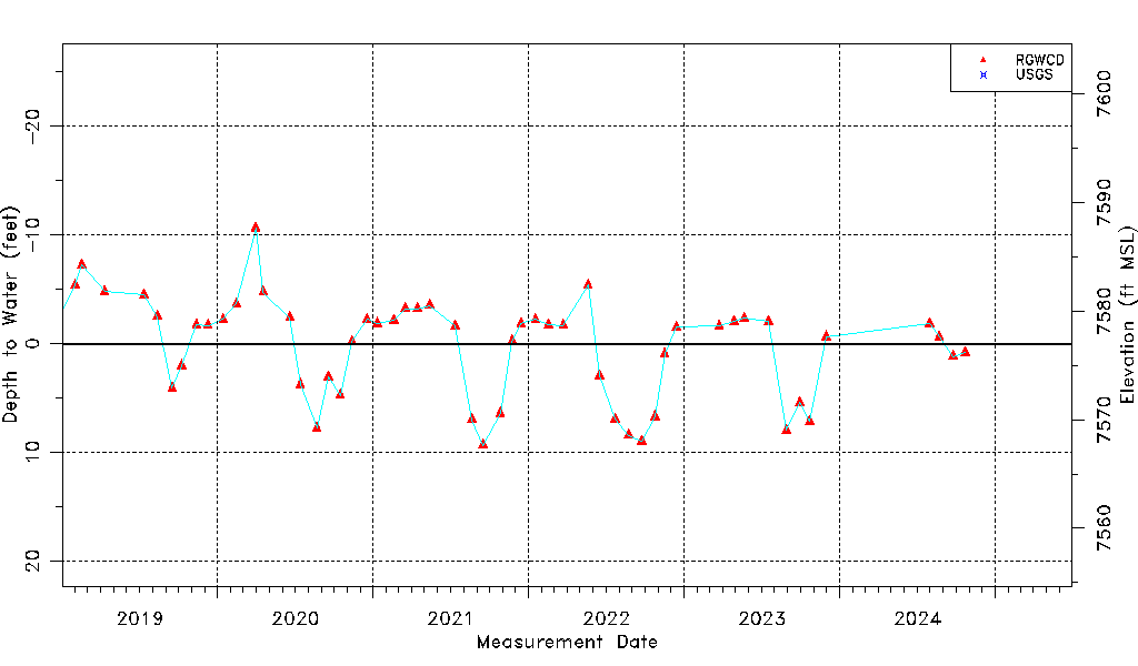
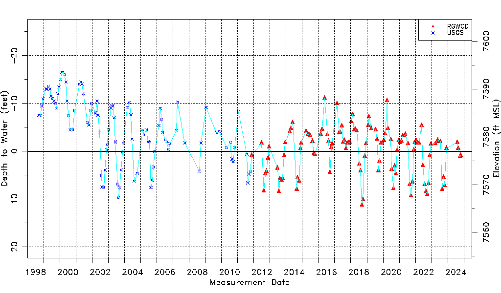
| Water-level Count | 228 |
| Water-level Date Range | 09/16/1998 thru 03/26/2026 |
| Monitored within the last 18 months | Yes, most recently on 03/26/2026 |
| Depth-to-Water Range (ft) | -16.50 to 11.20 |
| Water Table Elevation Range (ft NAVD88) | 7565.79 to 7593.49 |
| Water-Level-Source:Number-of-Measurements | RGWCD:131 USGS:97 |