| Well Information Table |
|---|
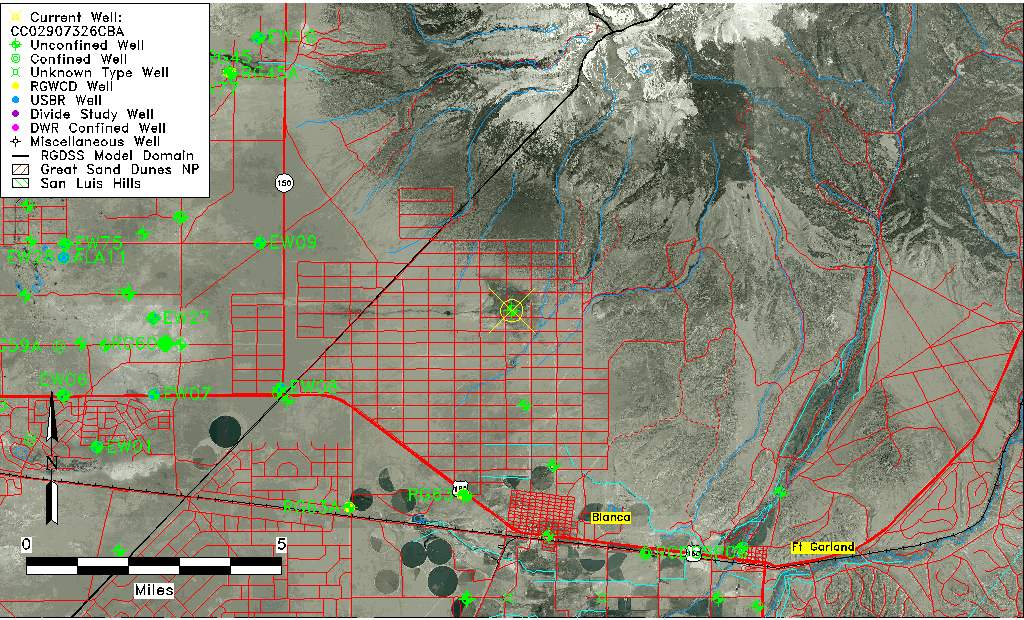
| Common Well ID | CC02907326CBA |
| USGS Well ID | 372955105310701 |
| USGS Station Name | CC02907326CBA |
| USGS Construction Date | 01/01/1953 |
| USGS Site Type | Well |
| USGS Site Use Information | Observation |
| USGS Groundwater Use Information | Unused |
| Data Source(s) | USGS |
| Location Data |
|---|
| TRS | CC02907326CBA |
| USGS TRS 1 | CC02907326CBA |
| USGS TRS | NENWSWS026T0029SR0073WC |
| Longitude/Latitude (NAD83) | -105.52056800 , 37.49900600 |
| Longitude/Latitude Data Source | GWSI decimal LAT/LONG field |
| USGS Longitude/Latitude (NAD83) | -105.520568000 , 37.499006000 |
| Easting, Northing RGDSS-NAD83 (US ft) | 244519.86 , 183183.80 |
| USGS Topography | Hillside (slope) |
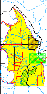
| USGS County | Costilla County |
| USGS Map Name | BLANCA |
| USGS Map Scale | 24000 |
| Elevation and Depth Data |
|---|
| Ground Elevation (ft NAVD88) | 7924.46 |
| Elevation Data Source | USGS GWSI database |
| USGS Ground Elevation (ft NGVD29) | 7920.00 |
| 1/3-Arc Second NED Ground Elevation (ft NAVD88) | 7922.30 |
| 1-Arc Second NED Ground Elevation (ft NAVD88) | 7922.35 |
| SRTM Ground Elevation (ft NAVD88) | 7926.45 |
| Total Depth (ft) | 250.00 |
| USGS Well Depth (ft) | 250.00 |
| Model Layer | 1 |
| Model Layer Source | Well Depth |
| Depth of Bottom of Layer 1 | 454 |
| Depth of Bottom of Layer 2 | 539 |
| Depth of Bottom of Layer 3 | 575 |
| Depth of Bottom of Layer 4 | 1010 |
| Additional Well Information | Production, Construction |
| Aquifer Information |
|---|
| Aquifer Type | Unconfined |
| Aquifer Type Source | TD Elevation/Model Layer |
| USGS Hydrologic Unit | San Luis |
| USGS Data Available | Water-level (GW.LEV) |
| Water-level Database Information |
|---|
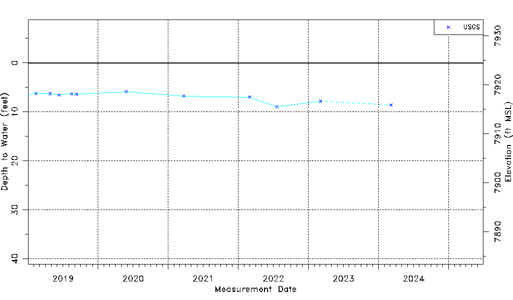
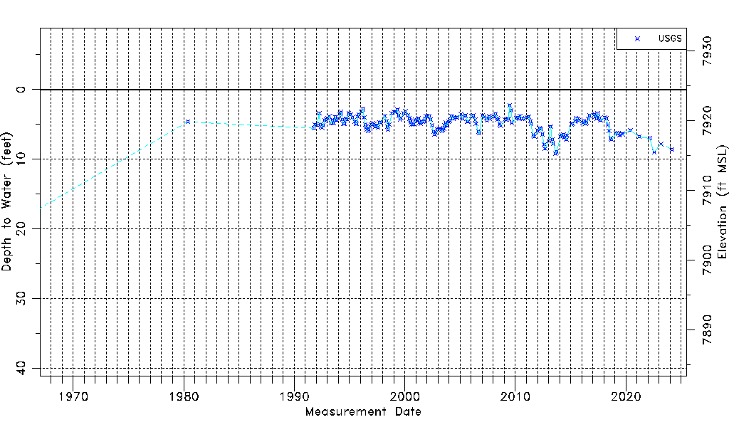
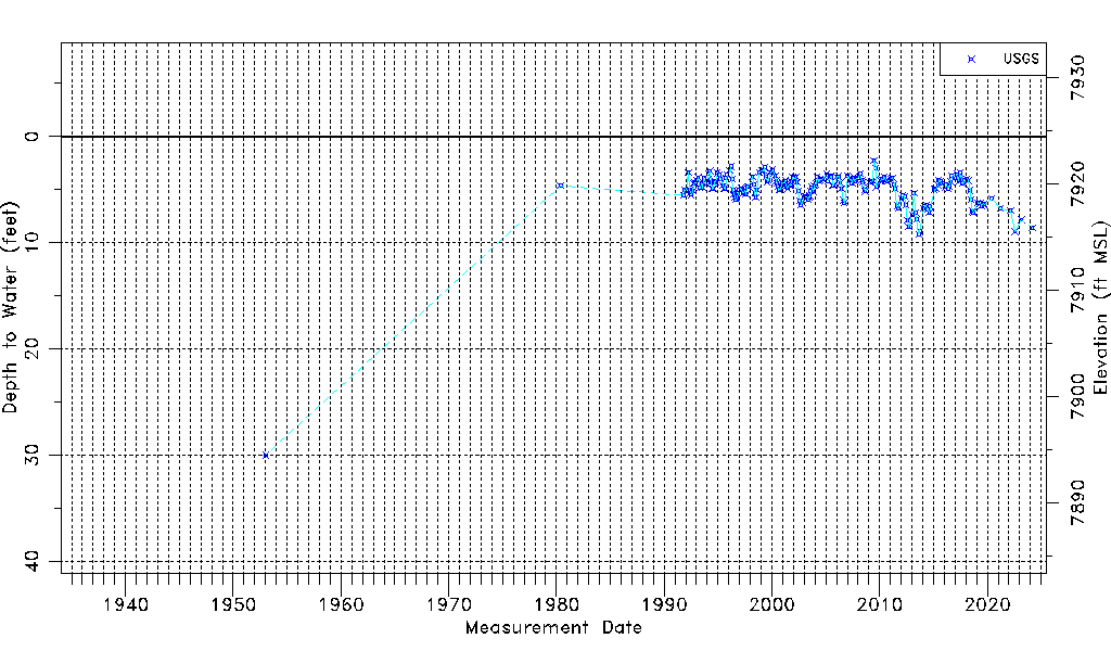
| Water-level Count | 202 |
| Water-level Date Range | 01/01/1953 thru 03/11/2025 |
| Monitored within the last 18 months | Yes, most recently on 03/11/2025 |
| Depth-to-Water Range (ft) | 2.26 to 30.00 |
| Water Table Elevation Range (ft NAVD88) | 7894.46 to 7922.20 |
| Water-Level-Source:Number-of-Measurements | USGS:202 |