| Well Information Table |
|---|
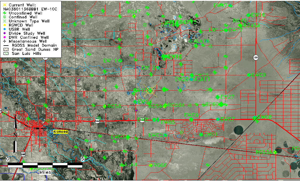
| Common Well ID | NA03801136BBB1 EW-10C |
| USBR Well ID | EW10C |
| USGS Well ID | 373011105434701 |
| USGS Station Name | NA03801136BBB1 EW-10C |
| USGS Construction Date | 10/02/1980 |
| USGS Site Type | Well |
| USGS Site Use Information | Observation |
| USGS Groundwater Use Information | Unused |
| Data Source(s) | USGS, USBR |
| Location Data |
|---|
| TRS | NA03801136BBB1 EW-10C |
| USBR TRS | NA03801136BBB1 |
| USGS TRS 1 | NA03801136BBB1 EW-10C |
| Longitude/Latitude (NAD83) | -105.73037949 , 37.50312726 |
| Longitude/Latitude Data Source | USBOR EW well locations |
| USGS Longitude/Latitude (NAD83) | -105.730296000 , 37.503060400 |
| USBR Longitude/Latitude (NAD27) | -105.729805688482 , 37.5031224108721 |
| Easting, Northing RGDSS-NAD83 (US ft) | 183673.83 , 184654.96 |
| USGS Topography | Valley flat |
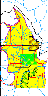
| USGS County | Alamosa County |
| USGS Map Name | DRY LAKES |
| USGS Map Scale | 24000 |
| Elevation and Depth Data |
|---|
| Ground Elevation (ft NAVD88) | 7522.71 |
| Elevation Data Source | USBOR EW well database |
| USBR Ground Elevation (ft NGVD29) | 7518.7 |
| USGS Ground Elevation (ft NGVD29) | 7520.30 |
| 1/3-Arc Second NED Ground Elevation (ft NAVD88) | 7523.33 |
| 1-Arc Second NED Ground Elevation (ft NAVD88) | 7523.77 |
| SRTM Ground Elevation (ft NAVD88) | 7527.83 |
| Total Depth (ft) | 111.00 |
| USBR Total Depth (ft) | 111 |
| USGS Hole Depth (ft) | 111.00 |
| USGS Well Depth (ft) | 110.00 |
| Model Layer | 2 |
| Model Layer Source | Well Depth |
| Depth of Bottom of Layer 1 | 60 |
| Depth of Bottom of Layer 2 | 279 |
| Depth of Bottom of Layer 3 | 788 |
| Depth of Bottom of Layer 4 | 2625 |
| Additional Well Information | Logs, Construction |
| Aquifer Information |
|---|
| Aquifer Type | Confined |
| Aquifer Type Source | EW_AQFR |
| USGS Hydrologic Unit | San Luis |
| USGS Data Available | Water-level (GW.LEV) |
| Water-level Database Information |
|---|
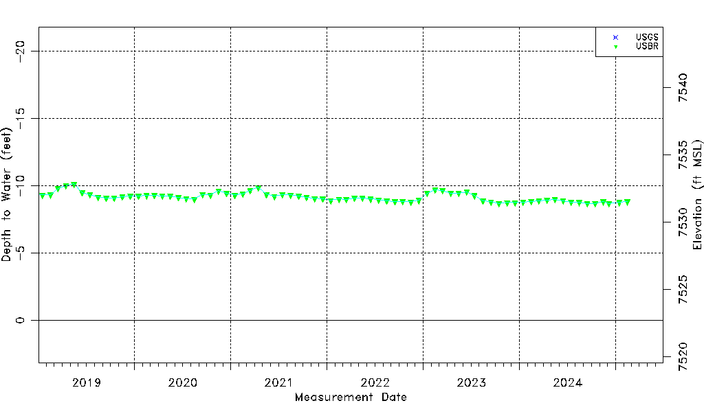
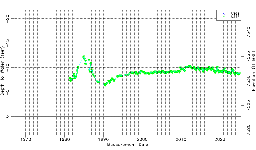
| Water-level Count | 418 |
| Water-level Date Range | 04/27/1981 thru 09/15/2025 |
| Monitored within the last 18 months | Yes, most recently on 09/15/2025 |
| Depth-to-Water Range (ft) | -12.30 to -6.37 |
| Water Table Elevation Range (ft NAVD88) | 7529.08 to 7535.01 |
| Water-Level-Source:Number-of-Measurements | USGS:23 USBR:409 |