| Well Information Table |
|---|
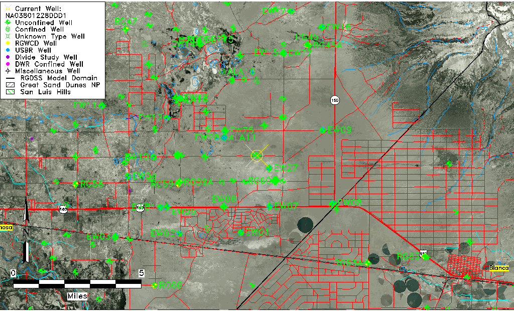
| Common Well ID | NA03801228DDD1 |
| USGS Well ID | 373016105395601 |
| USGS Station Name | NA03801228DDD1 |
| USGS Construction Date | 08/17/1977 |
| USGS Site Type | Well |
| USGS Site Use Information | Observation |
| USGS Groundwater Use Information | Unknown |
| Data Source(s) | USGS |
| Location Data |
|---|
| TRS | NA03801228DDD1 |
| USGS TRS 1 | NA03801228DDD1 |
| Longitude/Latitude (NAD83) | -105.65696070 , 37.50389410 |
| Longitude/Latitude Data Source | GWSI decimal LAT/LONG field |
| USGS Longitude/Latitude (NAD83) | -105.656960700 , 37.503894100 |
| Easting, Northing RGDSS-NAD83 (US ft) | 204964.83 , 184928.79 |
| USGS Topography | Valley flat |
| USGS County | Alamosa County |
| USGS Map Name | DRY LAKES |
| USGS Map Scale | 24000 |
| Elevation and Depth Data |
|---|
| Ground Elevation (ft NAVD88) | 7577.16 |
| Elevation Data Source | USGS GWSI database |
| USGS Ground Elevation (ft NGVD29) | 7573.00 |
| 1/3-Arc Second NED Ground Elevation (ft NAVD88) | 7577.63 |
| 1-Arc Second NED Ground Elevation (ft NAVD88) | 7577.32 |
| SRTM Ground Elevation (ft NAVD88) | 7572.56 |
| Total Depth (ft) | 11.40 |
| USGS Hole Depth (ft) | 11.40 |
| USGS Well Depth (ft) | 11.40 |
| Model Layer | 1 |
| Model Layer Source | Well Depth |
| Depth of Bottom of Layer 1 | 90 |
| Depth of Bottom of Layer 2 | 274 |
| Depth of Bottom of Layer 3 | 706 |
| Depth of Bottom of Layer 4 | 2037 |
| Additional Well Information | Construction |
| Aquifer Information |
|---|
| Aquifer Type | Unconfined |
| Aquifer Type Source | TD Elevation/Model Layer |
| USGS Primary Aquifer | Tertiary System |
| USGS Aquifer Type | Unconfined Single Aquifer |
| USGS Hydrologic Unit | San Luis |
| USGS Data Available | Water-level (GW.LEV) |
| Water-level Database Information |
|---|
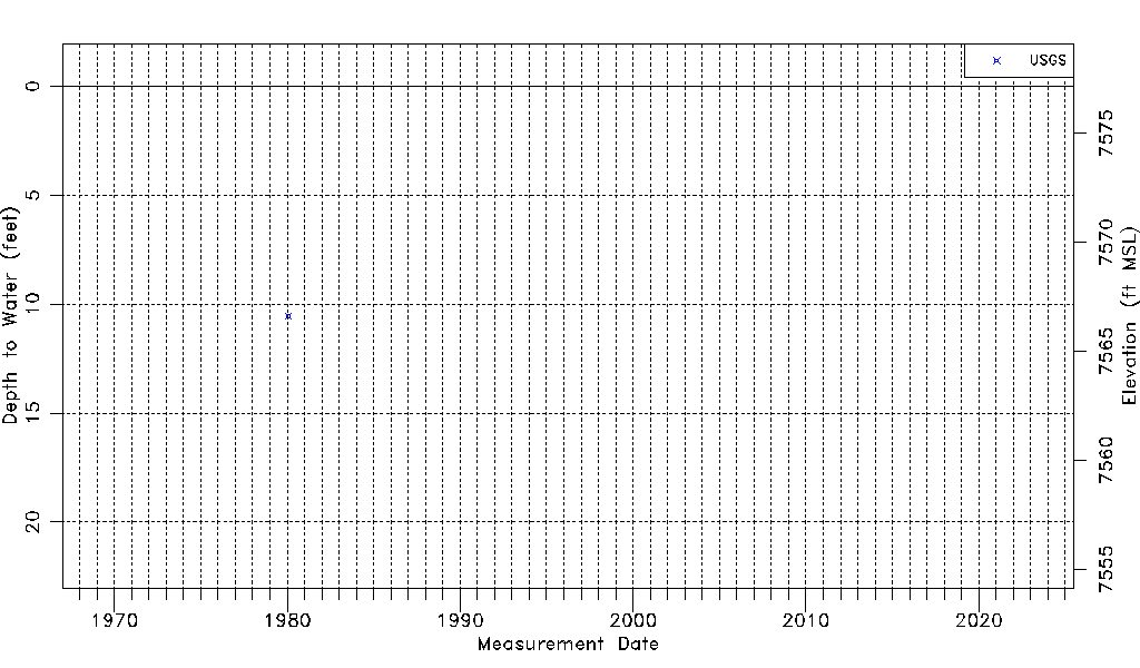
| Water-level Count | 1 |
| Water-level Date Range | 01/30/1980 thru 01/30/1980 |
| Monitored within the last 18 months | No, most recently on 01/30/1980 |
| Depth-to-Water Range (ft) | 10.54 to 10.54 |
| Water Table Elevation Range (ft NAVD88) | 7566.62 to 7566.62 |
| Water-Level-Source:Number-of-Measurements | USGS:1 |