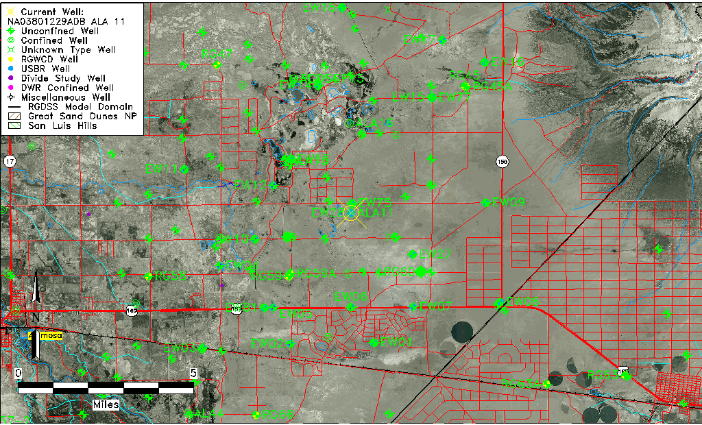
| Well Information Table |
|---|
| Common Well ID | NA03801229ADB ALA 11 |
| RGWCD Confined Aquifer Well ID | ALA11 |
| USBR Well ID | EW28C |
| USGS Well ID | 373051105404701 |
| USGS Station Name | NA03801229ADB ALA 11 |
| USGS Site Type | Well |
| USGS Site Use Information | Observation |
| USGS Groundwater Use Information | Unknown |
| Data Source(s) | USGS, USBR |
| Location Data |
|---|
| TRS | NA03801229ADB ALA 11 |
| USBR TRS | NA03801229ADB |
| USGS TRS 1 | NA03801229ADB ALA 11 |
| Longitude/Latitude (NAD83) | -105.68030199 , 37.51410298 |
| Longitude/Latitude Data Source | Davis Engineering Survey |
| USGS Longitude/Latitude (NAD83) | -105.680305600 , 37.514111100 |
| Easting, Northing RGDSS-NAD83 (US ft) | 198196.48 , 188644.72 |
| USGS County | Alamosa County |
| USGS Map Name | DRY LAKES |
| USGS Map Scale | 24000 |
| Elevation and Depth Data |
|---|
| Ground Elevation (ft NAVD88) | 7549.49 |
| Elevation Data Source | Davis Engineering Survey |
| USGS Ground Elevation (ft NAVD88) | 7549.49 |
| 1/3-Arc Second NED Ground Elevation (ft NAVD88) | 7549.13 |
| 1-Arc Second NED Ground Elevation (ft NAVD88) | 7550.08 |
| SRTM Ground Elevation (ft NAVD88) | 7551.52 |
| Total Depth (ft) | 340.00 |
| USBR Total Depth (ft) | 340 |
| Model Layer | 3 |
| Model Layer Source | Well Depth |
| Depth of Bottom of Layer 1 | 65 |
| Depth of Bottom of Layer 2 | 272 |
| Depth of Bottom of Layer 3 | 775 |
| Depth of Bottom of Layer 4 | 2395 |
| Additional Well Information | NONE |
| Aquifer Information |
|---|
| Aquifer Type | Confined |
| Aquifer Type Source | RGWCD_AQ |
| USGS Aquifer Type | Confined Single Aquifer |
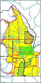
| USGS Hydrologic Unit | San Luis |
| USGS Data Available | Water-level (GW.LEV) |
| Water-level Database Information |
|---|
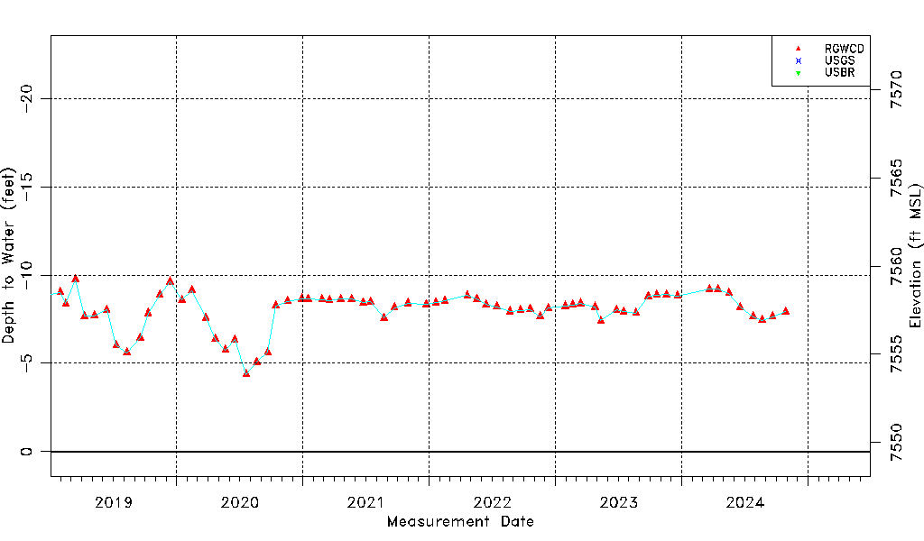
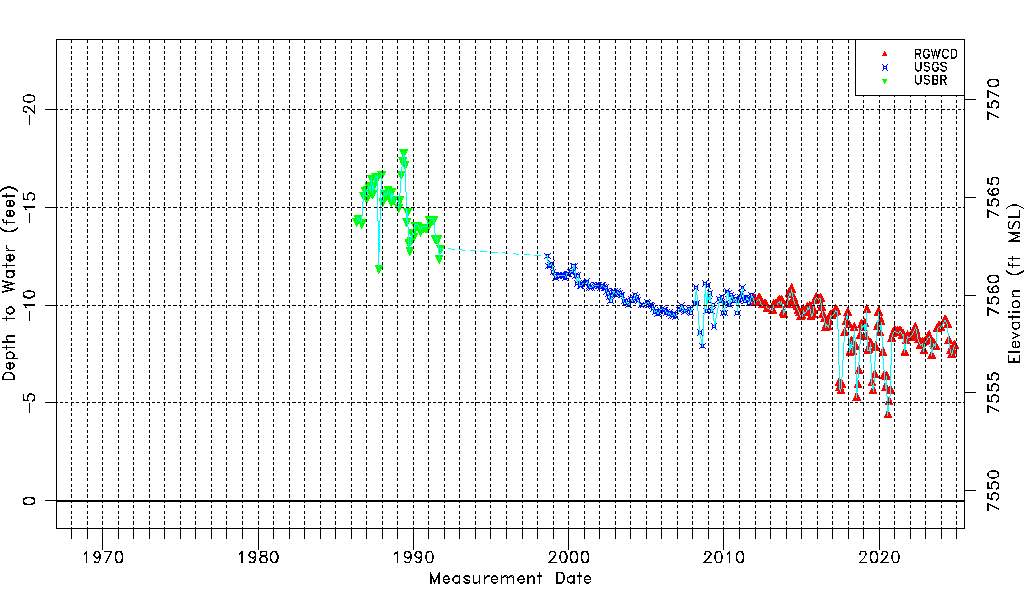
| Water-level Count | 345 |
| Water-level Date Range | 05/08/1986 thru 03/23/2026 |
| Monitored within the last 18 months | Yes, most recently on 03/23/2026 |
| Depth-to-Water Range (ft) | -17.80 to -4.38 |
| Water Table Elevation Range (ft NAVD88) | 7553.87 to 7567.29 |
| Water-Level-Source:Number-of-Measurements | RGWCD:149 USGS:136 USBR:60 |