| Well Information Table |
|---|
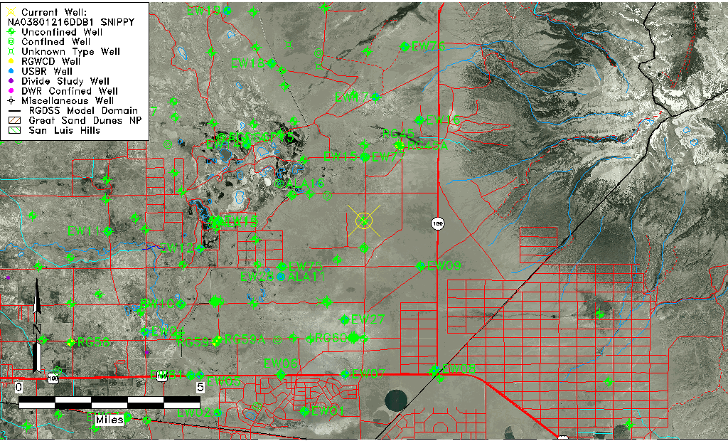
| Common Well ID | NA03801216DDB1 SNIPPY |
| USGS Well ID | 373211105393701 |
| USGS Station Name | NA03801216DDB1 SNIPPY |
| USGS Construction Date | 01/01/1958 |
| USGS Site Type | Well |
| USGS Site Use Information | Observation |
| USGS Groundwater Use Information | Unused |
| Data Source(s) | USGS |
| Location Data |
|---|
| TRS | NA03801216DDB1 SNIPPY |
| USGS TRS 1 | NA03801216DDB1 SNIPPY |
| Longitude/Latitude (NAD83) | -105.63862680 , 37.53639350 |
| Longitude/Latitude Data Source | GWSI decimal LAT/LONG field |
| USGS Longitude/Latitude (NAD83) | -105.638626800 , 37.536393500 |
| Easting, Northing RGDSS-NAD83 (US ft) | 210277.53 , 196759.84 |
| USGS Topography | Valley flat |
| USGS County | Alamosa County |
| USGS Map Name | DRY LAKES |
| USGS Map Scale | 24000 |
| Elevation and Depth Data |
|---|
| Ground Elevation (ft NAVD88) | 7554.18 |
| Elevation Data Source | USGS GWSI database |
| USGS Ground Elevation (ft NGVD29) | 7550.00 |
| 1/3-Arc Second NED Ground Elevation (ft NAVD88) | 7579.76 |
| 1-Arc Second NED Ground Elevation (ft NAVD88) | 7582.22 |
| SRTM Ground Elevation (ft NAVD88) | 7582.07 |
| Total Depth (ft) | 72.00 |
| USGS Hole Depth (ft) | 72.00 |
| USGS Well Depth (ft) | 72.00 |
| Model Layer | 1 |
| Model Layer Source | Well Depth |
| Depth of Bottom of Layer 1 | 75 |
| Depth of Bottom of Layer 2 | 364 |
| Depth of Bottom of Layer 3 | 761 |
| Depth of Bottom of Layer 4 | 2084 |
| Additional Well Information | Production, Logs, Construction |
| Aquifer Information |
|---|
| Aquifer Type | Unconfined |
| Aquifer Type Source | TD Elevation/Model Layer |
| USGS Hydrologic Unit | San Luis |
| USGS Data Available | Water-level (GW.LEV) |
| Water-level Database Information |
|---|
| Water-level Count | 278 |
| Water-level Date Range | 11/29/1977 thru 09/14/1987 |
| Monitored within the last 18 months | No, most recently on 09/14/1987 |
| Depth-to-Water Range (ft) | 7.74 to 9.64 |
| Water Table Elevation Range (ft NAVD88) | 7544.54 to 7546.44 |
| Water-Level-Source:Number-of-Measurements | USGS:278 |