| Well Information Table |
|---|
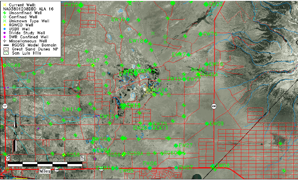
| Common Well ID | NA03801208DBD ALA 16 |
| RGWCD Confined Aquifer Well ID | ALA16 |
| USGS Well ID | 373305105405201 |
| USGS Station Name | NA03801208DBD ALA 16 |
| USGS Construction Date | 12/03/1998 |
| USGS Site Type | Well |
| USGS Site Use Information | Withdrawal of Water |
| USGS Groundwater Use Information | Unknown |
| Data Source(s) | USGS |
| Location Data |
|---|
| TRS | NA03801208DBD ALA 16 |
| USGS TRS 1 | NA03801208DBD ALA 16 |
| Longitude/Latitude (NAD83) | -105.68121675 , 37.55123413 |
| Longitude/Latitude Data Source | Davis Engineering Survey |
| USGS Longitude/Latitude (NAD83) | -105.681222200 , 37.551222200 |
| Easting, Northing RGDSS-NAD83 (US ft) | 197932.88 , 202160.58 |
| USGS Topography | Dunes |
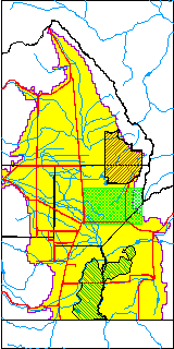
| USGS County | Alamosa County |
| USGS Map Name | DRY LAKES |
| USGS Map Scale | 24000 |
| Elevation and Depth Data |
|---|
| Ground Elevation (ft NAVD88) | 7528.99 |
| Elevation Data Source | Davis Engineering Survey |
| USGS Ground Elevation (ft NAVD88) | 7528.99 |
| 1/3-Arc Second NED Ground Elevation (ft NAVD88) | 7524.38 |
| 1-Arc Second NED Ground Elevation (ft NAVD88) | 7527.87 |
| SRTM Ground Elevation (ft NAVD88) | 7526.25 |
| Total Depth (ft) | 593.00 |
| USGS Hole Depth (ft) | 600.00 |
| USGS Well Depth (ft) | 593.00 |
| Model Layer | 3 |
| Model Layer Source | Well Depth |
| Depth of Bottom of Layer 1 | 27 |
| Depth of Bottom of Layer 2 | 298 |
| Depth of Bottom of Layer 3 | 886 |
| Depth of Bottom of Layer 4 | 2563 |
| Additional Well Information | Construction |
| Aquifer Information |
|---|
| Aquifer Type | Confined |
| Aquifer Type Source | RGWCD_AQ |
| USGS Aquifer Type | Confined Single Aquifer |
| USGS Hydrologic Unit | San Luis |
| USGS Data Available | Water-level (GW.LEV) |
| Water-level Database Information |
|---|
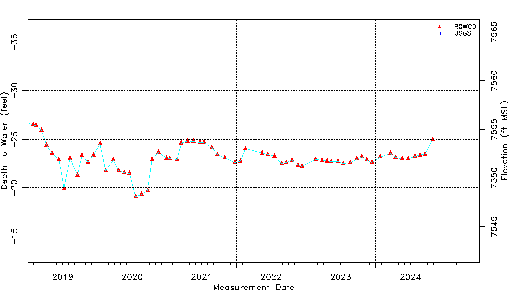
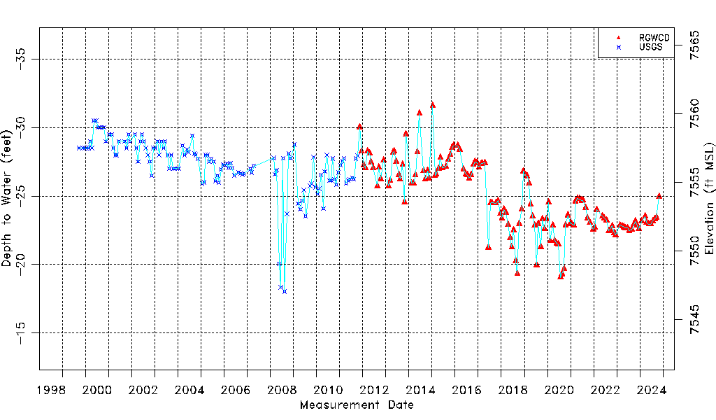
| Water-level Count | 270 |
| Water-level Date Range | 09/22/1999 thru 03/01/2026 |
| Monitored within the last 18 months | Yes, most recently on 03/01/2026 |
| Depth-to-Water Range (ft) | -31.59 to -18.04 |
| Water Table Elevation Range (ft NAVD88) | 7547.03 to 7560.58 |
| Water-Level-Source:Number-of-Measurements | RGWCD:147 USGS:123 |