| Well Information Table |
|---|
| Common Well ID | NA03901236DCC2 EW-16C |
| USBR Well ID | EW16C |
| USGS Well ID | 373435105363602 |
| USGS Station Name | NA03901236DCC2 EW-16C |
| USGS Construction Date | 06/30/1980 |
| USGS Site Type | Well |
| USGS Site Use Information | Observation |
| USGS Groundwater Use Information | Unused |
| Data Source(s) | USGS, USBR |
| Location Data |
|---|
| TRS | NA03901236DCC2 EW-16C |
| USBR TRS | NA03901236DCC2 |
| USGS TRS 1 | NA03901236DCC2 EW-16C |
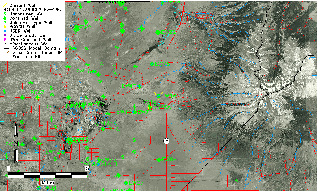
| Longitude/Latitude (NAD83) | -105.61075057 , 37.57653067 |
| Longitude/Latitude Data Source | USBOR EW well locations |
| USGS Longitude/Latitude (NAD83) | -105.610570300 , 37.576392870 |
| USBR Longitude/Latitude (NAD27) | -105.610180221625 , 37.5765266896133 |
| Easting, Northing RGDSS-NAD83 (US ft) | 218348.70 , 211373.67 |
| USGS Topography | Valley flat |
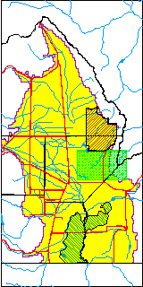
| USGS County | Alamosa County |
| USGS Map Name | TWIN PEAKS |
| USGS Map Scale | 24000 |
| Elevation and Depth Data |
|---|
| Ground Elevation (ft NAVD88) | 7618.34 |
| Elevation Data Source | USBOR EW well database |
| USBR Ground Elevation (ft NGVD29) | 7614.1 |
| USGS Ground Elevation (ft NGVD29) | 7514.00 |
| 1/3-Arc Second NED Ground Elevation (ft NAVD88) | 7621.07 |
| 1-Arc Second NED Ground Elevation (ft NAVD88) | 7619.13 |
| SRTM Ground Elevation (ft NAVD88) | 7621.11 |
| Total Depth (ft) | 180.00 |
| USBR Total Depth (ft) | 180 |
| USGS Hole Depth (ft) | 180.00 |
| USGS Well Depth (ft) | 180.00 |
| Model Layer | 2 |
| Model Layer Source | Well Depth |
| Depth of Bottom of Layer 1 | 123 |
| Depth of Bottom of Layer 2 | 506 |
| Depth of Bottom of Layer 3 | 833 |
| Depth of Bottom of Layer 4 | 1806 |
| Additional Well Information | Logs, Construction |
| Aquifer Information |
|---|
| Aquifer Type | Confined |
| Aquifer Type Source | EW_AQFR |
| USGS Hydrologic Unit | San Luis |
| USGS Data Available | Water-level (GW.LEV) |
| Water-level Database Information |
|---|
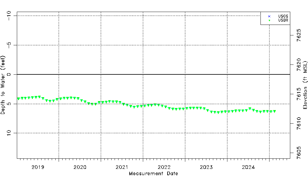
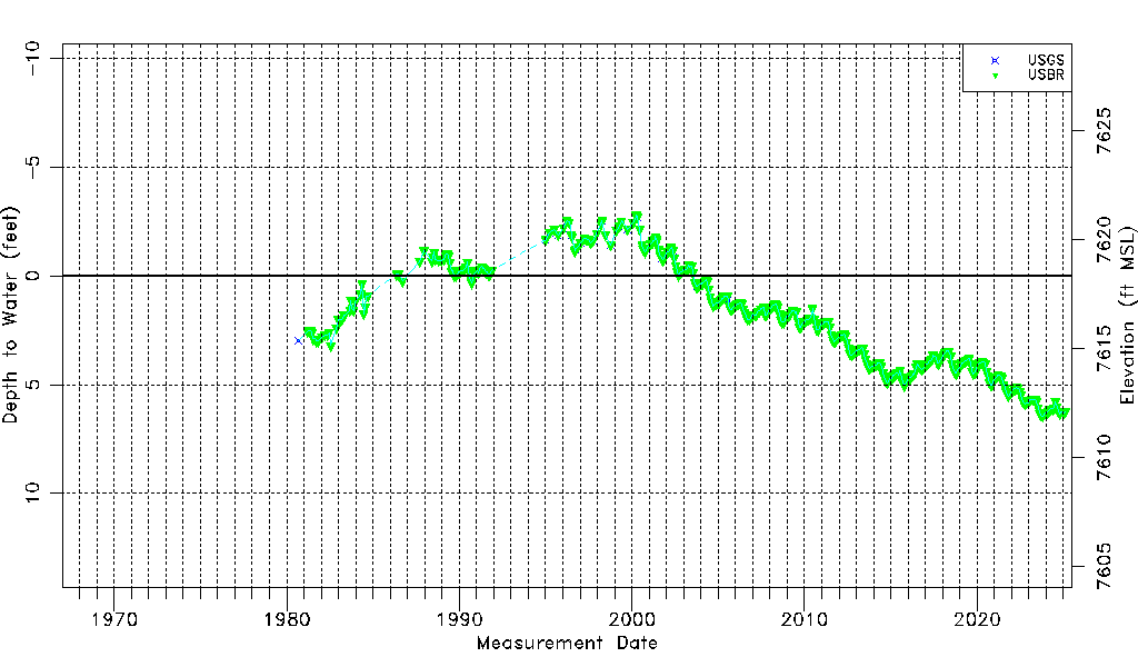
| Water-level Count | 448 |
| Water-level Date Range | 09/04/1980 thru 09/15/2025 |
| Monitored within the last 18 months | Yes, most recently on 09/15/2025 |
| Depth-to-Water Range (ft) | -2.80 to 6.88 |
| Water Table Elevation Range (ft NAVD88) | 7611.46 to 7621.14 |
| Water-Level-Source:Number-of-Measurements | USGS:32 USBR:418 |